Maps of London
Essex (1st Ed/Rev 1862-96) LVIII.5 (includes: Loughton; Theydon Bois) - 25 Inch Map
1 : 2500 Topographic maps Ordnance Survey Ordnance Survey
Essex LVIII.NW - OS Six-Inch Map
1 : 10560 Topographic maps Ordnance Survey Ordnance Survey
Essex (New Series 1913-) n LX.16 (includes: Theydon Bois) - 25 Inch Map
1 : 2500 Topographic maps Ordnance Survey Ordnance Survey
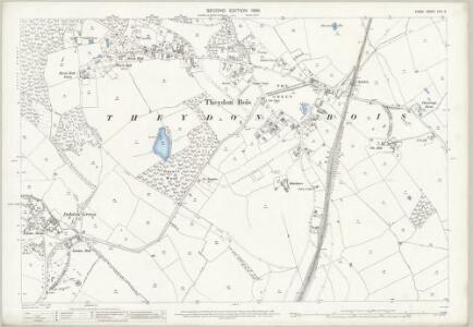
Essex (New Series 1913-) n LXIX.4 (includes: Loughton; Theydon Bois) - 25 Inch Map
1 : 2500 Topographic maps Ordnance Survey Ordnance Survey
Essex (New Series 1913-) n LXIX.4 (includes: Loughton; Theydon Bois) - 25 Inch Map
1 : 2500 Topographic maps Ordnance Survey Ordnance Survey
Essex LVIII - OS Six-Inch Map
1 : 10560 Topographic maps Ordnance Survey Ordnance Survey
Essex nLX.SE - OS Six-Inch Map
1 : 10560 Topographic maps Ordnance Survey Ordnance Survey
Essex nLX.SE - OS Six-Inch Map
1 : 10560 Topographic maps Ordnance Survey Ordnance Survey
Essex nLX.SE - OS Six-Inch Map
1 : 10560 Topographic maps Ordnance Survey Ordnance Survey
Essex nLXIX.NE - OS Six-Inch Map
1 : 10560 Topographic maps Ordnance Survey Ordnance Survey
Middlesex VIII.NE - OS Six-Inch Map
1 : 10560 Topographic maps Ordnance Survey Ordnance Survey
Essex (New Series 1913-) n LX.15 (includes: Loughton; Theydon Bois; Waltham Holy Cross) - 25 Inch Map
1 : 2500 Topographic maps Ordnance Survey Ordnance Survey
Essex (New Series 1913-) n LXIX.3 (includes: Loughton) - 25 Inch Map
1 : 2500 Topographic maps Ordnance Survey Ordnance Survey
Essex (New Series 1913-) n LXIX.3 (includes: Loughton) - 25 Inch Map
1 : 2500 Topographic maps Ordnance Survey Ordnance Survey
TQ49 - OS 1:25,000 Provisional Series Map
1 : 25000 Topographic maps Ordnance Survey Ordnance Survey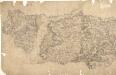
Epping
Pencil lines radiating from trigonometrical stations cover this drawing. They show the angles used for measuring distances and plotting topographical features. To the left of the map on Chestnut Common, the word 'flag' denotes the site of such a station. Hoddesden Park Wood and surrounding woodland are shown by individual trees with a line at the base, indicating shadow. This laborious technique was often replaced by a more generalised, stippled representation of treetops. The Lee River, running from Standstead at the top of this drawing, branches to form a canal leading down to the Powder Mills, which manufactured Gun Powder for shipping to London. Locks on the canal are shown in red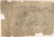
Enfield
Triangulation lines radiating from fixed points are clearly visible on this map. A pecked red line running adjacent to Lee River marks the boundary separating Essex from Hertforshire and Middlesex. Henhault Forest is shown by a stippled canopy of tree tops at the centre of the drawing. Perhaps the most interesting detail on this map is just south of the forest: a small drawing of a tree inside an enclosure marked 'Fairlop Oak'. This giant oak tree was something of a local landmark. In 1791, William Forsyth, gardener to George III, made unsuccessful attempts to halt the tree's decline. The year that this map was published, the tree was badly burnt by a fire started during a picnic. Its health steadily continued to wane until it was blown down in a gale in 1820. The inclusion of details such as the Fairlop Oak reveals the meticulous nature of the Survey, and the great attention paid to local detail. Budgen, Charles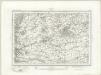
Romford (Outline) - OS One-Inch Revised New Series
1 : 63360 Topographic maps Ordnance Survey Ordnance Survey
Romford (Hills) - OS One-Inch Revised New Series
1 : 63360 Topographic maps Ordnance Survey Ordnance Survey
London passenger transport map
Ordnance Survey
Die Environs von London
1 : 470000 Londýn (Anglie)
Hertford& St Albans
Ordnance Survey
Fairburn’s Map of the Country twelve miles round London. Second Edition
Fairburn, John London
MAP SHEWING THE SEVERAL WALKS OR DELIVERIES IN THE COUNTRY DISTRICTS OF THE TWO PENNY POST, With the Rides to which they are attached numbered to correspond with the figure in the accompanying List
This map was commissioned by the House of Commons for the21st report of the Commissioners of Revenue Inquiry. It title features at top right, with its border divided in degrees of latitude and longitude. Rides and delivery walks in the Two-Penny Country Post are highlighted in colour and numbered for reference. A list of rides and key to delivery walks appears in a table at bottom right. Arrowsmith, Aaron

Ordnance Survey of England and Wales (Sheet 7), South Wales
Ordnance Survey, Great Britain
England & Wales. Diagram of London
Ordnance Survey
Accurater Grundriss u: Gegend der kœnigl: gross-brittannischen Haupt und Residentz-Stadt London
1 Karte : Kupferdruck ; 34 x 57 cm, Bildgrösse 50 x 59 cm Homännische Erben
London and Environs, Plate 55, V. III
1 : 100000 Bartholomew, John