Maps of South Bucks
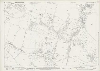
Buckinghamshire LVI.7 (includes: Datchet; Slough; Stoke Poges) - 25 Inch Map
1 : 2500 Topographic maps Ordnance Survey Ordnance Survey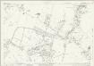
Buckinghamshire LVI.7 (includes: Datchet; Slough; Stoke Poges) - 25 Inch Map
1 : 2500 Topographic maps Ordnance Survey Ordnance Survey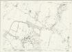
Buckinghamshire LVI.7 (includes: Datchet; Slough; Stoke Poges) - 25 Inch Map
1 : 2500 Topographic maps Ordnance Survey Ordnance Survey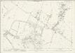
Buckinghamshire LVI.7 (includes: Datchet; Slough; Stoke Poges) - 25 Inch Map
1 : 2500 Topographic maps Ordnance Survey Ordnance Survey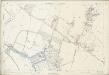
Buckinghamshire LVI.7 (includes: Datchet; Slough; Stoke Poges) - 25 Inch Map
1 : 2500 Topographic maps Ordnance Survey Ordnance Survey
Map of Ditton Parke
Map of Ditton Park from "A Description of the Honour of Windesor", John Norden's survey of Windsor. The title page states that the survey was "taken and performed by the perambulation view and delineation of John Norden In Anno 1607". The plans are the result of a survey conducted on foot by Norden. The maps in this volume show communication routes, individual buildings, field boundaries and parkland along with details of wildlife and human activity, such as stags in Windsor Park and people boating on the Thames. The scale at which the maps are presented varies throughout the volume, with feet, perches and miles being the units of measurement recorded by a scale bar. John Norden is best known for his work "Speculum Britainiae", literally a "Mirror of Britain", which in its attempt to include the road names and town plans, lacking on many county maps of the period, was a direct ancestor of the modern A-Z. As well as producing several county maps in the 1590s, Norden worked as a land surveyor producing surveys for landowners and was the author of a work which outlines principles of surveying, known as the "Surveyor's Dialogue". Norden, John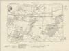
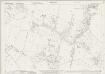
Buckinghamshire LVI.NE - OS Six-Inch Map
1 : 10560 Topographic maps Ordnance Survey Ordnance Survey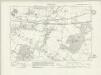
Buckinghamshire LVI.NE - OS Six-Inch Map
1 : 10560 Topographic maps Ordnance Survey Ordnance Survey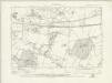
Buckinghamshire LVI.NE - OS Six-Inch Map
1 : 10560 Topographic maps Ordnance Survey Ordnance Survey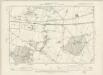
Buckinghamshire LVI.NE - OS Six-Inch Map
1 : 10560 Topographic maps Ordnance Survey Ordnance Survey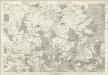
Berkshire XXXII - OS Six-Inch Map
1 : 10560 Topographic maps Ordnance Survey Ordnance Survey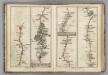
Egham to Binfield, Hounslow to Windsor.
1 : 63360 Cary, John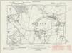
Middlesex XIX.NW - OS Six-Inch Map
1 : 10560 Topographic maps Ordnance Survey Ordnance Survey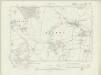
Middlesex XIX.NW - OS Six-Inch Map
1 : 10560 Topographic maps Ordnance Survey Ordnance Survey
Middlesex XIX.NE - OS Six-Inch Map
1 : 10560 Topographic maps Ordnance Survey Ordnance Survey
The first sheet of an actual survey of Berkshire
1 Blatt : 68 x 52 cm publish'd according to act of parliament by John Rocque chorographer to their royal Highnesses the late and present Prince of Wales etc. in the Strand
Carte topographique de le comté de Middlesex, 1
1 Blatt : 53 x 69 cm John Rocque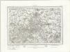
Windsor (Outline) - OS One-Inch Revised New Series
1 : 63360 Topographic maps Ordnance Survey Ordnance Survey
Windsor (Hills) - OS One-Inch Revised New Series
1 : 63360 Topographic maps Ordnance Survey Ordnance Survey
Uxbridge, Windsor
1 : 31680 This plan of the Chiltern Hills runs from Beaconsfield and Harefield at the top to Windsor Park, Egham and Staines at the bottom. A section of the Grand Junction Canal, running from Harefield down to West Drayton, is shown in aquamarine. The paper carries the watermark "E ,amp; P", standing for Edmeads and Pine. Boyce
A new correct map of Middlesex
Warburton, John, Bland, Joseph and Smyth, Payler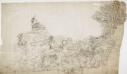
Hampstead
1 : 31680 The individual settlements that make up this area of London are shown by red blocks, with boundary lines indicating the fields separating them. Shading and soft interlining indicate relief, neatly illustrated at Primrose Hill, the summit of which is left bare. The barracks at the edge of Hyde Park are illustrated at the very bottom of the map. The dark blue-black line running from West Drayton to Brentford and Paddington is the Grand Junction Canal. This was London's principal link to the rest of Britain's canals, allowing the passage of goods to and from the industrial towns of the North and Midlands. Hyett includes a ground plan of Kenwood House in Hampstead, showing a level of detail much greater than might be expected from a map with a scale of two inches-to-the-mile. Hyett, William
London passenger transport map
Ordnance Survey
Estates at Windsor, Berkshire
This is a manuscript map of the area surrounding Windsor in Berkshire. It forms part of an atlas that belonged to William Cecil Lord Burghley, Elizabeth I’s Secretary of State. Burghley used this atlas to illustrate domestic matters. Burghley was in charge of administration for the Royal Estate of Windsor. The Royal Estates were notoriously slackly administered, a flaw that no official involved was keen to remedy as there were considerable personal advantages to be gained from inadequacies in the system. The map is drawn to scale with a scale bar of 5.5 - 6 miles. The many parks are shown by enclosure symbols, an important feature of any landscape for military purposes as it was in parks that troops could rest and horses graze. Communication routes such as roads and pathways are indicated by double or single broken lines and the rivers and the points at which they are bridged are also shown. The waterways were a vital communication route at the time, especially in this area where the Thames provides direct access to the centre of London.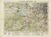
England and Wales [OS of]
Ordnance Survey
England and Wales [OS of]
Ordnance Survey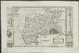
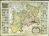
Midlesex
1 : 178000 by H. Moll [London] : [H. Moll etc.]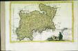
Provincia di Middlesex
1 Karte : Kupferdruck ; 19 x 29 cm Zatta; Zuliani; Pitteri presso Antonio Zatta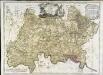
A map of the county of Middlesex
1 Karte : Kupferdruck ; 50 x 68 cm Rocque publish'd according to act of parliament by J. Rocque in the Strand