Maps of South Bucks
Buckinghamshire XLVIII.8 (includes: Chalfont St Peter; Gerrards Cross; Rickmansworth Urban) - 25 Inch Map
1 : 2500 Topographic maps Ordnance Survey Ordnance Survey
Buckinghamshire XLVIII.8 (includes: Chalfont St Peter; Gerrards Cross; Rickmansworth Urban) - 25 Inch Map
1 : 2500 Topographic maps Ordnance Survey Ordnance Survey
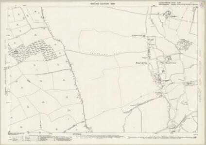
Buckinghamshire XLVIII.NE - OS Six-Inch Map
1 : 10560 Topographic maps Ordnance Survey Ordnance Survey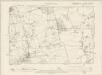
Buckinghamshire XLVIII.NE - OS Six-Inch Map
1 : 10560 Topographic maps Ordnance Survey Ordnance Survey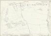
Hertfordshire XLIII.14 (includes: Chalfont St Peter; Rickmansworth Urban) - 25 Inch Map
1 : 2500 Topographic maps Ordnance Survey Ordnance Survey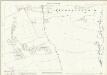
Hertfordshire XLIII.14 (includes: Chalfont St Peter; Rickmansworth Urban) - 25 Inch Map
1 : 2500 Topographic maps Ordnance Survey Ordnance Survey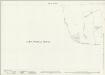
Hertfordshire XLVII.2 (includes: Chalfont St Peter; Denham; Gerrards Cross; Rickmansworth Urban) - 25 Inch Map
1 : 2500 Topographic maps Ordnance Survey Ordnance Survey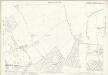
Hertfordshire XLVII.2 (includes: Chalfont St Peter; Denham; Gerrards Cross; Rickmansworth Urban) - 25 Inch Map
1 : 2500 Topographic maps Ordnance Survey Ordnance Survey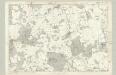
Buckinghamshire XLVIII - OS Six-Inch Map
1 : 10560 Topographic maps Ordnance Survey Ordnance Survey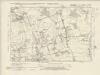
Hertfordshire XLIII.SW - OS Six-Inch Map
1 : 10560 Topographic maps Ordnance Survey Ordnance Survey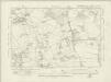
Hertfordshire XLIII.SW - OS Six-Inch Map
1 : 10560 Topographic maps Ordnance Survey Ordnance Survey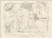
Hertfordshire XLIII.SW - OS Six-Inch Map
1 : 10560 Topographic maps Ordnance Survey Ordnance Survey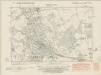
Hertfordshire XLVII.NW - OS Six-Inch Map
1 : 10560 Topographic maps Ordnance Survey Ordnance Survey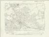
Hertfordshire XLVII.NW - OS Six-Inch Map
1 : 10560 Topographic maps Ordnance Survey Ordnance Survey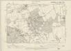
Hertfordshire XLVII.NW - OS Six-Inch Map
1 : 10560 Topographic maps Ordnance Survey Ordnance Survey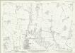
Hertfordshire XLIII.15 (includes: Rickmansworth Urban; Uxbridge) - 25 Inch Map
1 : 2500 Topographic maps Ordnance Survey Ordnance Survey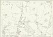
Hertfordshire XLIII.15 (includes: Rickmansworth Urban; Uxbridge) - 25 Inch Map
1 : 2500 Topographic maps Ordnance Survey Ordnance Survey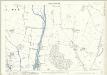
Hertfordshire XLIII.15 (includes: Rickmansworth Urban; Uxbridge) - 25 Inch Map
1 : 2500 Topographic maps Ordnance Survey Ordnance Survey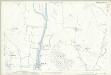
Middlesex IV.15 (includes: Rickmansworth Urban; Uxbridge) - 25 Inch Map
1 : 2500 Topographic maps Ordnance Survey Ordnance Survey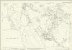
Hertfordshire XLVII.3 (includes: Denham; Rickmansworth Urban; Uxbridge) - 25 Inch Map
1 : 2500 Topographic maps Ordnance Survey Ordnance Survey
Hertfordshire XLVII.3 (includes: Denham; Rickmansworth Urban; Uxbridge) - 25 Inch Map
1 : 2500 Topographic maps Ordnance Survey Ordnance Survey
Hertfordshire XLVII.3 (includes: Denham; Rickmansworth Urban; Uxbridge) - 25 Inch Map
1 : 2500 Topographic maps Ordnance Survey Ordnance Survey
Middlesex IX.3 (includes: Denham; Rickmansworth Urban; Uxbridge) - 25 Inch Map
1 : 2500 Topographic maps Ordnance Survey Ordnance Survey
TQ09 - OS 1:25,000 Provisional Series Map
1 : 25000 Topographic maps Ordnance Survey Ordnance Survey
Carte topographique de le comté de Middlesex, 1
1 Blatt : 53 x 69 cm John Rocque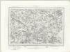
Beaconsfield (Outline) - OS One-Inch Revised New Series
1 : 63360 Topographic maps Ordnance Survey Ordnance Survey
Beaconsfield (Hills) - OS One-Inch Revised New Series
1 : 63360 Topographic maps Ordnance Survey Ordnance Survey
Uxbridge, Windsor
1 : 31680 This plan of the Chiltern Hills runs from Beaconsfield and Harefield at the top to Windsor Park, Egham and Staines at the bottom. A section of the Grand Junction Canal, running from Harefield down to West Drayton, is shown in aquamarine. The paper carries the watermark "E ,amp; P", standing for Edmeads and Pine. Boyce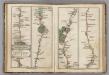
London to Tring.
1 : 63360 Cary, John