Maps of Aylesbury Vale
Buckinghamshire XXV.14 (includes: Eaton Bray; Edlesborough) - 25 Inch Map
1 : 2500 Topographic maps Ordnance Survey Ordnance Survey
Buckinghamshire XXV.14 (includes: Eaton Bray; Edlesborough) - 25 Inch Map
1 : 2500 Topographic maps Ordnance Survey Ordnance Survey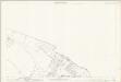
Buckinghamshire XXV.14 (includes: Eaton Bray; Edlesborough) - 25 Inch Map
1 : 2500 Topographic maps Ordnance Survey Ordnance Survey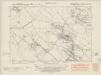
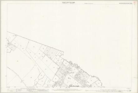
Buckinghamshire XXV.SW - OS Six-Inch Map
1 : 10560 Topographic maps Ordnance Survey Ordnance Survey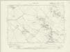
Buckinghamshire XXV.SW - OS Six-Inch Map
1 : 10560 Topographic maps Ordnance Survey Ordnance Survey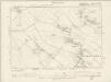
Buckinghamshire XXV.SW - OS Six-Inch Map
1 : 10560 Topographic maps Ordnance Survey Ordnance Survey
Bedfordshire XXXI.8 & 12 (includes: Eaton Bray; Edlesborough; Ivinghoe; Totternhoe) - 25 Inch Map
1 : 2500 Topographic maps Ordnance Survey Ordnance Survey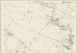
Bedfordshire XXXI.8 (includes: Eaton Bray; Edlesborough; Totternhoe) - 25 Inch Map
1 : 2500 Topographic maps Ordnance Survey Ordnance Survey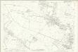
Bedfordshire XXXI.8 (includes: Eaton Bray; Edlesborough; Totternhoe) - 25 Inch Map
1 : 2500 Topographic maps Ordnance Survey Ordnance Survey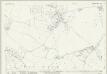
Bedfordshire XXXII.5 (includes: Dunstable; Eaton Bray; Edlesborough; Totternhoe) - 25 Inch Map
1 : 2500 Topographic maps Ordnance Survey Ordnance Survey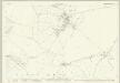
Bedfordshire XXXII.5 (includes: Dunstable; Eaton Bray; Edlesborough; Totternhoe) - 25 Inch Map
1 : 2500 Topographic maps Ordnance Survey Ordnance Survey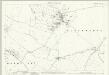
Bedfordshire XXXII.5 (includes: Dunstable; Eaton Bray; Edlesborough; Totternhoe) - 25 Inch Map
1 : 2500 Topographic maps Ordnance Survey Ordnance Survey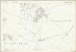
Bedfordshire XXXII.5 (includes: Dunstable; Eaton Bray; Edlesborough; Totternhoe) - 25 Inch Map
1 : 2500 Topographic maps Ordnance Survey Ordnance Survey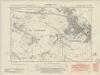
Bedfordshire XXXII.NW - OS Six-Inch Map
1 : 10560 Topographic maps Ordnance Survey Ordnance Survey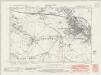
Bedfordshire XXXII.NW - OS Six-Inch Map
1 : 10560 Topographic maps Ordnance Survey Ordnance Survey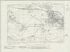
Bedfordshire XXXII.NW - OS Six-Inch Map
1 : 10560 Topographic maps Ordnance Survey Ordnance Survey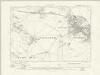
Bedfordshire XXXII.NW - OS Six-Inch Map
1 : 10560 Topographic maps Ordnance Survey Ordnance Survey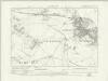
Bedfordshire XXXII.NW - OS Six-Inch Map
1 : 10560 Topographic maps Ordnance Survey Ordnance Survey
Bedfordshire XXXII.NW - OS Six-Inch Map
1 : 10560 Topographic maps Ordnance Survey Ordnance Survey
Bedfordshire XXXII.NW - OS Six-Inch Map
1 : 10560 Topographic maps Ordnance Survey Ordnance Survey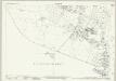
Bedfordshire XXXI.8 & 12 (includes: Eaton Bray; Edlesborough; Ivinghoe; Totternhoe) - 25 Inch Map
1 : 2500 Topographic maps Ordnance Survey Ordnance Survey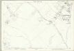
Bedfordshire XXXI.12 (includes: Edlesborough; Ivinghoe) - 25 Inch Map
1 : 2500 Topographic maps Ordnance Survey Ordnance Survey
Bedfordshire XXXI.12 (includes: Edlesborough; Ivinghoe) - 25 Inch Map
1 : 2500 Topographic maps Ordnance Survey Ordnance Survey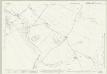
Bedfordshire XXXII.9 (includes: Eaton Bray; Edlesborough; Whipsnade) - 25 Inch Map
1 : 2500 Topographic maps Ordnance Survey Ordnance Survey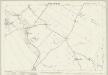
Bedfordshire XXXII.9 (includes: Eaton Bray; Edlesborough; Whipsnade) - 25 Inch Map
1 : 2500 Topographic maps Ordnance Survey Ordnance Survey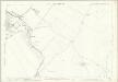
Bedfordshire XXXII.9 (includes: Eaton Bray; Edlesborough; Whipsnade) - 25 Inch Map
1 : 2500 Topographic maps Ordnance Survey Ordnance Survey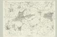
Buckinghamshire XXV - OS Six-Inch Map
1 : 10560 Topographic maps Ordnance Survey Ordnance Survey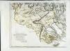
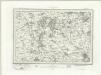
The county of Bedford, 7
1 Blatt : 53 x 72 cm s.n.
A topographical map of Hartford-Shire, 1
1 Blatt : 54 x 72 cm A. Dury
Leighton Buzzard (Hills) - OS One-Inch Revised New Series
1 : 63360 Topographic maps Ordnance Survey Ordnance Survey