Maps of Shepway
Kent LXXIV.8 (includes: Folkestone; Newington; Saltwood) - 25 Inch Map
1 : 2500 Topographic maps Ordnance Survey Ordnance Survey
Kent LXXIV.8 (includes: Folkestone; Newington; Saltwood) - 25 Inch Map
1 : 2500 Topographic maps Ordnance Survey Ordnance Survey
Kent LXXIV.8 (includes: Folkestone; Newington; Saltwood) - 25 Inch Map
1 : 2500 Topographic maps Ordnance Survey Ordnance Survey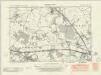
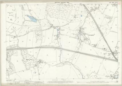
Kent LXXIV.NE - OS Six-Inch Map
1 : 10560 Topographic maps Ordnance Survey Ordnance Survey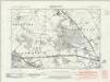
Kent LXXIV.NE - OS Six-Inch Map
1 : 10560 Topographic maps Ordnance Survey Ordnance Survey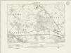
Kent LXXIV.NE - OS Six-Inch Map
1 : 10560 Topographic maps Ordnance Survey Ordnance Survey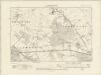
Kent LXXIV.NE - OS Six-Inch Map
1 : 10560 Topographic maps Ordnance Survey Ordnance Survey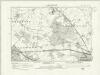
Kent LXXIV.NE - OS Six-Inch Map
1 : 10560 Topographic maps Ordnance Survey Ordnance Survey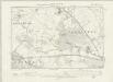
Kent LXXIV.NE - OS Six-Inch Map
1 : 10560 Topographic maps Ordnance Survey Ordnance Survey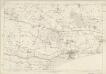
Kent LXXIV - OS Six-Inch Map
1 : 10560 Topographic maps Ordnance Survey Ordnance Survey
TR13 - OS 1:25,000 Provisional Series Map
1 : 25000 Topographic maps Ordnance Survey Ordnance Survey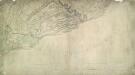
Dover (Kent)
The cliffs of Dover are shown almost pictorially on this plan, with dark striations indicating steepness. Relief is shown elsewhere by shading and interlining ('hachuring'). Field boundaries are observed. The sandy coast is represented by a speckled pattern and grassland by a green wash. Dover Castle is seen in plan, with dark hachure lines depicting the steep underlying rocks. The castle, known as the 'Key to England', was a site of unique strategic importance, affording the shortest crossing point of the English Channel to continental Europe. Its defences were improved during the Napoleonic conflicts. Special tunnels were even bored beneath the keep for emergency entrance and exit. This drawing was surveyed while the war was at its most ferocious, yet no batteries are recorded.
A topographical-map, of the county of Kent, 19
1 Blatt : 54 x 71 cm A. Dury, W. Herbert
Folkestone (Hills) - OS One-Inch Revised New Series
1 : 63360 Topographic maps Ordnance Survey Ordnance Survey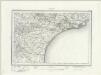
Folkestone (Outline) - OS One-Inch Revised New Series
1 : 63360 Topographic maps Ordnance Survey Ordnance Survey
The description of Romney Marsh, Walland, Marshy, Denge and Gulforde marsh, with the divisions of their waterings, heads, armes, principal sewers and their gutts
This is a map of the Romney Marsh area, dating from around 1590. It shows the network of sewers and waterways in the area and is principally concerned with drainage. The locations of bridges are carefully recorded. The topography of the landscape is depicted with hills, trees, churches, towns, villages and windmills shown pictorially. A small island in the sea records the location where a village once stood. Camber castle is shown and the draughtsman has attempted to indicate the actual architectural features of the castle.
Partie de l'Angleterre
1 : 110000 Anglie jižní Fricx, Eugene Henry Harrewyn, Jacques chez Eugene Henry Fricx
East Kent - OS One-Inch Map
1 : 63360 Topographic maps Ordnance Survey Ordnance Survey
To the Right Honorable the Master, Wardens, and Elder Brethren, of the Trinity House, this chart of the Downs and Margate Roads is ... dedicated
1 : 56000 Heather, W. (William) Heather, W. (William)
Kent, Sheet 31 - Bartholomew's "Half Inch to the Mile Maps" of England & Wales
1 : 126720 Topographic maps Bartholomew, John George John Bartholomew & Co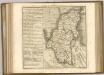
Een gedeelte van het Kanaal van de Hoofden tot den hoek van Bevesier als meede een gedeelte van de cust van Vrankrijk
English Channel Gerard van Keulen
Cantium vernacule Kent
1 : 130000 Amstelodami : apud Joannem Janssonium
CANTIVM | Vernacule | KENT.
[Amsterdam : Joan Blaeu]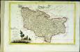
Provincia di Kent
1 Karte : Kupferdruck ; 18 x 29 cm Zatta; Zuliani; Pitteri presso Antonio Zatta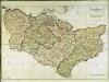
A map of the county of Kent
1 Karte : Kupferdruck ; 49 x 70 cm Kitchin; Dury; Andrews; Herbert A. Dury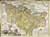
An accurate map of the county of Kent
1 Karte : Kupferdruck ; 50 x 69 cm Bowen; Hinton sold by J. Hinton at the Kings Arms in St. Pauls Church Yard
Cantivm vernacule Kent
1 Karte : Kupferdruck ; 37 x 51 cm Blaeu Joan Blaeu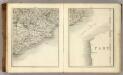
Sheets 17-18. (Cary's England, Wales, and Scotland).
1 : 360000 Cary, John, ca. 1754-1835