Maps of Wealden
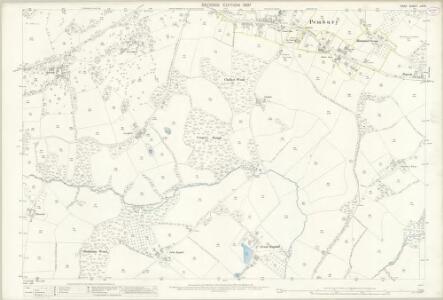
Kent LXI.9 (includes: Pembury; Tunbridge Wells) - 25 Inch Map
1 : 2500 Topographic maps Ordnance Survey Ordnance Survey
Kent LXI.9 (includes: Pembury; Tunbridge Wells) - 25 Inch Map
1 : 2500 Topographic maps Ordnance Survey Ordnance Survey
Kent LXI.9 (includes: Pembury; Tunbridge Wells) - 25 Inch Map
1 : 2500 Topographic maps Ordnance Survey Ordnance Survey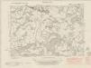
Kent LXI.SW - OS Six-Inch Map
1 : 10560 Topographic maps Ordnance Survey Ordnance Survey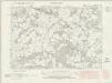
Kent LXI.SW - OS Six-Inch Map
1 : 10560 Topographic maps Ordnance Survey Ordnance Survey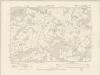
Kent LXI.SW - OS Six-Inch Map
1 : 10560 Topographic maps Ordnance Survey Ordnance Survey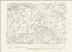
Kent LXI.SW - OS Six-Inch Map
1 : 10560 Topographic maps Ordnance Survey Ordnance Survey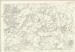
Kent LXI - OS Six-Inch Map
1 : 10560 Topographic maps Ordnance Survey Ordnance Survey
Sussex VII - OS Six-Inch Map
1 : 10560 Topographic maps Ordnance Survey Ordnance Survey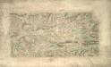
Tunbridge Wells (Kent)
This drawing shows the area around Tunbridge Wells in Kent. The town itself is indicated by red blocks, with the surrounding forests and downs depicted by various green washes. Brushwork interlinging and shading ('hachuring') records relative relief. It is in this area in particular that the Ordnance Survey drawings surpass earlier county maps. The draughtsman has represented individual trees forming avenues and blocks, notably in Eridge Park.
A topographical-map, of the county of Kent, 17
1 Blatt : 54 x 71 cm A. Dury, W. Herbert
Tunbridge Wells (Hills) - OS One-Inch Revised New Series
1 : 63360 Topographic maps Ordnance Survey Ordnance Survey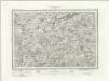
Tunbridge Wells (Outline) - OS One-Inch Revised New Series
1 : 63360 Topographic maps Ordnance Survey Ordnance Survey
A sketch of the roads within fourteen miles of Tunbridge Wells
1 : 100000 Brackett, William Clifford, J J. Clifford
London passenger transport map
Ordnance Survey
London SE - OS One-Inch Map
1 : 63360 Topographic maps Ordnance Survey Ordnance Survey
Eastbourne - OS One-Inch Map
1 : 63360 Topographic maps Ordnance Survey Ordnance Survey
Surrey, Sheet 30 - Bartholomew's "Half Inch to the Mile Maps" of England & Wales
1 : 126720 Topographic maps Bartholomew, John George John Bartholomew & Co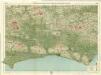
Sussex, Sheet 32 - Bartholomew's "Half Inch to the Mile Maps" of England & Wales
1 : 126720 Topographic maps Bartholomew, John George John Bartholomew & Co
Suthsexia vernacule Sussex
1 Karte : Kupferdruck ; 36 x 49 cm Valck; Schenk apud Gerardum Valk et Petrum Schenk
Svthsexia; vernacule Svssex
1 Karte : Kupferdruck ; 37 x 51 cm Blaeu Joan Blaeu
Kent, Sheet 31 - Bartholomew's "Half Inch to the Mile Maps" of England & Wales
1 : 126720 Topographic maps Bartholomew, John George John Bartholomew & Co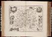
Surria vernacule Surrey / [Joannes Janssonius]
1 : 200000 Annotatie: Oorspr. verschenen in: Ioannis Ianssonii Novus atlas ... - Amstelodami : apud Iohannem Ianssonium, 1646; Origineel is Blad 26 in atlas factice Janssonius, Joannes (jr.) (1588-1664) [Amsterdam : Joannes Janssonius]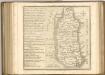

Surria. Vernacule Surrey. [Karte], in: Novus atlas absolutissimus, Bd. 7, S. 148.
1 Karte aus Atlas Janssonius Offizin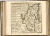
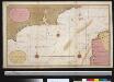
Een gedeelte van het Kanaal van de Hoofden tot den hoek van Bevesier als meede een gedeelte van de cust van Vrankrijk
English Channel Gerard van Keulen
Cantium vernacule Kent
1 : 130000 Amstelodami : apud Joannem Janssonium
CANTIVM | Vernacule | KENT.
[Amsterdam : Joan Blaeu]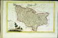
Provincia di Kent
1 Karte : Kupferdruck ; 18 x 29 cm Zatta; Zuliani; Pitteri presso Antonio Zatta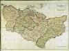
A map of the county of Kent
1 Karte : Kupferdruck ; 49 x 70 cm Kitchin; Dury; Andrews; Herbert A. Dury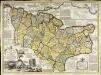
An accurate map of the county of Kent
1 Karte : Kupferdruck ; 50 x 69 cm Bowen; Hinton sold by J. Hinton at the Kings Arms in St. Pauls Church Yard