Maps of Sevenoaks
Kent LXI.5 (includes: Pembury) - 25 Inch Map
1 : 2500 Topographic maps Ordnance Survey Ordnance Survey
Kent LXI.5 (includes: Pembury) - 25 Inch Map
1 : 2500 Topographic maps Ordnance Survey Ordnance Survey
Kent LXI.5 (includes: Pembury) - 25 Inch Map
1 : 2500 Topographic maps Ordnance Survey Ordnance Survey
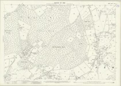
Kent LXI.NW - OS Six-Inch Map
1 : 10560 Topographic maps Ordnance Survey Ordnance Survey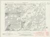
Kent LXI.NW - OS Six-Inch Map
1 : 10560 Topographic maps Ordnance Survey Ordnance Survey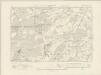
Kent LXI.NW - OS Six-Inch Map
1 : 10560 Topographic maps Ordnance Survey Ordnance Survey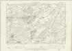
Kent LXI.NW - OS Six-Inch Map
1 : 10560 Topographic maps Ordnance Survey Ordnance Survey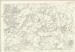
Kent LXI - OS Six-Inch Map
1 : 10560 Topographic maps Ordnance Survey Ordnance Survey
TQ64 - OS 1:25,000 Provisional Series Map
1 : 25000 Topographic maps Ordnance Survey Ordnance Survey
Tonbridge (Kent)(002OSD000000005U00354000)
1 : 21120 Drawing showing the area around Tonbridge in Kent. The lack of hill sketching on this drawing suggests an intermediate rather than a finished plan. Field boundaries, woodland and buildings are intricately presented. Individual trees are meticulously drawn along the avenue in Knowle Park. Measurements in ink are given in the bottom left of this drawing. A triangulation diagram appears on the reverse of the manuscript. This was used by the draughtsman to plot topographical features.
A topographical-map, of the county of Kent, 12
1 Blatt : 54 x 71 cm A. Dury, W. Herbert
A sketch of the roads within fourteen miles of Tunbridge Wells
1 : 100000 Brackett, William Clifford, J J. Clifford
London passenger transport map
Ordnance Survey
London SE - OS One-Inch Map
1 : 63360 Topographic maps Ordnance Survey Ordnance Survey
Eastbourne - OS One-Inch Map
1 : 63360 Topographic maps Ordnance Survey Ordnance Survey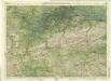
Surrey, Sheet 30 - Bartholomew's "Half Inch to the Mile Maps" of England & Wales
1 : 126720 Topographic maps Bartholomew, John George John Bartholomew & Co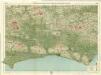
Sussex, Sheet 32 - Bartholomew's "Half Inch to the Mile Maps" of England & Wales
1 : 126720 Topographic maps Bartholomew, John George John Bartholomew & Co
Suthsexia vernacule Sussex
1 Karte : Kupferdruck ; 36 x 49 cm Valck; Schenk apud Gerardum Valk et Petrum Schenk
Svthsexia; vernacule Svssex
1 Karte : Kupferdruck ; 37 x 51 cm Blaeu Joan Blaeu
Kent, Sheet 31 - Bartholomew's "Half Inch to the Mile Maps" of England & Wales
1 : 126720 Topographic maps Bartholomew, John George John Bartholomew & Co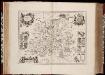
Surria vernacule Surrey / [Joannes Janssonius]
1 : 200000 Annotatie: Oorspr. verschenen in: Ioannis Ianssonii Novus atlas ... - Amstelodami : apud Iohannem Ianssonium, 1646; Origineel is Blad 26 in atlas factice Janssonius, Joannes (jr.) (1588-1664) [Amsterdam : Joannes Janssonius]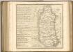

Surria. Vernacule Surrey. [Karte], in: Novus atlas absolutissimus, Bd. 7, S. 148.
1 Karte aus Atlas Janssonius Offizin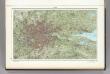
60. London. The World Atlas.
1 : 250000 USSR (Union of Soviet Socialist Republics).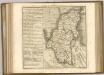
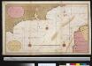
Een gedeelte van het Kanaal van de Hoofden tot den hoek van Bevesier als meede een gedeelte van de cust van Vrankrijk
English Channel Gerard van Keulen
Cantium vernacule Kent
1 : 130000 Amstelodami : apud Joannem Janssonium
CANTIVM | Vernacule | KENT.
[Amsterdam : Joan Blaeu]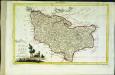
Provincia di Kent
1 Karte : Kupferdruck ; 18 x 29 cm Zatta; Zuliani; Pitteri presso Antonio Zatta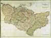
A map of the county of Kent
1 Karte : Kupferdruck ; 49 x 70 cm Kitchin; Dury; Andrews; Herbert A. Dury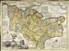
An accurate map of the county of Kent
1 Karte : Kupferdruck ; 50 x 69 cm Bowen; Hinton sold by J. Hinton at the Kings Arms in St. Pauls Church Yard