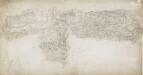
Maps of Wealden
Kent LIX.10 & 9 (includes: Cowden; East Grinstead; Forest Row; Hartfield; Lingfield) - 25 Inch Map
1 : 2500 Topographic maps Ordnance Survey Ordnance Survey
Kent LIX.9 (includes: East Grinstead; Forest Row; Lingfield) - 25 Inch Map
1 : 2500 Topographic maps Ordnance Survey Ordnance Survey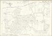
Kent LIX.9 (includes: East Grinstead; Forest Row; Lingfield) - 25 Inch Map
1 : 2500 Topographic maps Ordnance Survey Ordnance Survey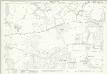
Surrey XLIII.10 (includes: East Grinstead; Forest Row; Lingfield) - 25 Inch Map
1 : 2500 Topographic maps Ordnance Survey Ordnance Survey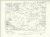
Surrey XLIII.SW - OS Six-Inch Map
1 : 10560 Topographic maps Ordnance Survey Ordnance Survey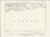
Surrey XLIII.SW - OS Six-Inch Map
1 : 10560 Topographic maps Ordnance Survey Ordnance Survey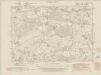
Kent LIX.SW - OS Six-Inch Map
1 : 10560 Topographic maps Ordnance Survey Ordnance Survey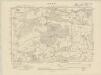
Kent LIX.SW - OS Six-Inch Map
1 : 10560 Topographic maps Ordnance Survey Ordnance Survey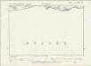
Kent LIX.SW - OS Six-Inch Map
1 : 10560 Topographic maps Ordnance Survey Ordnance Survey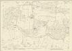
Sussex V.7 (includes: Forest Row) - 25 Inch Map
1 : 2500 Topographic maps Ordnance Survey Ordnance Survey
Sussex V.7 (includes: Forest Row) - 25 Inch Map
1 : 2500 Topographic maps Ordnance Survey Ordnance Survey
Sussex V.6 (includes: East Grinstead; Forest Row) - 25 Inch Map
1 : 2500 Topographic maps Ordnance Survey Ordnance Survey
Sussex V.6 (includes: East Grinstead; Forest Row) - 25 Inch Map
1 : 2500 Topographic maps Ordnance Survey Ordnance Survey
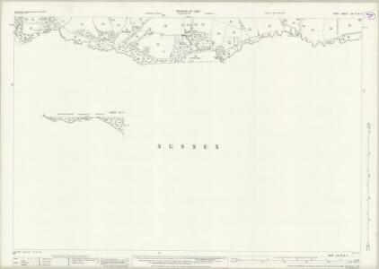
Sussex V - OS Six-Inch Map
1 : 10560 Topographic maps Ordnance Survey Ordnance Survey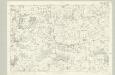
Surrey XLIII - OS Six-Inch Map
1 : 10560 Topographic maps Ordnance Survey Ordnance Survey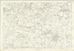
Kent LIX - OS Six-Inch Map
1 : 10560 Topographic maps Ordnance Survey Ordnance Survey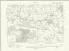
Sussex V.NE - OS Six-Inch Map
1 : 10560 Topographic maps Ordnance Survey Ordnance Survey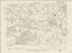
Sussex V.NE - OS Six-Inch Map
1 : 10560 Topographic maps Ordnance Survey Ordnance Survey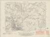
Sussex V.NW - OS Six-Inch Map
1 : 10560 Topographic maps Ordnance Survey Ordnance Survey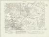
Sussex V.NW - OS Six-Inch Map
1 : 10560 Topographic maps Ordnance Survey Ordnance Survey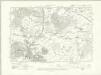
Sussex V.NW - OS Six-Inch Map
1 : 10560 Topographic maps Ordnance Survey Ordnance Survey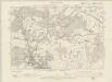
Sussex V.NW - OS Six-Inch Map
1 : 10560 Topographic maps Ordnance Survey Ordnance Survey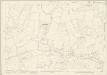
Sussex V.3 (includes: Cowden; Forest Row; Hartfield; Lingfield) - 25 Inch Map
1 : 2500 Topographic maps Ordnance Survey Ordnance Survey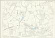
Sussex V.3 (includes: Cowden; Forest Row; Hartfield; Lingfield) - 25 Inch Map
1 : 2500 Topographic maps Ordnance Survey Ordnance Survey
Sussex V.2 (includes: East Grinstead; Forest Row; Lingfield) - 25 Inch Map
1 : 2500 Topographic maps Ordnance Survey Ordnance Survey
Sussex V.2 (includes: East Grinstead; Forest Row; Lingfield) - 25 Inch Map
1 : 2500 Topographic maps Ordnance Survey Ordnance Survey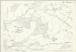
Sussex V.2 (includes: East Grinstead; Forest Row; Lingfield) - 25 Inch Map
1 : 2500 Topographic maps Ordnance Survey Ordnance Survey
Tunbridge Wells (Hills) - OS One-Inch Revised New Series
1 : 63360 Topographic maps Ordnance Survey Ordnance Survey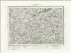
Tunbridge Wells (Outline) - OS One-Inch Revised New Series
1 : 63360 Topographic maps Ordnance Survey Ordnance Survey