Maps of Bromley
Kent XVI.9 (includes: Bromley; Orpington) - 25 Inch Map
1 : 2500 Topographic maps Ordnance Survey Ordnance Survey
Kent XVI.9 (includes: Bromley; Orpington) - 25 Inch Map
1 : 2500 Topographic maps Ordnance Survey Ordnance Survey
Kent XVI.9 (includes: Bromley; Orpington) - 25 Inch Map
1 : 2500 Topographic maps Ordnance Survey Ordnance Survey
Kent XVI.9 (includes: Bromley; Orpington) - 25 Inch Map
1 : 2500 Topographic maps Ordnance Survey Ordnance Survey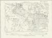
Surrey XIVa.SW - OS Six-Inch Map
1 : 10560 Topographic maps Ordnance Survey Ordnance Survey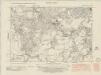
Kent XVI.SW - OS Six-Inch Map
1 : 10560 Topographic maps Ordnance Survey Ordnance Survey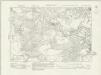
Kent XVI.SW - OS Six-Inch Map
1 : 10560 Topographic maps Ordnance Survey Ordnance Survey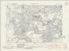
Kent XVI.SW - OS Six-Inch Map
1 : 10560 Topographic maps Ordnance Survey Ordnance Survey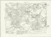
Kent XVI.SW - OS Six-Inch Map
1 : 10560 Topographic maps Ordnance Survey Ordnance Survey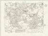
Kent XVI.SW - OS Six-Inch Map
1 : 10560 Topographic maps Ordnance Survey Ordnance Survey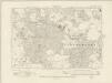
Kent XVI.SW - OS Six-Inch Map
1 : 10560 Topographic maps Ordnance Survey Ordnance Survey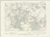
Kent XVI.SW - OS Six-Inch Map
1 : 10560 Topographic maps Ordnance Survey Ordnance Survey
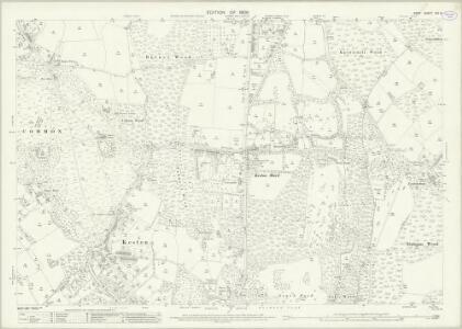
Kent XVI - OS Six-Inch Map
1 : 10560 Topographic maps Ordnance Survey Ordnance Survey
TQ46 - OS 1:25,000 Provisional Series Map
1 : 25000 Topographic maps Ordnance Survey Ordnance Survey
Bromley (Kent)
1 : 21120 Drawing showing the area around Bromley in Kent. Field boundaries enclosing cultivated land dominate this map of what is now south-east London. Such land is depicted by a striped pattern. Ruled dashed red lines also feature strongly. They radiate from trigonometrical stations used for measuring and plotting topographical features. The signalling telegraph station in Plow Garlic Hill at the top left of the plan marks the site of a trigonometrical station.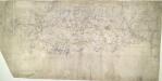
Eynsford (Kent)
This drawing, showing the area around Eynsford in Kent, is covered by a network of red rays, radiating from fixed points marking triangulation stations. These stations, usually sites of relative physical eminence, provided a framework within which to survey the topography of the land. On this plan, red lines radiate from the village church of Ash, marked by a red cross, and from an obelisk in Lullingstone Park. On the far left of the drawing, the word "flag" represents another triangulation point, from which the surveyor took angular measurements. Handwritten annotations at the bottom of the drawing refer to area measurements. There are some corrections in ink Pink, George
A topographical-map, of the county of Kent, 6
1 Blatt : 54 x 69 cm s.n.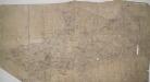
Dartford, Kent
Details of this drawing are corrected in heavy black ink with crosses placed over incorrect field boundaries and communication routes. Red pecked lines form a grid over the drawing. These are triangulation lines, which the draughtsman used to plot features of the landscape. A characteristically straight Roman road is shown leading from Dartford. In the bottom right, the scale is recorded and area calculations laid out.
Dartford (Hills) - OS One-Inch Revised New Series
1 : 63360 Topographic maps Ordnance Survey Ordnance Survey
Dartford (Outline) - OS One-Inch Revised New Series
1 : 63360 Topographic maps Ordnance Survey Ordnance Survey
Croydon
1 : 31680 Woodland and agricultural land dominate this plan, which covers an area from Beckenham and Croydon at the top, to Felbridge, Hackenham and Gotwick at the bottom. Buildings are infilled and blocked together at Croydon, the largest settlement shown.
How to travel in and around London by railway
London : M. Vigers
Reigate 2
1 : 31680 A dashed black-ink line runs along the boundary of Surrey and Sussex at the bottom of this plan of the North Downs., The bottom right of the manuscript carries a blue- rubber stamp from the 1950s, indicating that the plan was held in the Ordnance Survey Medium and Small Scales Division. Budgen, Thomas
London passenger transport map
Ordnance Survey
Die Environs von London
1 : 470000 Londýn (Anglie)
[Kaart], uit: S.E. London & Sevenoaks
1 : 64000 titelvariant: Ordnance Survey contoured road map of S.E. London and Sevenoaks; Annotatie: Omslagtitel: Ordnance Survey contoured road map of S.E. London and Sevenoaks Ordnance Survey Southampton : The Director General, at the Ordnance Survey Office
The Environs Of London.
1 : 95000 Colton, G.W.
London environs.
1 : 91500 Society for the Diffusion of Useful Knowledge (Great Britain)
Official railway map of London and its environs
1 : 33000 J. & W. Emslie Railway Clearing House