Maps of Compton
Sussex XLVII.3 (includes: Compton; Stoughton) - 25 Inch Map
1 : 2500 Topographic maps Ordnance Survey Ordnance Survey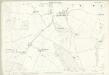
Sussex XLVII.3 (includes: Compton; Stoughton) - 25 Inch Map
1 : 2500 Topographic maps Ordnance Survey Ordnance Survey
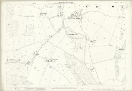
Sussex XLVII.NE - OS Six-Inch Map
1 : 10560 Topographic maps Ordnance Survey Ordnance Survey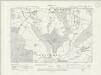
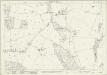
Sussex XLVII.NE - OS Six-Inch Map
1 : 10560 Topographic maps Ordnance Survey Ordnance Survey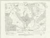
Sussex XLVII.NE - OS Six-Inch Map
1 : 10560 Topographic maps Ordnance Survey Ordnance Survey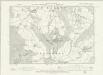
Sussex XLVII.NE - OS Six-Inch Map
1 : 10560 Topographic maps Ordnance Survey Ordnance Survey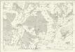
Sussex XLVII - OS Six-Inch Map
1 : 10560 Topographic maps Ordnance Survey Ordnance Survey
SU71 - OS 1:25,000 Provisional Series Map
1 : 25000 Topographic maps Ordnance Survey Ordnance Survey
Blendworth
.The county boundary with Sussex is marked on the right edge of this drawing by a black pecked line. Although this drawing predates the obligatory recording of archaeological sites, Roman remains and Rowland's Castle are represented to the bottom right. Ancient burial mounds are marked in many places by a circle and the word 'Tumulas'. Fir trees are marked at Draxford, to the central left of the map, the draughtsman distinguishing between these coniferous trees and deciduous ones. A large compass-drawn circle with a marked radius appears at the top of the drawing. Crocker, Edmund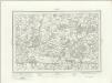
Fareham (Outline) - OS One-Inch Revised New Series
1 : 63360 Topographic maps Ordnance Survey Ordnance Survey
Fareham (Hills) - OS One-Inch Revised New Series
1 : 63360 Topographic maps Ordnance Survey Ordnance Survey
Arundel 8
1 : 31680 The Ordnance Survey took particular care in plotting the south coast of England, as this was the area most immediately vulnerable to invasion. This plan notes military barracks at Selsea, Aldwick and Bognor to the bottom right of the plan. Buildings are blocked in red and black ink and infilled at Chichester, in the centre of the plan, and Arundel, at the right. A poor house and pest house are located a considerable distance beyond the boundaries of Chichester.

Map of Hampshire, including the Isle of Wight, 4
1 Blatt : 53 x 69 cm s.n.
Chichester - OS One-Inch Map
1 : 63360 Topographic maps Ordnance Survey Ordnance Survey
To the right honorable the master, wardens & elder brethren of the Trinity House, this chart of Spithead is ... dedicated
1 : 110000 Heather, W. (William) Heather and Williams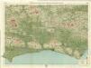
Sussex, Sheet 32 - Bartholomew's "Half Inch to the Mile Maps" of England & Wales
1 : 126720 Topographic maps Bartholomew, John George John Bartholomew & Co
New Forrest & Isle of Wight, Sheet 33 - Bartholomew's "Half Inch to the Mile Maps" of England & Wales
1 : 126720 Topographic maps Bartholomew, John George John Bartholomew & Co
Hantonia sive Sovthantonensis comitatvs vulgo Hant-shire
1 Karte : Kupferdruck ; 40 x 48 cm Blaeu Joan Blaeu
Suthsexia vernacule Sussex
1 Karte : Kupferdruck ; 36 x 49 cm Valck; Schenk apud Gerardum Valk et Petrum Schenk
Svthsexia; vernacule Svssex
1 Karte : Kupferdruck ; 37 x 51 cm Blaeu Joan Blaeu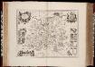
Surria vernacule Surrey / [Joannes Janssonius]
1 : 200000 Annotatie: Oorspr. verschenen in: Ioannis Ianssonii Novus atlas ... - Amstelodami : apud Iohannem Ianssonium, 1646; Origineel is Blad 26 in atlas factice Janssonius, Joannes (jr.) (1588-1664) [Amsterdam : Joannes Janssonius]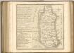

Surria. Vernacule Surrey. [Karte], in: Novus atlas absolutissimus, Bd. 7, S. 148.
1 Karte aus Atlas Janssonius Offizin
Sheets 15-16. (Cary's England, Wales, and Scotland).
1 : 360000 Cary, John, ca. 1754-1835
A new improved map of Hampshire
1 Karte : Kupferdruck ; 51 x 67 cm Kitchin; Hinton sold by I. Hinton at the Kings Arms in St. Pauls Church Yard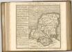

Bacon's twentieth century map of Hampshire
1 : 125000 titelvariant: Bacon's new map of Hampshire; Annotatie: Omslagtitel: Bacon's new map of Hampshire; Met plaatsnamenregister en afstandentabel London : Bacon
Hantoniæ comitatus cum Bercheria
1 Karte : Kupferdruck ; 42 x 53 cm Valck; Schenk apud G. Valk et P. Schenk