Maps of Wealden
Sussex VII.11 (includes: Frant; Lamberhurst; Pembury) - 25 Inch Map
1 : 2500 Topographic maps Ordnance Survey Ordnance Survey
Sussex VII.11 (includes: Frant; Lamberhurst; Pembury) - 25 Inch Map
1 : 2500 Topographic maps Ordnance Survey Ordnance Survey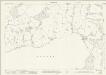
Kent LXI.13 (includes: Frant; Lamberhurst; Pembury; Tunbridge Wells) - 25 Inch Map
1 : 2500 Topographic maps Ordnance Survey Ordnance Survey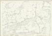
Kent LXI.13 (includes: Frant; Lamberhurst; Pembury; Tunbridge Wells) - 25 Inch Map
1 : 2500 Topographic maps Ordnance Survey Ordnance Survey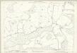
Kent LXI.13 (includes: Frant; Lamberhurst; Pembury; Tunbridge Wells) - 25 Inch Map
1 : 2500 Topographic maps Ordnance Survey Ordnance Survey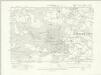
Sussex VII.SE - OS Six-Inch Map
1 : 10560 Topographic maps Ordnance Survey Ordnance Survey
Sussex VII.SE - OS Six-Inch Map
1 : 10560 Topographic maps Ordnance Survey Ordnance Survey
Sussex VII - OS Six-Inch Map
1 : 10560 Topographic maps Ordnance Survey Ordnance Survey
Kent LXI.SW - OS Six-Inch Map
1 : 10560 Topographic maps Ordnance Survey Ordnance Survey
Kent LXI.SW - OS Six-Inch Map
1 : 10560 Topographic maps Ordnance Survey Ordnance Survey
Kent LXI.SW - OS Six-Inch Map
1 : 10560 Topographic maps Ordnance Survey Ordnance Survey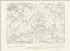
Kent LXI.SW - OS Six-Inch Map
1 : 10560 Topographic maps Ordnance Survey Ordnance Survey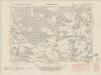
Kent LXIX.NW - OS Six-Inch Map
1 : 10560 Topographic maps Ordnance Survey Ordnance Survey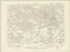
Kent LXIX.NW - OS Six-Inch Map
1 : 10560 Topographic maps Ordnance Survey Ordnance Survey
Kent LXIX.NW - OS Six-Inch Map
1 : 10560 Topographic maps Ordnance Survey Ordnance Survey
Kent LXIX.1 (includes: Frant; Lamberhurst) - 25 Inch Map
1 : 2500 Topographic maps Ordnance Survey Ordnance Survey
Kent LXIX.1 (includes: Frant; Lamberhurst) - 25 Inch Map
1 : 2500 Topographic maps Ordnance Survey Ordnance Survey
Kent LXIX.1 (includes: Frant; Lamberhurst) - 25 Inch Map
1 : 2500 Topographic maps Ordnance Survey Ordnance Survey
Kent LXI.14 (includes: Brenchley; Lamberhurst) - 25 Inch Map
1 : 2500 Topographic maps Ordnance Survey Ordnance Survey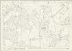
Kent LXI.14 (includes: Brenchley; Lamberhurst) - 25 Inch Map
1 : 2500 Topographic maps Ordnance Survey Ordnance Survey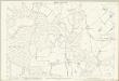
Kent LXI.14 (includes: Brenchley; Lamberhurst) - 25 Inch Map
1 : 2500 Topographic maps Ordnance Survey Ordnance Survey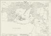
Kent LXIX.2 (includes: Frant; Lamberhurst) - 25 Inch Map
1 : 2500 Topographic maps Ordnance Survey Ordnance Survey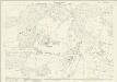
Kent LXIX.2 (includes: Frant; Lamberhurst) - 25 Inch Map
1 : 2500 Topographic maps Ordnance Survey Ordnance Survey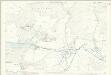
Kent LXIX.2 (includes: Frant; Lamberhurst) - 25 Inch Map
1 : 2500 Topographic maps Ordnance Survey Ordnance Survey
TQ63 - OS 1:25,000 Provisional Series Map
1 : 25000 Topographic maps Ordnance Survey Ordnance Survey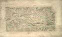
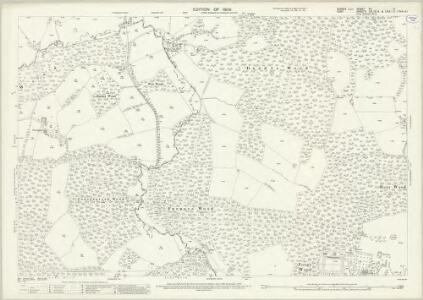
Tunbridge Wells (Kent)
This drawing shows the area around Tunbridge Wells in Kent. The town itself is indicated by red blocks, with the surrounding forests and downs depicted by various green washes. Brushwork interlinging and shading ('hachuring') records relative relief. It is in this area in particular that the Ordnance Survey drawings surpass earlier county maps. The draughtsman has represented individual trees forming avenues and blocks, notably in Eridge Park.
A topographical-map, of the county of Kent, 17
1 Blatt : 54 x 71 cm A. Dury, W. Herbert
Cranbrook (Kent)
1 : 21120 Drawing showing the area around Cranbrook in Kent. Green washes distinguish cultivated land and woodland from uncultivated land. Relative relief is indicated by shading and brushwork interlining - a technique known as hachuring. One of the notable features of the Ordnance Survey is the attention paid to accurately recording relief, an important issue in planning military campaigns.
Tunbridge Wells (Hills) - OS One-Inch Revised New Series
1 : 63360 Topographic maps Ordnance Survey Ordnance Survey