Maps of Farnham
Surrey XXX.2 (includes: Farnham) - 25 Inch Map
1 : 2500 Topographic maps Ordnance Survey Ordnance Survey
Surrey XXX.2 (includes: Farnham) - 25 Inch Map
1 : 2500 Topographic maps Ordnance Survey Ordnance Survey
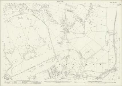
Surrey XXX.NW - OS Six-Inch Map
1 : 10560 Topographic maps Ordnance Survey Ordnance Survey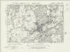
Surrey XXX.NW - OS Six-Inch Map
1 : 10560 Topographic maps Ordnance Survey Ordnance Survey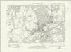
Surrey XXX.NW - OS Six-Inch Map
1 : 10560 Topographic maps Ordnance Survey Ordnance Survey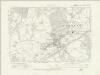
Surrey XXX.NW - OS Six-Inch Map
1 : 10560 Topographic maps Ordnance Survey Ordnance Survey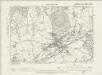
Surrey XXX.NW - OS Six-Inch Map
1 : 10560 Topographic maps Ordnance Survey Ordnance Survey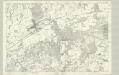
Surrey XXX - OS Six-Inch Map
1 : 10560 Topographic maps Ordnance Survey Ordnance Survey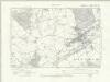
Hampshire & Isle of Wight XXVIII.NE - OS Six-Inch Map
1 : 10560 Topographic maps Ordnance Survey Ordnance Survey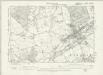
Hampshire & Isle of Wight XXVIII.NE - OS Six-Inch Map
1 : 10560 Topographic maps Ordnance Survey Ordnance Survey
Hampshire and Isle of Wight XX.16 (includes: Aldershot; Crondall; Farnham) - 25 Inch Map
1 : 2500 Topographic maps Ordnance Survey Ordnance Survey
Hampshire and Isle of Wight XX.16 (includes: Aldershot; Crondall; Farnham) - 25 Inch Map
1 : 2500 Topographic maps Ordnance Survey Ordnance Survey
Hampshire and Isle of Wight XX.16 (includes: Aldershot; Crondall; Farnham) - 25 Inch Map
1 : 2500 Topographic maps Ordnance Survey Ordnance Survey
Hampshire and Isle of Wight XX.16 (includes: Aldershot; Crondall; Farnham) - 25 Inch Map
1 : 2500 Topographic maps Ordnance Survey Ordnance Survey
Hampshire and Isle of Wight XXI.13 (includes: Aldershot; Farnham) - 25 Inch Map
1 : 2500 Topographic maps Ordnance Survey Ordnance Survey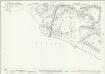
Hampshire and Isle of Wight XXI.13 (includes: Aldershot; Farnham) - 25 Inch Map
1 : 2500 Topographic maps Ordnance Survey Ordnance Survey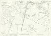
Hampshire and Isle of Wight XXI.13 (includes: Aldershot; Farnham) - 25 Inch Map
1 : 2500 Topographic maps Ordnance Survey Ordnance Survey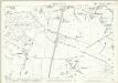
Hampshire and Isle of Wight XXI.13 (includes: Aldershot; Farnham) - 25 Inch Map
1 : 2500 Topographic maps Ordnance Survey Ordnance Survey
SU84 - OS 1:25,000 Provisional Series Map
1 : 25000 Topographic maps Ordnance Survey Ordnance Survey
Godalming
1 : 31680 .This map is in excellent condition and has retained its colour through two centuries. The turquoise wash, used to indicate water, remains particularly bright and vibrant. Commonland is the most prominent topographical feature in the drawing, denoted by open dotting. Large commons are shown at Frensham, Fernham, Thursley, Witley and Hinkley. Commons were carefully detailed by the surveyors, with a view to their possible use as military encampments. Although illustrating archaeological features did not become obligatory until 1816, this map notes a Bronze Age structure called the Devil's Jump, near Elstead at the centre of the map. Budgen, Thomas
Aldershot (Hills) - OS One-Inch Revised New Series
1 : 63360 Topographic maps Ordnance Survey Ordnance Survey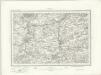
Aldershot (Outline) - OS One-Inch Revised New Series
1 : 63360 Topographic maps Ordnance Survey Ordnance Survey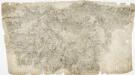
Odiham
1 : 31680 The most striking feature of this drawing is the triangulation web covering a large area around the East Hampstead Plain. According to manuscript sources, the different ground levels in this region made it an ideal case study for assistant engineers training for the Ordnance Survey under the tuition of Robert Dawson, the surveyor of this plan. Two circles on the main road through Hartford Bridge Flats represent triangulation points. Dawson, Robert
Map of Hampshire, including the Isle of Wight, 2
1 Blatt : 55 x 70 cm s.n.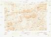
Guildford
1 : 63360 Ordnance Survey Office
Guildford
1 : 63360 Ordnance Survey Office
Guildford
1 : 63360 Ordnance Survey Office
London passenger transport map
Ordnance Survey
Map of Hampshire, including the Isle of Wight, 4
1 Blatt : 53 x 69 cm s.n.