Maps of Ringmer
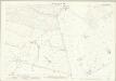
Sussex LIV - OS Six-Inch Map
1 : 10560 Topographic maps Ordnance Survey Ordnance Survey
Sussex LIV.NE - OS Six-Inch Map
1 : 10560 Topographic maps Ordnance Survey Ordnance Survey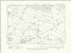
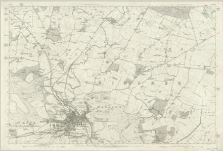
Sussex LIV.NE - OS Six-Inch Map
1 : 10560 Topographic maps Ordnance Survey Ordnance Survey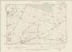
Sussex LIV.NE - OS Six-Inch Map
1 : 10560 Topographic maps Ordnance Survey Ordnance Survey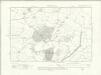
Sussex LIV.SE - OS Six-Inch Map
1 : 10560 Topographic maps Ordnance Survey Ordnance Survey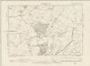
Sussex LIV.SE - OS Six-Inch Map
1 : 10560 Topographic maps Ordnance Survey Ordnance Survey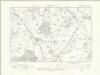
Sussex LIV.NW - OS Six-Inch Map
1 : 10560 Topographic maps Ordnance Survey Ordnance Survey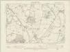
Sussex LIV.NW - OS Six-Inch Map
1 : 10560 Topographic maps Ordnance Survey Ordnance Survey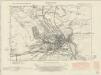
Sussex LIV.SW - OS Six-Inch Map
1 : 10560 Topographic maps Ordnance Survey Ordnance Survey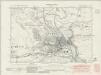
Sussex LIV.SW - OS Six-Inch Map
1 : 10560 Topographic maps Ordnance Survey Ordnance Survey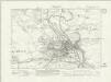
Sussex LIV.SW - OS Six-Inch Map
1 : 10560 Topographic maps Ordnance Survey Ordnance Survey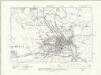
Sussex LIV.SW - OS Six-Inch Map
1 : 10560 Topographic maps Ordnance Survey Ordnance Survey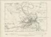
Sussex LIV.SW - OS Six-Inch Map
1 : 10560 Topographic maps Ordnance Survey Ordnance Survey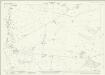
Sussex LIV.8 (includes: Ringmer) - 25 Inch Map
1 : 2500 Topographic maps Ordnance Survey Ordnance Survey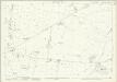
Sussex LIV.8 (includes: Ringmer) - 25 Inch Map
1 : 2500 Topographic maps Ordnance Survey Ordnance Survey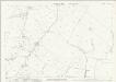
Sussex LIV.12 (includes: Laughton; Ringmer) - 25 Inch Map
1 : 2500 Topographic maps Ordnance Survey Ordnance Survey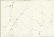
Sussex LIV.12 (includes: Laughton; Ringmer) - 25 Inch Map
1 : 2500 Topographic maps Ordnance Survey Ordnance Survey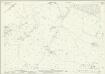
Sussex LIV.3 (includes: Barcombe; Ringmer) - 25 Inch Map
1 : 2500 Topographic maps Ordnance Survey Ordnance Survey
Sussex LIV.3 (includes: Barcombe; Ringmer) - 25 Inch Map
1 : 2500 Topographic maps Ordnance Survey Ordnance Survey
Sussex LIV.3 (includes: Barcombe; Ringmer) - 25 Inch Map
1 : 2500 Topographic maps Ordnance Survey Ordnance Survey
Sussex LIV.3 (includes: Barcombe; Ringmer) - 25 Inch Map
1 : 2500 Topographic maps Ordnance Survey Ordnance Survey
Sussex LIV.7 (includes: Ringmer) - 25 Inch Map
1 : 2500 Topographic maps Ordnance Survey Ordnance Survey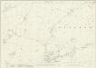
Sussex LIV.7 (includes: Ringmer) - 25 Inch Map
1 : 2500 Topographic maps Ordnance Survey Ordnance Survey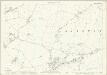
Sussex LIV.7 (includes: Ringmer) - 25 Inch Map
1 : 2500 Topographic maps Ordnance Survey Ordnance Survey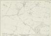
Sussex LIV.11 (includes: Glynde; Ringmer; South Malling Without) - 25 Inch Map
1 : 2500 Topographic maps Ordnance Survey Ordnance Survey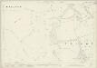
Sussex LIV.15 (includes: Glynde; Ringmer; South Malling Without) - 25 Inch Map
1 : 2500 Topographic maps Ordnance Survey Ordnance Survey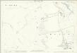
Sussex LIV.15 (includes: Glynde; Ringmer; South Malling Without) - 25 Inch Map
1 : 2500 Topographic maps Ordnance Survey Ordnance Survey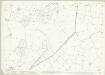
Sussex LIV.16 (includes: Glynde; Laughton; Ringmer; West Firle) - 25 Inch Map
1 : 2500 Topographic maps Ordnance Survey Ordnance Survey
Sussex LIV.16 (includes: Glynde; Laughton; Ringmer; West Firle) - 25 Inch Map
1 : 2500 Topographic maps Ordnance Survey Ordnance Survey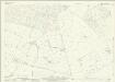
Sussex LIV.4 (includes: Little Horsted; Ringmer) - 25 Inch Map
1 : 2500 Topographic maps Ordnance Survey Ordnance Survey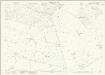
Sussex LIV.4 (includes: Little Horsted; Ringmer) - 25 Inch Map
1 : 2500 Topographic maps Ordnance Survey Ordnance Survey