Maps of Reading
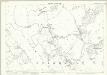
Oxfordshire LVI - OS Six-Inch Map
1 : 10560 Topographic maps Ordnance Survey Ordnance Survey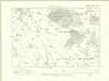
Berkshire XXIX.NE - OS Six-Inch Map
1 : 10560 Topographic maps Ordnance Survey Ordnance Survey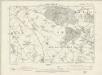
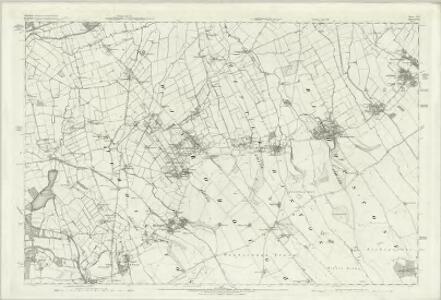
Oxfordshire LVI.NE - OS Six-Inch Map
1 : 10560 Topographic maps Ordnance Survey Ordnance Survey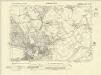
Berkshire XXIX.SE - OS Six-Inch Map
1 : 10560 Topographic maps Ordnance Survey Ordnance Survey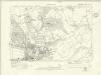
Berkshire XXIX.SE - OS Six-Inch Map
1 : 10560 Topographic maps Ordnance Survey Ordnance Survey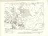
Berkshire XXIX.SE - OS Six-Inch Map
1 : 10560 Topographic maps Ordnance Survey Ordnance Survey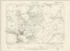
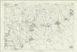
Oxfordshire LVI.SE - OS Six-Inch Map
1 : 10560 Topographic maps Ordnance Survey Ordnance Survey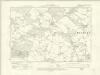
Berkshire XXIX.NW - OS Six-Inch Map
1 : 10560 Topographic maps Ordnance Survey Ordnance Survey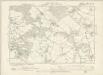
Oxfordshire LVI.NW - OS Six-Inch Map
1 : 10560 Topographic maps Ordnance Survey Ordnance Survey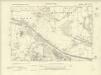
Berkshire XXIX.SW - OS Six-Inch Map
1 : 10560 Topographic maps Ordnance Survey Ordnance Survey
Berkshire XXIX.SW - OS Six-Inch Map
1 : 10560 Topographic maps Ordnance Survey Ordnance Survey
Berkshire XXIX.SW - OS Six-Inch Map
1 : 10560 Topographic maps Ordnance Survey Ordnance Survey
Oxfordshire LVI.SW - OS Six-Inch Map
1 : 10560 Topographic maps Ordnance Survey Ordnance Survey
Oxfordshire LVI.8 (includes: Eye and Dunsden; Shiplake) - 25 Inch Map
1 : 2500 Topographic maps Ordnance Survey Ordnance Survey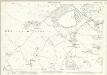
Oxfordshire LVI.8 (includes: Eye and Dunsden; Shiplake) - 25 Inch Map
1 : 2500 Topographic maps Ordnance Survey Ordnance Survey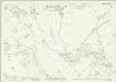
Oxfordshire LVI.12 (includes: Eye and Dunsden) - 25 Inch Map
1 : 2500 Topographic maps Ordnance Survey Ordnance Survey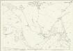
Oxfordshire LVI.12 (includes: Eye and Dunsden) - 25 Inch Map
1 : 2500 Topographic maps Ordnance Survey Ordnance Survey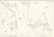
Oxfordshire LVI.12 (includes: Eye and Dunsden) - 25 Inch Map
1 : 2500 Topographic maps Ordnance Survey Ordnance Survey
Berkshire XXIX.16 (includes: Earley; Eye and Dunsden; Reading; Sonning) - 25 Inch Map
1 : 2500 Topographic maps Ordnance Survey Ordnance Survey
Oxfordshire LVI.16 (includes: Earley; Eye and Dunsden; Reading; Sonning) - 25 Inch Map
1 : 2500 Topographic maps Ordnance Survey Ordnance Survey
Berkshire XXIX.16 (includes: Earley; Eye and Dunsden; Reading; Sonning) - 25 Inch Map
1 : 2500 Topographic maps Ordnance Survey Ordnance Survey
Oxfordshire LVI.16 (includes: Earley; Eye and Dunsden; Reading; Sonning) - 25 Inch Map
1 : 2500 Topographic maps Ordnance Survey Ordnance Survey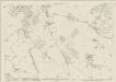
Oxfordshire LVI.3 (includes: Eye and Dunsden; Harpsden; Kidmore End; Shiplake) - 25 Inch Map
1 : 2500 Topographic maps Ordnance Survey Ordnance Survey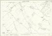
Oxfordshire LVI.3 (includes: Eye and Dunsden; Harpsden; Kidmore End; Shiplake) - 25 Inch Map
1 : 2500 Topographic maps Ordnance Survey Ordnance Survey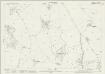
Berkshire XXIX.7 (includes: Eye and Dunsden; Kidmore End; Reading) - 25 Inch Map
1 : 2500 Topographic maps Ordnance Survey Ordnance Survey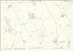
Oxfordshire LVI.7 (includes: Eye and Dunsden; Kidmore End; Reading) - 25 Inch Map
1 : 2500 Topographic maps Ordnance Survey Ordnance Survey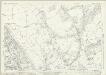
Berkshire XXIX.11 (includes: Eye and Dunsden; Kidmore End; Reading) - 25 Inch Map
1 : 2500 Topographic maps Ordnance Survey Ordnance Survey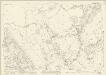
Berkshire XXIX.11 (includes: Eye and Dunsden; Kidmore End; Reading) - 25 Inch Map
1 : 2500 Topographic maps Ordnance Survey Ordnance Survey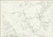
Berkshire XXIX.11 (includes: Eye and Dunsden; Kidmore End; Reading) - 25 Inch Map
1 : 2500 Topographic maps Ordnance Survey Ordnance Survey