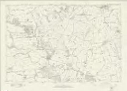
Maps of Northumberland
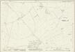
Northumberland nLIX - OS Six-Inch Map
1 : 10560 Topographic maps Ordnance Survey Ordnance Survey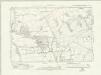
Northumberland nLIX.NW - OS Six-Inch Map
1 : 10560 Topographic maps Ordnance Survey Ordnance Survey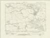
Northumberland nLIX.SW - OS Six-Inch Map
1 : 10560 Topographic maps Ordnance Survey Ordnance Survey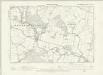
Northumberland LXIII.NW - OS Six-Inch Map
1 : 10560 Topographic maps Ordnance Survey Ordnance Survey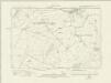
Northumberland nLIX.NE - OS Six-Inch Map
1 : 10560 Topographic maps Ordnance Survey Ordnance Survey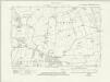
Northumberland nLIX.SE - OS Six-Inch Map
1 : 10560 Topographic maps Ordnance Survey Ordnance Survey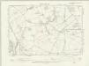
Northumberland LIV.SW - OS Six-Inch Map
1 : 10560 Topographic maps Ordnance Survey Ordnance Survey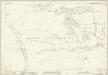
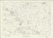
Northumberland (New Series) LIX.5 (includes: Ewesley; Healey And Combhill; Netherwitton; Nunnykirk; Ritton Colt Park) - 25 Inch Map
1 : 2500 Topographic maps Ordnance Survey Ordnance Survey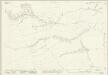
Northumberland (New Series) LIX.9 (includes: Ewesley; Healey And Combhill; Longwitton; Netherwitton) - 25 Inch Map
1 : 2500 Topographic maps Ordnance Survey Ordnance Survey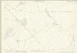
Northumberland (Old Series) LIV.15 (includes: Fenrother; Freeholders Quarter; Long Horsley Common; Riddells Quarter; Stanton) - 25 Inch Map
1 : 2500 Topographic maps Ordnance Survey Ordnance Survey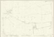
Northumberland (New Series) LIX.13 (includes: Longwitton; Netherwitton) - 25 Inch Map
1 : 2500 Topographic maps Ordnance Survey Ordnance Survey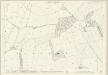
Northumberland (Old Series) LXIII.3 (includes: Fenrother; Long Horsley Common; Riddells Quarter; Stanton) - 25 Inch Map
1 : 2500 Topographic maps Ordnance Survey Ordnance Survey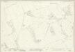
Northumberland (New Series) LIX.2 (includes: Coatyards; Freeholders Quarter; Netherwitton; Ritton Colt Park; Todburn; Wingates) - 25 Inch Map
1 : 2500 Topographic maps Ordnance Survey Ordnance Survey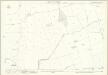
Northumberland (Old Series) LXIII.7 (includes: Benridge; Pigdon; Stanton) - 25 Inch Map
1 : 2500 Topographic maps Ordnance Survey Ordnance Survey
Northumberland (New Series) LIX.6 (includes: Healey And Combhill; Netherwitton; Wingates) - 25 Inch Map
1 : 2500 Topographic maps Ordnance Survey Ordnance Survey
Northumberland (New Series) LIX.10 (includes: Healey And Combhill; Netherwitton) - 25 Inch Map
1 : 2500 Topographic maps Ordnance Survey Ordnance Survey
Northumberland (Old Series) LIV.14 (includes: Freeholders Quarter; Netherwitton; Riddells Quarter; Stanton; Wingates; Witton Shields) - 25 Inch Map
1 : 2500 Topographic maps Ordnance Survey Ordnance Survey
Northumberland (New Series) LIX.14 (includes: East Thornton; Longshaws; Longwitton; Netherwitton; West Thornton) - 25 Inch Map
1 : 2500 Topographic maps Ordnance Survey Ordnance Survey
Northumberland (New Series) LIX.1 (includes: Coatyards; Healey And Combhill; Hollinghill; Netherwitton; Ritton Colt Park; Ritton White House; Wingates) - 25 Inch Map
1 : 2500 Topographic maps Ordnance Survey Ordnance Survey
Northumberland LXIII.NE - OS Six-Inch Map
1 : 10560 Topographic maps Ordnance Survey Ordnance Survey
Northumberland (Old Series) LXIII.2 (includes: Netherwitton; Stanton; Witton Shields) - 25 Inch Map
1 : 2500 Topographic maps Ordnance Survey Ordnance Survey
Northumberland (New Series) LIX.3 (includes: Bigges Quarter; Freeholders Quarter; Long Horsley Common; Netherwitton; Riddells Quarter; Stanton; Todburn; Wingates; Witton Shields) - 25 Inch Map
1 : 2500 Topographic maps Ordnance Survey Ordnance Survey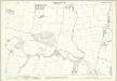
Northumberland (Old Series) LXIII.6 (includes: Longshaws; Netherwitton; Stanton; Witton Shields) - 25 Inch Map
1 : 2500 Topographic maps Ordnance Survey Ordnance Survey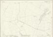
Northumberland (New Series) LIX.7 (includes: Freeholders Quarter; Netherwitton; Riddells Quarter; Stanton; Witton Shields) - 25 Inch Map
1 : 2500 Topographic maps Ordnance Survey Ordnance Survey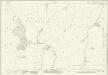
Northumberland (New Series) LIX.11 (includes: Netherwitton; Stanton; Witton Shields) - 25 Inch Map
1 : 2500 Topographic maps Ordnance Survey Ordnance Survey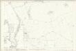
Northumberland (Old Series) LIV.13 (includes: Healey And Combhill; Netherwitton; Nunnykirk; Ritton Colt Park; Wingates) - 25 Inch Map
1 : 2500 Topographic maps Ordnance Survey Ordnance Survey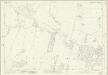
Northumberland (New Series) LIX.15 (includes: Longshaws; Netherwitton; Nunriding; Pigdon; Stanton; Witton Shields) - 25 Inch Map
1 : 2500 Topographic maps Ordnance Survey Ordnance Survey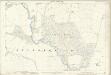
Northumberland (Old Series) LXIII.1 (includes: Healey And Combhill; Netherwitton) - 25 Inch Map
1 : 2500 Topographic maps Ordnance Survey Ordnance Survey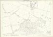
Northumberland (Old Series) LXIII.5 (includes: Longshaws; Longwitton; Netherwitton) - 25 Inch Map
1 : 2500 Topographic maps Ordnance Survey Ordnance Survey