Maps of Northumberland
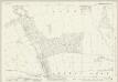
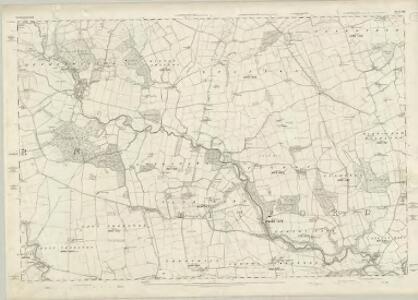
Northumberland LXIII - OS Six-Inch Map
1 : 10560 Topographic maps Ordnance Survey Ordnance Survey
Northumberland LXIII.NE - OS Six-Inch Map
1 : 10560 Topographic maps Ordnance Survey Ordnance Survey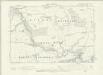
Northumberland LXIII.SE - OS Six-Inch Map
1 : 10560 Topographic maps Ordnance Survey Ordnance Survey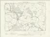
Northumberland LXIII.NW - OS Six-Inch Map
1 : 10560 Topographic maps Ordnance Survey Ordnance Survey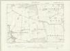
Northumberland LXIII.SW - OS Six-Inch Map
1 : 10560 Topographic maps Ordnance Survey Ordnance Survey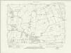
Northumberland nLIX.SE - OS Six-Inch Map
1 : 10560 Topographic maps Ordnance Survey Ordnance Survey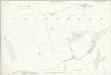
Northumberland (Old Series) LXIII.4 (includes: Fenrother; High And Low Highlaws; Stanton) - 25 Inch Map
1 : 2500 Topographic maps Ordnance Survey Ordnance Survey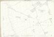
Northumberland (Old Series) LXIII.8 (includes: Benridge; Fenrother; High And Low Highlaws; Stanton) - 25 Inch Map
1 : 2500 Topographic maps Ordnance Survey Ordnance Survey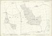
Northumberland (Old Series) LXIII.12 (includes: Benridge; High And Low Highlaws; Pigdon) - 25 Inch Map
1 : 2500 Topographic maps Ordnance Survey Ordnance Survey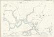
Northumberland (Old Series) LXIII.16 (includes: Benridge; Mitford; Morpeth; Newton Park; Newton Underwood; Pigdon; Spital Hill) - 25 Inch Map
1 : 2500 Topographic maps Ordnance Survey Ordnance Survey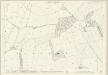
Northumberland (Old Series) LXIII.3 (includes: Fenrother; Long Horsley Common; Riddells Quarter; Stanton) - 25 Inch Map
1 : 2500 Topographic maps Ordnance Survey Ordnance Survey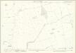
Northumberland (Old Series) LXIII.7 (includes: Benridge; Pigdon; Stanton) - 25 Inch Map
1 : 2500 Topographic maps Ordnance Survey Ordnance Survey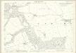
Northumberland (Old Series) LXIII.11 (includes: Benridge; Longshaws; Nunriding; Pigdon; Stanton) - 25 Inch Map
1 : 2500 Topographic maps Ordnance Survey Ordnance Survey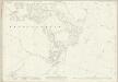
Northumberland (New Series) LIX.10 (includes: Healey And Combhill; Netherwitton) - 25 Inch Map
1 : 2500 Topographic maps Ordnance Survey Ordnance Survey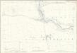
Northumberland (Old Series) LXIII.15 (includes: Newton Park; Newton Underwood; Nunriding; Pigdon; Throphill) - 25 Inch Map
1 : 2500 Topographic maps Ordnance Survey Ordnance Survey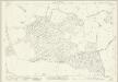
Northumberland (New Series) LIX.14 (includes: East Thornton; Longshaws; Longwitton; Netherwitton; West Thornton) - 25 Inch Map
1 : 2500 Topographic maps Ordnance Survey Ordnance Survey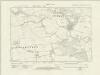
Northumberland nLIX.SW - OS Six-Inch Map
1 : 10560 Topographic maps Ordnance Survey Ordnance Survey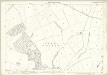
Northumberland (Old Series) LXIII.2 (includes: Netherwitton; Stanton; Witton Shields) - 25 Inch Map
1 : 2500 Topographic maps Ordnance Survey Ordnance Survey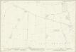
Northumberland (New Series) LXVIII.2 (includes: East Thornton; Longshaws; Longwitton; West Thornton) - 25 Inch Map
1 : 2500 Topographic maps Ordnance Survey Ordnance Survey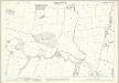
Northumberland (Old Series) LXIII.6 (includes: Longshaws; Netherwitton; Stanton; Witton Shields) - 25 Inch Map
1 : 2500 Topographic maps Ordnance Survey Ordnance Survey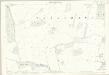
Northumberland (Old Series) LXIII.10 (includes: East Thornton; Longshaws; Nunriding; Stanton; Throphill) - 25 Inch Map
1 : 2500 Topographic maps Ordnance Survey Ordnance Survey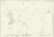
Northumberland (New Series) LIX.11 (includes: Netherwitton; Stanton; Witton Shields) - 25 Inch Map
1 : 2500 Topographic maps Ordnance Survey Ordnance Survey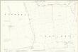
Northumberland (Old Series) LXIII.14 (includes: East Thornton; Meldon; Newton Underwood; Nunriding; Throphill) - 25 Inch Map
1 : 2500 Topographic maps Ordnance Survey Ordnance Survey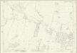
Northumberland (New Series) LIX.15 (includes: Longshaws; Netherwitton; Nunriding; Pigdon; Stanton; Witton Shields) - 25 Inch Map
1 : 2500 Topographic maps Ordnance Survey Ordnance Survey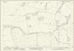
Northumberland (New Series) LXVIII.3 (includes: East Thornton; Longshaws; Newton Underwood; Nunriding; Throphill) - 25 Inch Map
1 : 2500 Topographic maps Ordnance Survey Ordnance Survey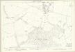
Northumberland (Old Series) LXIII.5 (includes: Longshaws; Longwitton; Netherwitton) - 25 Inch Map
1 : 2500 Topographic maps Ordnance Survey Ordnance Survey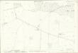
Northumberland (Old Series) LXIII.9 (includes: East Thornton; Longshaws; Longwitton; Netherwitton; West Thornton) - 25 Inch Map
1 : 2500 Topographic maps Ordnance Survey Ordnance Survey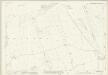
Northumberland (New Series) LIX.12 (includes: Benridge; Fenrother; Pigdon; Stanton) - 25 Inch Map
1 : 2500 Topographic maps Ordnance Survey Ordnance Survey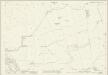
Northumberland (New Series) LIX.16 (includes: Benridge; Nunriding; Pigdon; Stanton) - 25 Inch Map
1 : 2500 Topographic maps Ordnance Survey Ordnance Survey