Maps of Northumberland
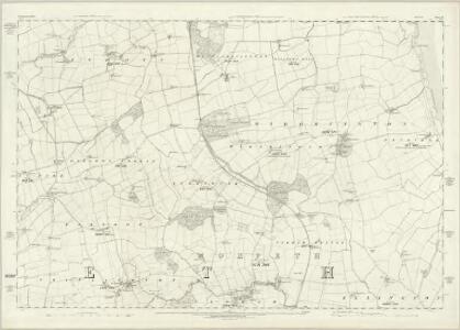
Northumberland LV - OS Six-Inch Map
1 : 10560 Topographic maps Ordnance Survey Ordnance Survey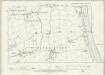
Northumberland LV.NE & LVI.NW - OS Six-Inch Map
1 : 10560 Topographic maps Ordnance Survey Ordnance Survey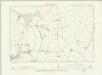
Northumberland LV.SE - OS Six-Inch Map
1 : 10560 Topographic maps Ordnance Survey Ordnance Survey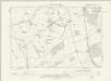
Northumberland LV.NW - OS Six-Inch Map
1 : 10560 Topographic maps Ordnance Survey Ordnance Survey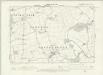
Northumberland LV.SW - OS Six-Inch Map
1 : 10560 Topographic maps Ordnance Survey Ordnance Survey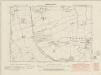
Northumberland nLI.SE - OS Six-Inch Map
1 : 10560 Topographic maps Ordnance Survey Ordnance Survey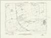
Northumberland nLI.SE - OS Six-Inch Map
1 : 10560 Topographic maps Ordnance Survey Ordnance Survey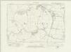
Northumberland nLX.NE - OS Six-Inch Map
1 : 10560 Topographic maps Ordnance Survey Ordnance Survey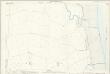
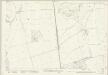
Northumberland (Old Series) LV.4 (includes: East Chevington; Hadston; Widdrington) - 25 Inch Map
1 : 2500 Topographic maps Ordnance Survey Ordnance Survey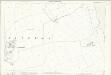
Northumberland (Old Series) LV.8 (includes: Widdrington) - 25 Inch Map
1 : 2500 Topographic maps Ordnance Survey Ordnance Survey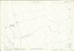
Northumberland (Old Series) LV.12 (includes: Cresswell; Ellington; Ulgham; Widdrington) - 25 Inch Map
1 : 2500 Topographic maps Ordnance Survey Ordnance Survey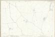
Northumberland (Old Series) LV.16 (includes: Cresswell; Ellington; Ulgham; Widdrington) - 25 Inch Map
1 : 2500 Topographic maps Ordnance Survey Ordnance Survey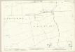
Northumberland (Old Series) LV.3 (includes: Bullocks Hall; East Chevington; West Chevington; Widdrington) - 25 Inch Map
1 : 2500 Topographic maps Ordnance Survey Ordnance Survey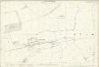
Northumberland (Old Series) LV.7 (includes: West Chevington; Widdrington) - 25 Inch Map
1 : 2500 Topographic maps Ordnance Survey Ordnance Survey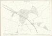
Northumberland (Old Series) LV.11 (includes: Ulgham; Widdrington) - 25 Inch Map
1 : 2500 Topographic maps Ordnance Survey Ordnance Survey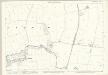
Northumberland (Old Series) LV.15 (includes: Ellington; Ulgham) - 25 Inch Map
1 : 2500 Topographic maps Ordnance Survey Ordnance Survey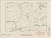
Northumberland nLI.SW - OS Six-Inch Map
1 : 10560 Topographic maps Ordnance Survey Ordnance Survey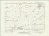
Northumberland nLI.SW - OS Six-Inch Map
1 : 10560 Topographic maps Ordnance Survey Ordnance Survey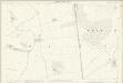
Northumberland (Old Series) LV.2 (includes: Eshott; Thirston With Shothaugh; West Chevington) - 25 Inch Map
1 : 2500 Topographic maps Ordnance Survey Ordnance Survey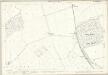
Northumberland (Old Series) LV.6 (includes: Earsdon Forest; Eshott; Ulgham; West Chevington; Widdrington) - 25 Inch Map
1 : 2500 Topographic maps Ordnance Survey Ordnance Survey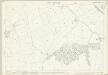
Northumberland (Old Series) LV.10 (includes: Earsdon Forest; Earsdon; Ulgham; Widdrington) - 25 Inch Map
1 : 2500 Topographic maps Ordnance Survey Ordnance Survey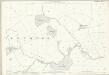
Northumberland (Old Series) LV.14 (includes: Earsdon; Tritlington; Ulgham) - 25 Inch Map
1 : 2500 Topographic maps Ordnance Survey Ordnance Survey
Northumberland (Old Series) LV.5 (includes: Bockenfield; Causey Park; Earsdon Forest; Eshott) - 25 Inch Map
1 : 2500 Topographic maps Ordnance Survey Ordnance Survey
Northumberland (Old Series) LV.9 (includes: Causey Park; Earsdon Forest; Earsdon) - 25 Inch Map
1 : 2500 Topographic maps Ordnance Survey Ordnance Survey
Northumberland (Old Series) LV.1 (includes: Bockenfield; Eshott; Thirston With Shothaugh) - 25 Inch Map
1 : 2500 Topographic maps Ordnance Survey Ordnance Survey
Northumberland (Old Series) LV.13 (includes: Causey Park; Earsdon; Fenrother; Tritlington) - 25 Inch Map
1 : 2500 Topographic maps Ordnance Survey Ordnance Survey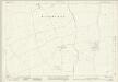
Northumberland (New Series) LI.12 (includes: Bullocks Hall; East Chevington; West Chevington; Widdrington) - 25 Inch Map
1 : 2500 Topographic maps Ordnance Survey Ordnance Survey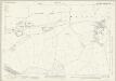
Northumberland (New Series) LI.16 (includes: Ulgham; Widdrington) - 25 Inch Map
1 : 2500 Topographic maps Ordnance Survey Ordnance Survey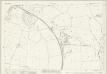
Northumberland (New Series) LX.4 (includes: Ellington; Ulgham; Widdrington) - 25 Inch Map
1 : 2500 Topographic maps Ordnance Survey Ordnance Survey