Maps of Northumberland
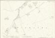
Northumberland LIV - OS Six-Inch Map
1 : 10560 Topographic maps Ordnance Survey Ordnance Survey
Northumberland LIV.NE - OS Six-Inch Map
1 : 10560 Topographic maps Ordnance Survey Ordnance Survey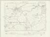
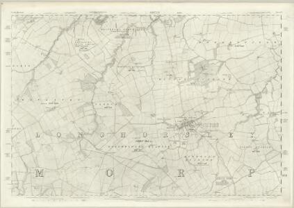
Northumberland LIV.SE - OS Six-Inch Map
1 : 10560 Topographic maps Ordnance Survey Ordnance Survey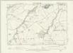
Northumberland LIV.NW - OS Six-Inch Map
1 : 10560 Topographic maps Ordnance Survey Ordnance Survey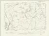
Northumberland LIV.SW - OS Six-Inch Map
1 : 10560 Topographic maps Ordnance Survey Ordnance Survey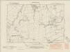
Northumberland nL.SE - OS Six-Inch Map
1 : 10560 Topographic maps Ordnance Survey Ordnance Survey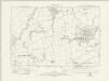
Northumberland nL.SE - OS Six-Inch Map
1 : 10560 Topographic maps Ordnance Survey Ordnance Survey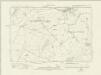
Northumberland nLIX.NE - OS Six-Inch Map
1 : 10560 Topographic maps Ordnance Survey Ordnance Survey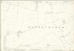
Northumberland (Old Series) LIV.4 (includes: Bigges Quarter; Bockenfield; Thirston With Shothaugh) - 25 Inch Map
1 : 2500 Topographic maps Ordnance Survey Ordnance Survey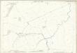
Northumberland (Old Series) LIV.8 (includes: Bigges Quarter; Bockenfield; Causey Park; Riddells Quarter) - 25 Inch Map
1 : 2500 Topographic maps Ordnance Survey Ordnance Survey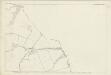
Northumberland (Old Series) LIV.8 (includes: Bigges Quarter; Bockenfield; Causey Park; Riddells Quarter) - 25 Inch Map
1 : 2500 Topographic maps Ordnance Survey Ordnance Survey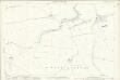
Northumberland (Old Series) LIV.12 (includes: Bigges Quarter; Causey Park; Riddells Quarter) - 25 Inch Map
1 : 2500 Topographic maps Ordnance Survey Ordnance Survey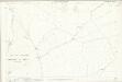
Northumberland (Old Series) LIV.16 (includes: Bigges Quarter; Causey Park; Earsdon; Fenrother; Long Horsley Common; Riddells Quarter) - 25 Inch Map
1 : 2500 Topographic maps Ordnance Survey Ordnance Survey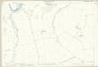
Northumberland (Old Series) LIV.3 (includes: Bigges Quarter; Bockenfield; Brinkburn High Ward; Brinkburn Low Ward; Riddells Quarter) - 25 Inch Map
1 : 2500 Topographic maps Ordnance Survey Ordnance Survey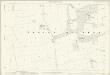
Northumberland (Old Series) LIV.7 (includes: Bigges Quarter; Riddells Quarter) - 25 Inch Map
1 : 2500 Topographic maps Ordnance Survey Ordnance Survey
Northumberland (Old Series) LIV.11 (includes: Bigges Quarter; Freeholders Quarter; Long Horsley Common; Riddells Quarter) - 25 Inch Map
1 : 2500 Topographic maps Ordnance Survey Ordnance Survey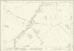
Northumberland (New Series) L.10 (includes: Brinkburn High Ward; Hesleyhurst; Raw; Wingates) - 25 Inch Map
1 : 2500 Topographic maps Ordnance Survey Ordnance Survey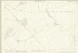
Northumberland (Old Series) LIV.15 (includes: Fenrother; Freeholders Quarter; Long Horsley Common; Riddells Quarter; Stanton) - 25 Inch Map
1 : 2500 Topographic maps Ordnance Survey Ordnance Survey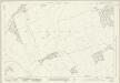
Northumberland (New Series) L.14 (includes: Wingates) - 25 Inch Map
1 : 2500 Topographic maps Ordnance Survey Ordnance Survey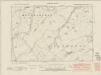
Northumberland nL.SW - OS Six-Inch Map
1 : 10560 Topographic maps Ordnance Survey Ordnance Survey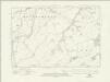
Northumberland nL.SW - OS Six-Inch Map
1 : 10560 Topographic maps Ordnance Survey Ordnance Survey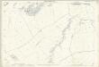
Northumberland (Old Series) LIV.2 (includes: Brinkburn High Ward; Brinkburn Low Ward; Raw; Riddells Quarter; Todburn; Wingates) - 25 Inch Map
1 : 2500 Topographic maps Ordnance Survey Ordnance Survey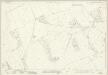
Northumberland (New Series) LIX.2 (includes: Coatyards; Freeholders Quarter; Netherwitton; Ritton Colt Park; Todburn; Wingates) - 25 Inch Map
1 : 2500 Topographic maps Ordnance Survey Ordnance Survey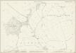
Northumberland (Old Series) LIV.6 (includes: Bigges Quarter; Brinkburn High Ward; Riddells Quarter; Todburn; Wingates) - 25 Inch Map
1 : 2500 Topographic maps Ordnance Survey Ordnance Survey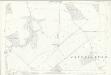
Northumberland (Old Series) LIV.10 (includes: Bigges Quarter; Freeholders Quarter; Netherwitton; Todburn; Wingates) - 25 Inch Map
1 : 2500 Topographic maps Ordnance Survey Ordnance Survey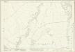
Northumberland (New Series) L.11 (includes: Bigges Quarter; Brinkburn High Ward; Riddells Quarter; Todburn; Wingates) - 25 Inch Map
1 : 2500 Topographic maps Ordnance Survey Ordnance Survey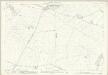
Northumberland (Old Series) LIV.14 (includes: Freeholders Quarter; Netherwitton; Riddells Quarter; Stanton; Wingates; Witton Shields) - 25 Inch Map
1 : 2500 Topographic maps Ordnance Survey Ordnance Survey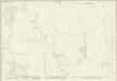
Northumberland (New Series) L.15 (includes: Bigges Quarter; Freeholders Quarter; Riddells Quarter; Todburn; Wingates) - 25 Inch Map
1 : 2500 Topographic maps Ordnance Survey Ordnance Survey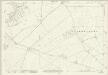
Northumberland (New Series) LIX.3 (includes: Bigges Quarter; Freeholders Quarter; Long Horsley Common; Netherwitton; Riddells Quarter; Stanton; Todburn; Wingates; Witton Shields) - 25 Inch Map
1 : 2500 Topographic maps Ordnance Survey Ordnance Survey