Maps of Leeds
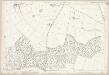
Yorkshire 189 - OS Six-Inch Map
1 : 10560 Topographic maps Ordnance Survey Ordnance Survey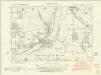
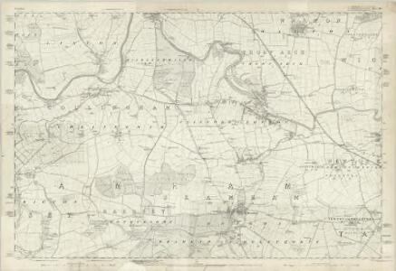
Yorkshire CLXXXIX.NW - OS Six-Inch Map
1 : 10560 Topographic maps Ordnance Survey Ordnance Survey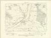
Yorkshire CLXXXIX.NW - OS Six-Inch Map
1 : 10560 Topographic maps Ordnance Survey Ordnance Survey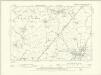
Yorkshire CLXXXIX.NW - OS Six-Inch Map
1 : 10560 Topographic maps Ordnance Survey Ordnance Survey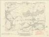
Yorkshire CLXXXIX.SW - OS Six-Inch Map
1 : 10560 Topographic maps Ordnance Survey Ordnance Survey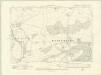
Yorkshire CLXXXIX.SW - OS Six-Inch Map
1 : 10560 Topographic maps Ordnance Survey Ordnance Survey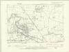
Yorkshire CLXXXIX.SW - OS Six-Inch Map
1 : 10560 Topographic maps Ordnance Survey Ordnance Survey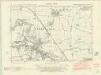
Yorkshire CLXXXIX.NE - OS Six-Inch Map
1 : 10560 Topographic maps Ordnance Survey Ordnance Survey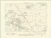
Yorkshire CLXXXIX.NE - OS Six-Inch Map
1 : 10560 Topographic maps Ordnance Survey Ordnance Survey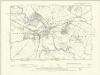
Yorkshire CLXXXIX.NE - OS Six-Inch Map
1 : 10560 Topographic maps Ordnance Survey Ordnance Survey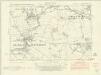
Yorkshire CLXXXIX.SE - OS Six-Inch Map
1 : 10560 Topographic maps Ordnance Survey Ordnance Survey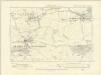
Yorkshire CLXXXIX.SE - OS Six-Inch Map
1 : 10560 Topographic maps Ordnance Survey Ordnance Survey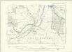
Yorkshire CLXXXIX.SE - OS Six-Inch Map
1 : 10560 Topographic maps Ordnance Survey Ordnance Survey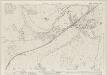
Yorkshire CLXXXIX.5 (includes: Bardsey Cum Rigton; Collingham; East Keswick; Sicklinghall) - 25 Inch Map
1 : 2500 Topographic maps Ordnance Survey Ordnance Survey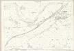
Yorkshire CLXXXIX.5 (includes: Bardsey Cum Rigton; Collingham; East Keswick; Sicklinghall) - 25 Inch Map
1 : 2500 Topographic maps Ordnance Survey Ordnance Survey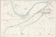
Yorkshire CLXXXIX.5 (includes: Bardsey Cum Rigton; Collingham; East Keswick; Sicklinghall) - 25 Inch Map
1 : 2500 Topographic maps Ordnance Survey Ordnance Survey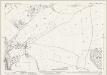
Yorkshire CLXXXIX.9 (includes: Bardsey Cum Rigton; Collingham; East Keswick; Wothersome) - 25 Inch Map
1 : 2500 Topographic maps Ordnance Survey Ordnance Survey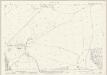
Yorkshire CLXXXIX.9 (includes: Bardsey Cum Rigton; Collingham; East Keswick; Wothersome) - 25 Inch Map
1 : 2500 Topographic maps Ordnance Survey Ordnance Survey
Yorkshire CLXXXIX.13 (includes: Bardsey Cum Rigton; Collingham; Scarcroft; Thorner; Wothersome) - 25 Inch Map
1 : 2500 Topographic maps Ordnance Survey Ordnance Survey
Yorkshire CLXXXIX.13 (includes: Bardsey Cum Rigton; Collingham; Scarcroft; Thorner; Wothersome) - 25 Inch Map
1 : 2500 Topographic maps Ordnance Survey Ordnance Survey
Yorkshire CLXXXIX.2 (includes: Boston Spa; Collingham; Wetherby) - 25 Inch Map
1 : 2500 Topographic maps Ordnance Survey Ordnance Survey
Yorkshire CLXXXIX.2 (includes: Boston Spa; Collingham; Wetherby) - 25 Inch Map
1 : 2500 Topographic maps Ordnance Survey Ordnance Survey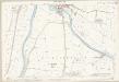
Yorkshire CLXXXIX.2 (includes: Boston Spa; Collingham; Wetherby) - 25 Inch Map
1 : 2500 Topographic maps Ordnance Survey Ordnance Survey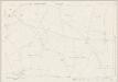
Yorkshire CLXXXIX.6 (includes: Boston Spa; Clifford; Collingham; Wetherby) - 25 Inch Map
1 : 2500 Topographic maps Ordnance Survey Ordnance Survey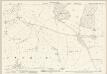
Yorkshire CLXXXIX.6 (includes: Boston Spa; Clifford; Collingham; Wetherby) - 25 Inch Map
1 : 2500 Topographic maps Ordnance Survey Ordnance Survey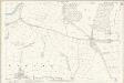
Yorkshire CLXXXIX.6 (includes: Boston Spa; Clifford; Collingham; Wetherby) - 25 Inch Map
1 : 2500 Topographic maps Ordnance Survey Ordnance Survey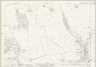
Yorkshire CLXXXIX.1 (includes: Collingham; East Keswick; Sicklinghall; Wetherby) - 25 Inch Map
1 : 2500 Topographic maps Ordnance Survey Ordnance Survey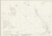
Yorkshire CLXXXIX.1 (includes: Collingham; East Keswick; Sicklinghall; Wetherby) - 25 Inch Map
1 : 2500 Topographic maps Ordnance Survey Ordnance Survey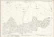
Yorkshire CLXXXIX.10 (includes: Bramham Cum Oglethorpe; Clifford; Collingham; Wothersome) - 25 Inch Map
1 : 2500 Topographic maps Ordnance Survey Ordnance Survey