Maps of North Yorkshire
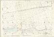
Yorkshire CLIII - OS Six-Inch Map
1 : 10560 Topographic maps Ordnance Survey Ordnance Survey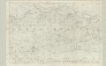
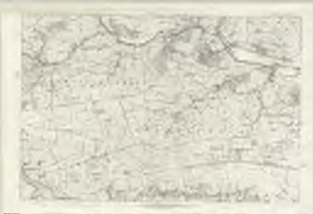
Yorkshire 153 - OS Six-Inch Map
1 : 10560 Topographic maps Ordnance Survey Ordnance Survey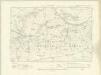
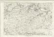
Yorkshire CLIII.NW - OS Six-Inch Map
1 : 10560 Topographic maps Ordnance Survey Ordnance Survey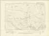
Yorkshire CLIII.SW - OS Six-Inch Map
1 : 10560 Topographic maps Ordnance Survey Ordnance Survey
Yorkshire CLIII.NE - OS Six-Inch Map
1 : 10560 Topographic maps Ordnance Survey Ordnance Survey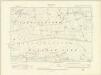
Yorkshire CLIII.SE - OS Six-Inch Map
1 : 10560 Topographic maps Ordnance Survey Ordnance Survey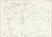
Yorkshire CLIII.5 (includes: Dacre; Menwith With Darley; Thornthwaite With Padside) - 25 Inch Map
1 : 2500 Topographic maps Ordnance Survey Ordnance Survey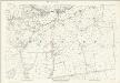
Yorkshire CLIII.5 (includes: Dacre; Menwith With Darley; Thornthwaite With Padside) - 25 Inch Map
1 : 2500 Topographic maps Ordnance Survey Ordnance Survey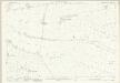
Yorkshire CLIII.9 (includes: Fewston; Menwith With Darley) - 25 Inch Map
1 : 2500 Topographic maps Ordnance Survey Ordnance Survey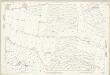
Yorkshire CLIII.9 (includes: Fewston; Menwith With Darley) - 25 Inch Map
1 : 2500 Topographic maps Ordnance Survey Ordnance Survey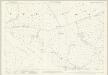
Yorkshire CLIII.13 (includes: Blubberhouses; Fewston; Great Timble) - 25 Inch Map
1 : 2500 Topographic maps Ordnance Survey Ordnance Survey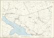
Yorkshire CLIII.13 (includes: Blubberhouses; Fewston; Great Timble) - 25 Inch Map
1 : 2500 Topographic maps Ordnance Survey Ordnance Survey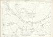
Yorkshire CLIII.2 (includes: Birstwith; Dacre; Hartwith Cum Winsley; Menwith With Darley) - 25 Inch Map
1 : 2500 Topographic maps Ordnance Survey Ordnance Survey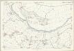
Yorkshire CLIII.2 (includes: Birstwith; Dacre; Hartwith Cum Winsley; Menwith With Darley) - 25 Inch Map
1 : 2500 Topographic maps Ordnance Survey Ordnance Survey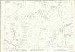
Yorkshire CLIII.1 (includes: Dacre; Menwith With Darley; Thornthwaite With Padside) - 25 Inch Map
1 : 2500 Topographic maps Ordnance Survey Ordnance Survey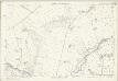
Yorkshire CLIII.1 (includes: Dacre; Menwith With Darley; Thornthwaite With Padside) - 25 Inch Map
1 : 2500 Topographic maps Ordnance Survey Ordnance Survey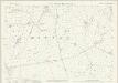
Yorkshire CLIII.6 (includes: Birstwith; Menwith With Darley) - 25 Inch Map
1 : 2500 Topographic maps Ordnance Survey Ordnance Survey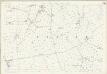
Yorkshire CLIII.6 (includes: Birstwith; Menwith With Darley) - 25 Inch Map
1 : 2500 Topographic maps Ordnance Survey Ordnance Survey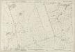
Yorkshire CLIII.10 (includes: Birstwith; Felliscliffe; Fewston; Menwith With Darley; Norwood) - 25 Inch Map
1 : 2500 Topographic maps Ordnance Survey Ordnance Survey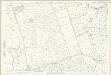
Yorkshire CLIII.10 (includes: Birstwith; Felliscliffe; Fewston; Menwith With Darley; Norwood) - 25 Inch Map
1 : 2500 Topographic maps Ordnance Survey Ordnance Survey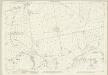
Yorkshire CLIII.14 (includes: Felliscliffe; Fewston; Haverah Park; Norwood) - 25 Inch Map
1 : 2500 Topographic maps Ordnance Survey Ordnance Survey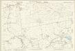
Yorkshire CLIII.14 (includes: Felliscliffe; Fewston; Haverah Park; Norwood) - 25 Inch Map
1 : 2500 Topographic maps Ordnance Survey Ordnance Survey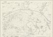
Yorkshire CLIII.3 (includes: Birstwith; Clint; Hartwith Cum Winsley; Menwith With Darley) - 25 Inch Map
1 : 2500 Topographic maps Ordnance Survey Ordnance Survey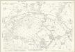
Yorkshire CLIII.3 (includes: Birstwith; Clint; Hartwith Cum Winsley; Menwith With Darley) - 25 Inch Map
1 : 2500 Topographic maps Ordnance Survey Ordnance Survey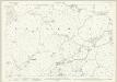
Yorkshire CLIII.7 (includes: Birstwith; Felliscliffe) - 25 Inch Map
1 : 2500 Topographic maps Ordnance Survey Ordnance Survey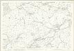
Yorkshire CLIII.7 (includes: Birstwith; Felliscliffe) - 25 Inch Map
1 : 2500 Topographic maps Ordnance Survey Ordnance Survey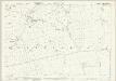
Yorkshire CLIII.11 (includes: Birstwith; Felliscliffe) - 25 Inch Map
1 : 2500 Topographic maps Ordnance Survey Ordnance Survey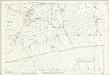
Yorkshire CLIII.11 (includes: Birstwith; Felliscliffe) - 25 Inch Map
1 : 2500 Topographic maps Ordnance Survey Ordnance Survey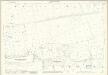
Yorkshire CLIII.15 (includes: Felliscliffe; Haverah Park; Norwood) - 25 Inch Map
1 : 2500 Topographic maps Ordnance Survey Ordnance Survey