Maps of North Yorkshire
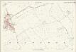
Yorkshire 120 - OS Six-Inch Map
1 : 10560 Topographic maps Ordnance Survey Ordnance Survey
Yorkshire CXX.NW - OS Six-Inch Map
1 : 10560 Topographic maps Ordnance Survey Ordnance Survey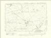
Yorkshire CXX.SW - OS Six-Inch Map
1 : 10560 Topographic maps Ordnance Survey Ordnance Survey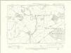
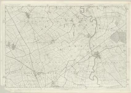
Yorkshire CXX.NE - OS Six-Inch Map
1 : 10560 Topographic maps Ordnance Survey Ordnance Survey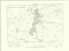
Yorkshire CXX.SE - OS Six-Inch Map
1 : 10560 Topographic maps Ordnance Survey Ordnance Survey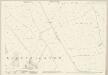
Yorkshire CXX.5 (includes: Dishforth; Marton Le Moor; Norton Le Clay) - 25 Inch Map
1 : 2500 Topographic maps Ordnance Survey Ordnance Survey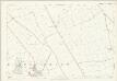
Yorkshire CXX.5 (includes: Dishforth; Marton Le Moor; Norton Le Clay) - 25 Inch Map
1 : 2500 Topographic maps Ordnance Survey Ordnance Survey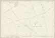
Yorkshire CXX.9 (includes: Kirby Hill; Langthorpe; Marton Le Moor; Norton Le Clay; Skelton) - 25 Inch Map
1 : 2500 Topographic maps Ordnance Survey Ordnance Survey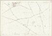
Yorkshire CXX.9 (includes: Kirby Hill; Langthorpe; Marton Le Moor; Norton Le Clay; Skelton) - 25 Inch Map
1 : 2500 Topographic maps Ordnance Survey Ordnance Survey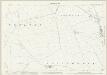
Yorkshire CXX.13 (includes: Kirby Hill; Langthorpe; Newby With Mulwith; Skelton) - 25 Inch Map
1 : 2500 Topographic maps Ordnance Survey Ordnance Survey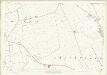
Yorkshire CXX.13 (includes: Kirby Hill; Langthorpe; Newby With Mulwith; Skelton) - 25 Inch Map
1 : 2500 Topographic maps Ordnance Survey Ordnance Survey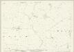
Yorkshire CXX.2 (includes: Asenby; Cundall With Leckby; Dishforth; Norton Le Clay) - 25 Inch Map
1 : 2500 Topographic maps Ordnance Survey Ordnance Survey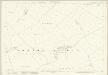
Yorkshire CXX.6 (includes: Cundall With Leckby; Dishforth; Norton Le Clay; Thornton Bridge) - 25 Inch Map
1 : 2500 Topographic maps Ordnance Survey Ordnance Survey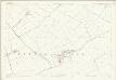
Yorkshire CXX.6 (includes: Cundall With Leckby; Dishforth; Norton Le Clay; Thornton Bridge) - 25 Inch Map
1 : 2500 Topographic maps Ordnance Survey Ordnance Survey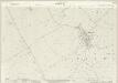
Yorkshire CXX.1 (includes: Dishforth; Hutton Conyers; Marton Le Moor; Rainton With Newby) - 25 Inch Map
1 : 2500 Topographic maps Ordnance Survey Ordnance Survey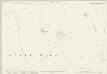
Yorkshire CXX.10 (includes: Kirby Hill; Milby; Norton Le Clay; Thornton Bridge) - 25 Inch Map
1 : 2500 Topographic maps Ordnance Survey Ordnance Survey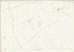
Yorkshire CXX.10 (includes: Kirby Hill; Milby; Norton Le Clay; Thornton Bridge) - 25 Inch Map
1 : 2500 Topographic maps Ordnance Survey Ordnance Survey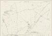
Yorkshire CXX.14 (includes: Boroughbridge; Ellenthorpe; Kirby Hill; Langthorpe; Milby) - 25 Inch Map
1 : 2500 Topographic maps Ordnance Survey Ordnance Survey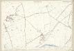
Yorkshire CXX.14 (includes: Boroughbridge; Ellenthorpe; Kirby Hill; Langthorpe; Milby) - 25 Inch Map
1 : 2500 Topographic maps Ordnance Survey Ordnance Survey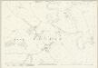
Yorkshire CXX.3 (includes: Cundall With Leckby; Eldmire With Crakehill; Fawdington) - 25 Inch Map
1 : 2500 Topographic maps Ordnance Survey Ordnance Survey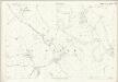
Yorkshire CXX.3 (includes: Cundall With Leckby; Eldmire With Crakehill; Fawdington) - 25 Inch Map
1 : 2500 Topographic maps Ordnance Survey Ordnance Survey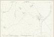
Yorkshire CXX.7 (includes: Brafferton; Cundall With Leckby; Norton Le Clay; Thornton Bridge) - 25 Inch Map
1 : 2500 Topographic maps Ordnance Survey Ordnance Survey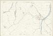
Yorkshire CXX.7 (includes: Brafferton; Cundall With Leckby; Norton Le Clay; Thornton Bridge) - 25 Inch Map
1 : 2500 Topographic maps Ordnance Survey Ordnance Survey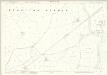
Yorkshire CXX.11 (includes: Brafferton; Helperby; Humberton; Kirby Hill; Milby; Thornton Bridge) - 25 Inch Map
1 : 2500 Topographic maps Ordnance Survey Ordnance Survey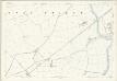
Yorkshire CXX.11 (includes: Brafferton; Helperby; Humberton; Kirby Hill; Milby; Thornton Bridge) - 25 Inch Map
1 : 2500 Topographic maps Ordnance Survey Ordnance Survey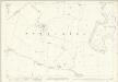
Yorkshire CXX.15 (includes: Ellenthorpe; Helperby; Humberton; Milby; Myton On Swale) - 25 Inch Map
1 : 2500 Topographic maps Ordnance Survey Ordnance Survey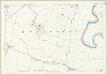
Yorkshire CXX.15 (includes: Ellenthorpe; Helperby; Humberton; Milby; Myton On Swale) - 25 Inch Map
1 : 2500 Topographic maps Ordnance Survey Ordnance Survey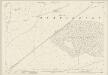
Yorkshire CXX.8 (includes: Brafferton; Cundall With Leckby; Fawdington; Helperby) - 25 Inch Map
1 : 2500 Topographic maps Ordnance Survey Ordnance Survey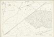
Yorkshire CXX.8 (includes: Brafferton; Cundall With Leckby; Fawdington; Helperby) - 25 Inch Map
1 : 2500 Topographic maps Ordnance Survey Ordnance Survey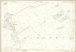
Yorkshire CXX.12 (includes: Brafferton; Helperby; Humberton) - 25 Inch Map
1 : 2500 Topographic maps Ordnance Survey Ordnance Survey