Maps of North Yorkshire
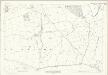
Yorkshire 104 - OS Six-Inch Map
1 : 10560 Topographic maps Ordnance Survey Ordnance Survey
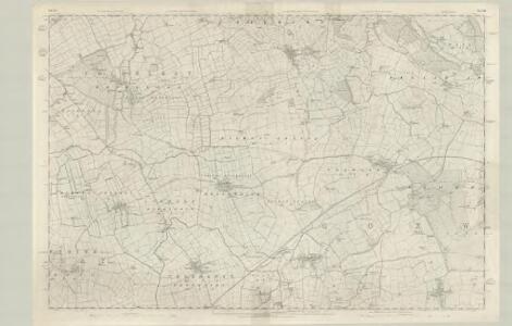
Yorkshire CIV.NW - OS Six-Inch Map
1 : 10560 Topographic maps Ordnance Survey Ordnance Survey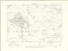
Yorkshire CIV.NW - OS Six-Inch Map
1 : 10560 Topographic maps Ordnance Survey Ordnance Survey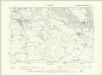
Yorkshire CIV.NW - OS Six-Inch Map
1 : 10560 Topographic maps Ordnance Survey Ordnance Survey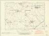
Yorkshire CIV.SW - OS Six-Inch Map
1 : 10560 Topographic maps Ordnance Survey Ordnance Survey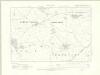
Yorkshire CIV.SW - OS Six-Inch Map
1 : 10560 Topographic maps Ordnance Survey Ordnance Survey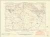
Yorkshire CIV.NE - OS Six-Inch Map
1 : 10560 Topographic maps Ordnance Survey Ordnance Survey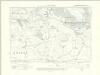
Yorkshire CIV.NE - OS Six-Inch Map
1 : 10560 Topographic maps Ordnance Survey Ordnance Survey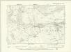
Yorkshire CIV.NE - OS Six-Inch Map
1 : 10560 Topographic maps Ordnance Survey Ordnance Survey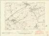
Yorkshire CIV.SE - OS Six-Inch Map
1 : 10560 Topographic maps Ordnance Survey Ordnance Survey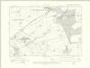
Yorkshire CIV.SE - OS Six-Inch Map
1 : 10560 Topographic maps Ordnance Survey Ordnance Survey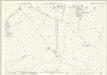
Yorkshire CIV.5 (includes: Bagby; Birdforth; Hutton Sessay; Sessay; Thirkleby) - 25 Inch Map
1 : 2500 Topographic maps Ordnance Survey Ordnance Survey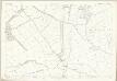
Yorkshire CIV.5 (includes: Bagby; Birdforth; Hutton Sessay; Sessay; Thirkleby) - 25 Inch Map
1 : 2500 Topographic maps Ordnance Survey Ordnance Survey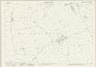
Yorkshire CIV.9 (includes: Birdforth; Hutton Sessay; Sessay; Thirkleby) - 25 Inch Map
1 : 2500 Topographic maps Ordnance Survey Ordnance Survey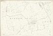
Yorkshire CIV.9 (includes: Birdforth; Hutton Sessay; Sessay; Thirkleby) - 25 Inch Map
1 : 2500 Topographic maps Ordnance Survey Ordnance Survey
Yorkshire CIV.13 (includes: Birdforth; Hutton Sessay; Sessay) - 25 Inch Map
1 : 2500 Topographic maps Ordnance Survey Ordnance Survey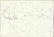
Yorkshire CIV.13 (includes: Birdforth; Hutton Sessay; Sessay) - 25 Inch Map
1 : 2500 Topographic maps Ordnance Survey Ordnance Survey
Yorkshire CIV.2 (includes: Carlton Husthwaite; Kilburn; Thirkleby) - 25 Inch Map
1 : 2500 Topographic maps Ordnance Survey Ordnance Survey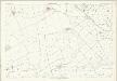
Yorkshire CIV.2 (includes: Carlton Husthwaite; Kilburn; Thirkleby) - 25 Inch Map
1 : 2500 Topographic maps Ordnance Survey Ordnance Survey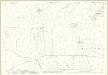
Yorkshire CIV.6 (includes: Birdforth; Carlton Husthwaite; Kilburn; Thirkleby; Wildon Grange) - 25 Inch Map
1 : 2500 Topographic maps Ordnance Survey Ordnance Survey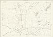
Yorkshire CIV.6 (includes: Birdforth; Carlton Husthwaite; Kilburn; Thirkleby; Wildon Grange) - 25 Inch Map
1 : 2500 Topographic maps Ordnance Survey Ordnance Survey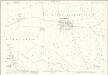
Yorkshire CIV.10 (includes: Angram Grange; Birdforth; Carlton Husthwaite; Husthwaite; Thormanby; Wildon Grange) - 25 Inch Map
1 : 2500 Topographic maps Ordnance Survey Ordnance Survey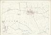
Yorkshire CIV.10 (includes: Angram Grange; Birdforth; Carlton Husthwaite; Husthwaite; Thormanby; Wildon Grange) - 25 Inch Map
1 : 2500 Topographic maps Ordnance Survey Ordnance Survey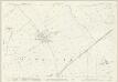
Yorkshire CIV.14 (includes: Angram Grange; Birdforth; Carlton Husthwaite; Husthwaite; Sessay; Thormanby) - 25 Inch Map
1 : 2500 Topographic maps Ordnance Survey Ordnance Survey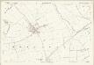
Yorkshire CIV.14 (includes: Angram Grange; Birdforth; Carlton Husthwaite; Husthwaite; Sessay; Thormanby) - 25 Inch Map
1 : 2500 Topographic maps Ordnance Survey Ordnance Survey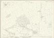
Yorkshire CIV.1 (includes: Bagby; Balk; Thirkleby) - 25 Inch Map
1 : 2500 Topographic maps Ordnance Survey Ordnance Survey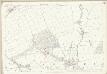
Yorkshire CIV.1 (includes: Bagby; Balk; Thirkleby) - 25 Inch Map
1 : 2500 Topographic maps Ordnance Survey Ordnance Survey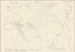
Yorkshire CIV.3 (includes: Byland With Wass; Coxwold; Kilburn; Oldstead) - 25 Inch Map
1 : 2500 Topographic maps Ordnance Survey Ordnance Survey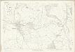
Yorkshire CIV.3 (includes: Byland With Wass; Coxwold; Kilburn; Oldstead) - 25 Inch Map
1 : 2500 Topographic maps Ordnance Survey Ordnance Survey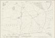
Yorkshire CIV.7 (includes: Angram Grange; Byland With Wass; Coxwold; Kilburn; Wildon Grange) - 25 Inch Map
1 : 2500 Topographic maps Ordnance Survey Ordnance Survey