Maps of Lancaster
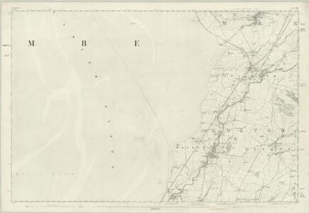
Lancashire XXIV - OS Six-Inch Map
1 : 10560 Topographic maps Ordnance Survey Ordnance Survey
Lancashire XXIV.NW - OS Six-Inch Map
1 : 10560 Topographic maps Ordnance Survey Ordnance Survey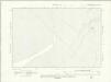
Lancashire XXIV.SW - OS Six-Inch Map
1 : 10560 Topographic maps Ordnance Survey Ordnance Survey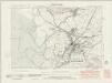
Lancashire XXIV.NE - OS Six-Inch Map
1 : 10560 Topographic maps Ordnance Survey Ordnance Survey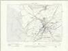
Lancashire XXIV.NE - OS Six-Inch Map
1 : 10560 Topographic maps Ordnance Survey Ordnance Survey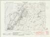
Lancashire XXIV.SE - OS Six-Inch Map
1 : 10560 Topographic maps Ordnance Survey Ordnance Survey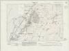
Lancashire XXIV.SE - OS Six-Inch Map
1 : 10560 Topographic maps Ordnance Survey Ordnance Survey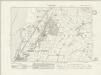
Lancashire XXIV.SE - OS Six-Inch Map
1 : 10560 Topographic maps Ordnance Survey Ordnance Survey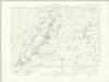
Lancashire XXIV.SE - OS Six-Inch Map
1 : 10560 Topographic maps Ordnance Survey Ordnance Survey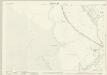
Lancashire XXIV.3 (includes: Carnforth; Warton) - 25 Inch Map
1 : 2500 Topographic maps Ordnance Survey Ordnance Survey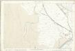
Lancashire XXIV.3 (includes: Carnforth; Warton) - 25 Inch Map
1 : 2500 Topographic maps Ordnance Survey Ordnance Survey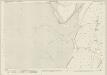
Lancashire XXIV.7 (includes: Bolton Le Sands; Carnforth; Warton) - 25 Inch Map
1 : 2500 Topographic maps Ordnance Survey Ordnance Survey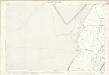
Lancashire XXIV.7 (includes: Bolton Le Sands; Carnforth; Warton) - 25 Inch Map
1 : 2500 Topographic maps Ordnance Survey Ordnance Survey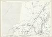
Lancashire XXIV.11 (includes: Bolton Le Sands; Carnforth) - 25 Inch Map
1 : 2500 Topographic maps Ordnance Survey Ordnance Survey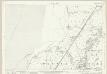
Lancashire XXIV.11 (includes: Bolton Le Sands; Carnforth) - 25 Inch Map
1 : 2500 Topographic maps Ordnance Survey Ordnance Survey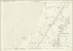
Lancashire XXIV.11 (includes: Bolton Le Sands; Carnforth) - 25 Inch Map
1 : 2500 Topographic maps Ordnance Survey Ordnance Survey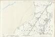
Lancashire XXIV.11 (includes: Bolton Le Sands; Carnforth) - 25 Inch Map
1 : 2500 Topographic maps Ordnance Survey Ordnance Survey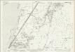
Lancashire XXIV.15 (includes: Bolton Le Sands; Nether Kellet; Slyne With Hest) - 25 Inch Map
1 : 2500 Topographic maps Ordnance Survey Ordnance Survey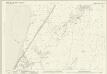
Lancashire XXIV.15 (includes: Bolton Le Sands; Nether Kellet; Slyne With Hest) - 25 Inch Map
1 : 2500 Topographic maps Ordnance Survey Ordnance Survey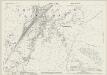
Lancashire XXIV.8 (includes: Carnforth; Nether Kellet; Over Kellet) - 25 Inch Map
1 : 2500 Topographic maps Ordnance Survey Ordnance Survey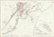
Lancashire XXIV.8 (includes: Carnforth; Nether Kellet; Over Kellet) - 25 Inch Map
1 : 2500 Topographic maps Ordnance Survey Ordnance Survey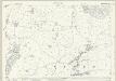
Lancashire XXIV.12 (includes: Bolton Le Sands; Carnforth; Nether Kellet; Over Kellet) - 25 Inch Map
1 : 2500 Topographic maps Ordnance Survey Ordnance Survey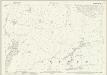
Lancashire XXIV.12 (includes: Bolton Le Sands; Carnforth; Nether Kellet; Over Kellet) - 25 Inch Map
1 : 2500 Topographic maps Ordnance Survey Ordnance Survey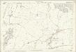
Lancashire XXIV.12 (includes: Bolton Le Sands; Carnforth; Nether Kellet; Over Kellet) - 25 Inch Map
1 : 2500 Topographic maps Ordnance Survey Ordnance Survey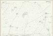
Lancashire XXIV.16 (includes: Bolton Le Sands; Halton; Nether Kellet; Slyne With Hest) - 25 Inch Map
1 : 2500 Topographic maps Ordnance Survey Ordnance Survey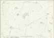
Lancashire XXIV.16 (includes: Bolton Le Sands; Halton; Nether Kellet; Slyne With Hest) - 25 Inch Map
1 : 2500 Topographic maps Ordnance Survey Ordnance Survey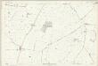
Lancashire XXIV.16 (includes: Bolton Le Sands; Halton; Nether Kellet; Slyne With Hest) - 25 Inch Map
1 : 2500 Topographic maps Ordnance Survey Ordnance Survey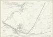
Lancashire XXIV.4 (includes: Carnforth; Warton) - 25 Inch Map
1 : 2500 Topographic maps Ordnance Survey Ordnance Survey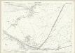
Lancashire XXIV.4 (includes: Carnforth; Warton) - 25 Inch Map
1 : 2500 Topographic maps Ordnance Survey Ordnance Survey