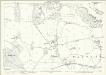
Maps of Hertfordshire
Hertfordshire XXIX - OS Six-Inch Map
1 : 10560 Topographic maps Ordnance Survey Ordnance Survey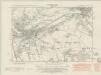
Hertfordshire XXIX.SE - OS Six-Inch Map
1 : 10560 Topographic maps Ordnance Survey Ordnance Survey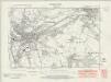
Hertfordshire XXIX.SE - OS Six-Inch Map
1 : 10560 Topographic maps Ordnance Survey Ordnance Survey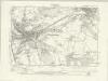
Hertfordshire XXIX.SE - OS Six-Inch Map
1 : 10560 Topographic maps Ordnance Survey Ordnance Survey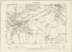
Hertfordshire XXIX.SE - OS Six-Inch Map
1 : 10560 Topographic maps Ordnance Survey Ordnance Survey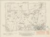
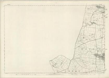
Hertfordshire XXIX.NE - OS Six-Inch Map
1 : 10560 Topographic maps Ordnance Survey Ordnance Survey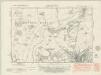
Hertfordshire XXIX.NE - OS Six-Inch Map
1 : 10560 Topographic maps Ordnance Survey Ordnance Survey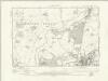
Hertfordshire XXIX.NE - OS Six-Inch Map
1 : 10560 Topographic maps Ordnance Survey Ordnance Survey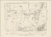
Hertfordshire XXIX.NE - OS Six-Inch Map
1 : 10560 Topographic maps Ordnance Survey Ordnance Survey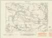
Hertfordshire XXIX.SW - OS Six-Inch Map
1 : 10560 Topographic maps Ordnance Survey Ordnance Survey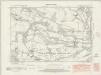
Hertfordshire XXIX.SW - OS Six-Inch Map
1 : 10560 Topographic maps Ordnance Survey Ordnance Survey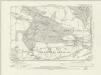
Hertfordshire XXIX.SW - OS Six-Inch Map
1 : 10560 Topographic maps Ordnance Survey Ordnance Survey
Hertfordshire XXIX.SW - OS Six-Inch Map
1 : 10560 Topographic maps Ordnance Survey Ordnance Survey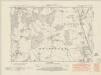
Hertfordshire XXIX.NW - OS Six-Inch Map
1 : 10560 Topographic maps Ordnance Survey Ordnance Survey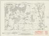
Hertfordshire XXIX.NW - OS Six-Inch Map
1 : 10560 Topographic maps Ordnance Survey Ordnance Survey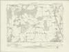
Hertfordshire XXIX.NW - OS Six-Inch Map
1 : 10560 Topographic maps Ordnance Survey Ordnance Survey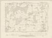
Hertfordshire XXIX.NW - OS Six-Inch Map
1 : 10560 Topographic maps Ordnance Survey Ordnance Survey
A plan of Hartford
1 Karte : Kupferdruck ; 41 x 57 cm Andrews; Wren; Dury; Cheever publish'd according to act of parliament and sold by A. Dury in Dukes court St. Martin's lane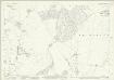
Hertfordshire XXIX.5 (includes: Bramfield; Tewin) - 25 Inch Map
1 : 2500 Topographic maps Ordnance Survey Ordnance Survey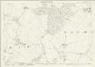
Hertfordshire XXIX.5 (includes: Bramfield; Tewin) - 25 Inch Map
1 : 2500 Topographic maps Ordnance Survey Ordnance Survey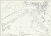
Hertfordshire XXIX.12 (includes: Great Amwell; Hertford; Ware Rural; Ware Urban) - 25 Inch Map
1 : 2500 Topographic maps Ordnance Survey Ordnance Survey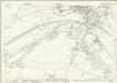
Hertfordshire XXIX.12 (includes: Great Amwell; Hertford; Ware Rural; Ware Urban) - 25 Inch Map
1 : 2500 Topographic maps Ordnance Survey Ordnance Survey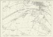
Hertfordshire XXIX.12 (includes: Great Amwell; Hertford; Ware Rural; Ware Urban) - 25 Inch Map
1 : 2500 Topographic maps Ordnance Survey Ordnance Survey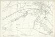
Hertfordshire XXIX.12 (includes: Great Amwell; Hertford; Ware Rural; Ware Urban) - 25 Inch Map
1 : 2500 Topographic maps Ordnance Survey Ordnance Survey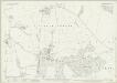
Hertfordshire XXIX.16 (includes: Brickendon Liberty; Great Amwell; Hertford; Little Amwell; Stanstead St Margaret; Ware Urban) - 25 Inch Map
1 : 2500 Topographic maps Ordnance Survey Ordnance Survey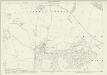
Hertfordshire XXIX.16 (includes: Brickendon Liberty; Great Amwell; Hertford; Little Amwell; Stanstead St Margaret; Ware Urban) - 25 Inch Map
1 : 2500 Topographic maps Ordnance Survey Ordnance Survey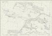
Hertfordshire XXIX.9 (includes: Bramfield; Hertingfordbury; Tewin; Welwyn Garden City) - 25 Inch Map
1 : 2500 Topographic maps Ordnance Survey Ordnance Survey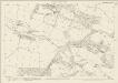
Hertfordshire XXIX.9 (includes: Bramfield; Hertingfordbury; Tewin; Welwyn Garden City) - 25 Inch Map
1 : 2500 Topographic maps Ordnance Survey Ordnance Survey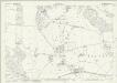
Hertfordshire XXIX.13 (includes: Bishops Hatfield; Hertingfordbury; Tewin) - 25 Inch Map
1 : 2500 Topographic maps Ordnance Survey Ordnance Survey