Maps of South Cambridgeshire
Essex nI - OS Six-Inch Map
1 : 10560 Topographic maps Ordnance Survey Ordnance Survey
Essex nI - OS Six-Inch Map
1 : 10560 Topographic maps Ordnance Survey Ordnance Survey
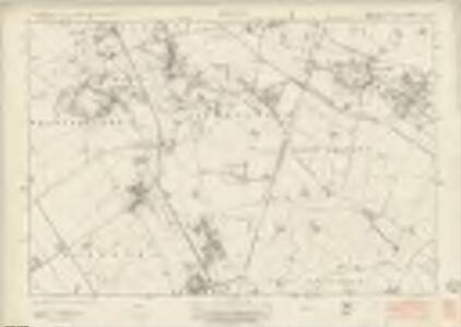
Cambridgeshire LIV.SE - OS Six-Inch Map
1 : 10560 Topographic maps Ordnance Survey Ordnance Survey
Cambridgeshire LIV.SE - OS Six-Inch Map
1 : 10560 Topographic maps Ordnance Survey Ordnance Survey
Cambridgeshire LIV.SE - OS Six-Inch Map
1 : 10560 Topographic maps Ordnance Survey Ordnance Survey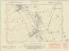
Cambridgeshire LIX.NE - OS Six-Inch Map
1 : 10560 Topographic maps Ordnance Survey Ordnance Survey
Cambridgeshire LIX.NE - OS Six-Inch Map
1 : 10560 Topographic maps Ordnance Survey Ordnance Survey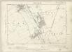
Essex II.NE - OS Six-Inch Map
1 : 10560 Topographic maps Ordnance Survey Ordnance Survey
Cambridgeshire LIX.NE - OS Six-Inch Map
1 : 10560 Topographic maps Ordnance Survey Ordnance Survey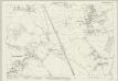
Cambridgeshire LIV.11 (includes: Pampisford; Sawston; Whittlesford) - 25 Inch Map
1 : 2500 Topographic maps Ordnance Survey Ordnance Survey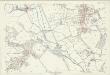
Cambridgeshire LIV.11 (includes: Pampisford; Sawston; Whittlesford) - 25 Inch Map
1 : 2500 Topographic maps Ordnance Survey Ordnance Survey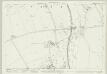
Cambridgeshire LIV.15 (includes: Duxford; Hinxton; Pampisford; Whittlesford) - 25 Inch Map
1 : 2500 Topographic maps Ordnance Survey Ordnance Survey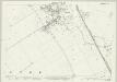
Cambridgeshire LIX.3 (includes: Duxford; Hinxton; Ickleton) - 25 Inch Map
1 : 2500 Topographic maps Ordnance Survey Ordnance Survey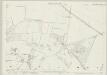
Cambridgeshire LIV.12 (includes: Babraham; Pampisford; Sawston) - 25 Inch Map
1 : 2500 Topographic maps Ordnance Survey Ordnance Survey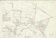
Cambridgeshire LIV.12 (includes: Babraham; Pampisford; Sawston) - 25 Inch Map
1 : 2500 Topographic maps Ordnance Survey Ordnance Survey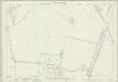
Cambridgeshire LIV.16 (includes: Great Abington; Hinxton; Pampisford) - 25 Inch Map
1 : 2500 Topographic maps Ordnance Survey Ordnance Survey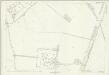
Cambridgeshire LIV.16 (includes: Great Abington; Hinxton; Pampisford) - 25 Inch Map
1 : 2500 Topographic maps Ordnance Survey Ordnance Survey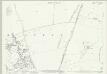
Cambridgeshire LIX.4 (includes: Great Abington; Great Chesterford; Hinxton; Ickleton) - 25 Inch Map
1 : 2500 Topographic maps Ordnance Survey Ordnance Survey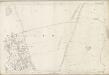
Essex (1st Ed/Rev 1862-96) II.4 (includes: Great Chesterford; Hinxton) - 25 Inch Map
1 : 2500 Topographic maps Ordnance Survey Ordnance Survey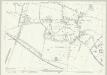
Cambridgeshire LV.9 (includes: Great Abington; Hildersham; Little Abington; Pampisford) - 25 Inch Map
1 : 2500 Topographic maps Ordnance Survey Ordnance Survey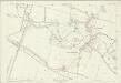
Cambridgeshire LV.9 (includes: Great Abington; Hildersham; Little Abington; Pampisford) - 25 Inch Map
1 : 2500 Topographic maps Ordnance Survey Ordnance Survey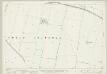
Cambridgeshire LV.13 (includes: Great Abington; Hildersham; Linton; Pampisford) - 25 Inch Map
1 : 2500 Topographic maps Ordnance Survey Ordnance Survey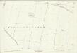
Cambridgeshire LV.13 (includes: Great Abington; Hildersham; Linton; Pampisford) - 25 Inch Map
1 : 2500 Topographic maps Ordnance Survey Ordnance Survey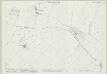
Cambridgeshire LX.1 (includes: Great Abington; Great Chesterford; Hildersham; Linton) - 25 Inch Map
1 : 2500 Topographic maps Ordnance Survey Ordnance Survey
Essex (New Series 1913-) n I.12 (includes: Great Abington; Great Chesterford; Hildersham; Linton) - 25 Inch Map
1 : 2500 Topographic maps Ordnance Survey Ordnance Survey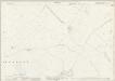
Essex (New Series 1913-) n I.16 (includes: Great Chesterford; Hadstock; Linton) - 25 Inch Map
1 : 2500 Topographic maps Ordnance Survey Ordnance Survey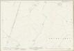
Essex (New Series 1913-) n I.15 (includes: Great Chesterford) - 25 Inch Map
1 : 2500 Topographic maps Ordnance Survey Ordnance Survey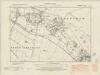
Cambridgeshire LV.SW - OS Six-Inch Map
1 : 10560 Topographic maps Ordnance Survey Ordnance Survey
Cambridgeshire LV.SW - OS Six-Inch Map
1 : 10560 Topographic maps Ordnance Survey Ordnance Survey