Maps of Essex

Maps of Essex

$title$

Essex XXIX - OS Six-Inch Map
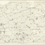
1 : 10560 Topographic maps Ordnance Survey Ordnance Survey
$title$

TM12 - OS 1:25,000 Provisional Series Map

1 : 25000 Topographic maps Ordnance Survey Ordnance Survey
$title$

Essex nXXXIX.NW - OS Six-Inch Map

1 : 10560 Topographic maps Ordnance Survey Ordnance Survey
$title$

Essex nXXXIX.NW - OS Six-Inch Map

1 : 10560 Topographic maps Ordnance Survey Ordnance Survey
$title$

Essex XXIX.NE - OS Six-Inch Map

1 : 10560 Topographic maps Ordnance Survey Ordnance Survey
$title$

Essex XXIX.SE - OS Six-Inch Map

1 : 10560 Topographic maps Ordnance Survey Ordnance Survey
$title$

Essex nXXX.SW - OS Six-Inch Map

1 : 10560 Topographic maps Ordnance Survey Ordnance Survey
$title$

Essex nXXX.SW - OS Six-Inch Map

1 : 10560 Topographic maps Ordnance Survey Ordnance Survey
$title$

Essex XXIX.NW - OS Six-Inch Map

1 : 10560 Topographic maps Ordnance Survey Ordnance Survey
$title$

Essex XXIX.SW - OS Six-Inch Map

1 : 10560 Topographic maps Ordnance Survey Ordnance Survey
$title$

Essex (New Series 1913-) n XXX.14 (includes: Great Oakley; Wix) - 25 Inch Map

1 : 2500 Topographic maps Ordnance Survey Ordnance Survey
$title$

Essex (New Series 1913-) n XXXIX.2 (includes: Beaumont cum Moze; Great Oakley; Tendring) - 25 Inch Map

1 : 2500 Topographic maps Ordnance Survey Ordnance Survey
$title$

Essex (New Series 1913-) n XXXIX.6 (includes: Beaumont cum Moze; Tendring; Thorpe Le Soken) - 25 Inch Map

1 : 2500 Topographic maps Ordnance Survey Ordnance Survey
$title$

Essex (New Series 1913-) n XXX.13 (includes: Great Oakley; Tendring; Wix) - 25 Inch Map

1 : 2500 Topographic maps Ordnance Survey Ordnance Survey
$title$

Essex (New Series 1913-) n XXXIX.1 (includes: Tendring) - 25 Inch Map

1 : 2500 Topographic maps Ordnance Survey Ordnance Survey
$title$

Essex (New Series 1913-) n XXXIX.5 (includes: Tendring; Weeley) - 25 Inch Map

1 : 2500 Topographic maps Ordnance Survey Ordnance Survey
$title$

Essex (New Series 1913-) n XXIX.16 (includes: Bradfield; Little Bentley; Little Bromley; Mistley; Wix) - 25 Inch Map

1 : 2500 Topographic maps Ordnance Survey Ordnance Survey
$title$

Essex (New Series 1913-) n XXXVIII.4 (includes: Little Bentley) - 25 Inch Map

1 : 2500 Topographic maps Ordnance Survey Ordnance Survey
$title$

Essex (New Series 1913-) n XXXVIII.8 (includes: Great Bentley; Little Bentley; Tendring) - 25 Inch Map

1 : 2500 Topographic maps Ordnance Survey Ordnance Survey
$title$

Essex (1st Ed/Rev 1862-96) XXIX.8 (includes: Beaumont cum Moze; Great Oakley; Wix) - 25 Inch Map

1 : 2500 Topographic maps Ordnance Survey Ordnance Survey
$title$

Essex (1st Ed/Rev 1862-96) XXIX.12 (includes: Beaumont cum Moze; Great Oakley) - 25 Inch Map

1 : 2500 Topographic maps Ordnance Survey Ordnance Survey
$title$

Essex (1st Ed/Rev 1862-96) XXIX.16 (includes: Beaumont cum Moze; Thorpe Le Soken) - 25 Inch Map

1 : 2500 Topographic maps Ordnance Survey Ordnance Survey
$title$

Essex (1st Ed/Rev 1862-96) XXIX.3 (includes: Wix) - 25 Inch Map

1 : 2500 Topographic maps Ordnance Survey Ordnance Survey
$title$

Essex (1st Ed/Rev 1862-96) XXIX.7 (includes: Great Oakley; Wix) - 25 Inch Map

1 : 2500 Topographic maps Ordnance Survey Ordnance Survey
$title$

Essex (1st Ed/Rev 1862-96) XXIX.11 (includes: Beaumont cum Moze; Great Oakley; Tendring) - 25 Inch Map

1 : 2500 Topographic maps Ordnance Survey Ordnance Survey
$title$

Essex (1st Ed/Rev 1862-96) XXIX.15 (includes: Beaumont cum Moze; Tendring; Thorpe Le Soken) - 25 Inch Map

1 : 2500 Topographic maps Ordnance Survey Ordnance Survey
$title$

Essex (1st Ed/Rev 1862-96) XXIX.4 (includes: Great Oakley; Ramsey; Wix) - 25 Inch Map

1 : 2500 Topographic maps Ordnance Survey Ordnance Survey
$title$

Essex (New Series 1913-) n XXX.10 (includes: Ramsey; Wix) - 25 Inch Map

1 : 2500 Topographic maps Ordnance Survey Ordnance Survey
$title$

Essex nXXXVIII.NE - OS Six-Inch Map

1 : 10560 Topographic maps Ordnance Survey Ordnance Survey
$title$

Essex nXXIX.SE - OS Six-Inch Map

1 : 10560 Topographic maps Ordnance Survey Ordnance Survey
© MapTiler © OpenStreetMap contributors
How does it work?
These instructions will show you how to find historical maps online.
Getting started
Type the place name in the search box to find the exact location. You can further adjust the search by zooming in and out.
Zoom
Zoom in and out with the buttons or use your mouse or touchpad natively.
Exact Area tool
Click here and draw a rectangle over the map to precisely define the search area.
Set filters
Narrow your search with advanced settings, such as Years (from/to), Fulltext, Publisher, etc.
Results
See the results of your search on the right side. You can scroll down to find more maps of this location.
?

Download OldMapsOnline Mobile