Maps of Derbyshire
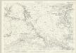
Derbyshire XXXIV - OS Six-Inch Map
1 : 10560 Topographic maps Ordnance Survey Ordnance Survey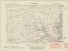
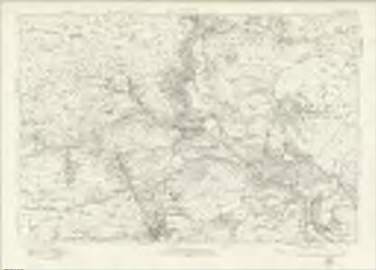
Derbyshire XXXIV.NW - OS Six-Inch Map
1 : 10560 Topographic maps Ordnance Survey Ordnance Survey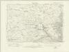
Derbyshire XXXIV.NW - OS Six-Inch Map
1 : 10560 Topographic maps Ordnance Survey Ordnance Survey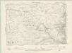
Derbyshire XXXIV.NW - OS Six-Inch Map
1 : 10560 Topographic maps Ordnance Survey Ordnance Survey
Derbyshire XXXIV.NW - OS Six-Inch Map
1 : 10560 Topographic maps Ordnance Survey Ordnance Survey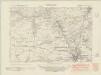
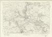
Derbyshire XXXIV.SW - OS Six-Inch Map
1 : 10560 Topographic maps Ordnance Survey Ordnance Survey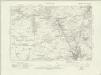
Derbyshire XXXIV.SW - OS Six-Inch Map
1 : 10560 Topographic maps Ordnance Survey Ordnance Survey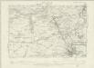
Derbyshire XXXIV.SW - OS Six-Inch Map
1 : 10560 Topographic maps Ordnance Survey Ordnance Survey
Derbyshire XXXIV.SW - OS Six-Inch Map
1 : 10560 Topographic maps Ordnance Survey Ordnance Survey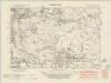
Derbyshire XXXIV.NE - OS Six-Inch Map
1 : 10560 Topographic maps Ordnance Survey Ordnance Survey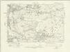
Derbyshire XXXIV.NE - OS Six-Inch Map
1 : 10560 Topographic maps Ordnance Survey Ordnance Survey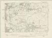
Derbyshire XXXIV.NE - OS Six-Inch Map
1 : 10560 Topographic maps Ordnance Survey Ordnance Survey
Derbyshire XXXIV.NE - OS Six-Inch Map
1 : 10560 Topographic maps Ordnance Survey Ordnance Survey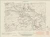
Derbyshire XXXIV.SE - OS Six-Inch Map
1 : 10560 Topographic maps Ordnance Survey Ordnance Survey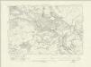
Derbyshire XXXIV.SE - OS Six-Inch Map
1 : 10560 Topographic maps Ordnance Survey Ordnance Survey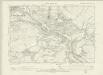
Derbyshire XXXIV.SE - OS Six-Inch Map
1 : 10560 Topographic maps Ordnance Survey Ordnance Survey
Derbyshire XXXIV.SE - OS Six-Inch Map
1 : 10560 Topographic maps Ordnance Survey Ordnance Survey
Derbyshire XXXIV.1 (includes: Bonsall; Wensley and Snitterton; Winster) - 25 Inch Map
1 : 2500 Topographic maps Ordnance Survey Ordnance Survey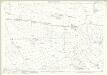
Derbyshire XXXIV.1 (includes: Bonsall; Wensley and Snitterton; Winster) - 25 Inch Map
1 : 2500 Topographic maps Ordnance Survey Ordnance Survey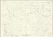
Derbyshire XXXIV.5 (includes: Bonsall; Ible; Ivonbrook Grange) - 25 Inch Map
1 : 2500 Topographic maps Ordnance Survey Ordnance Survey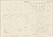
Derbyshire XXXIV.5 (includes: Bonsall; Ible; Ivonbrook Grange) - 25 Inch Map
1 : 2500 Topographic maps Ordnance Survey Ordnance Survey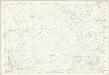
Derbyshire XXXIV.5 (includes: Bonsall; Ible; Ivonbrook Grange) - 25 Inch Map
1 : 2500 Topographic maps Ordnance Survey Ordnance Survey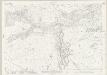
Derbyshire XXXIV.9 (includes: Bonsall; Hopton and Griffe Grange; Ible; Wirksworth) - 25 Inch Map
1 : 2500 Topographic maps Ordnance Survey Ordnance Survey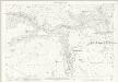
Derbyshire XXXIV.9 (includes: Bonsall; Hopton and Griffe Grange; Ible; Wirksworth) - 25 Inch Map
1 : 2500 Topographic maps Ordnance Survey Ordnance Survey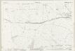
Derbyshire XXXIV.13 (includes: Carsington; Hopton and Griffe Grange; Wirksworth) - 25 Inch Map
1 : 2500 Topographic maps Ordnance Survey Ordnance Survey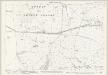
Derbyshire XXXIV.13 (includes: Carsington; Hopton and Griffe Grange; Wirksworth) - 25 Inch Map
1 : 2500 Topographic maps Ordnance Survey Ordnance Survey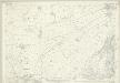
Derbyshire XXXIV.2 (includes: Bonsall; Matlock Bath; Matlock; Wensley and Snitterton) - 25 Inch Map
1 : 2500 Topographic maps Ordnance Survey Ordnance Survey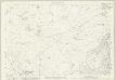
Derbyshire XXXIV.2 (includes: Bonsall; Matlock Bath; Matlock; Wensley and Snitterton) - 25 Inch Map
1 : 2500 Topographic maps Ordnance Survey Ordnance Survey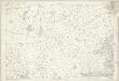
Derbyshire XXXIV.2 (includes: Bonsall; Matlock Bath; Matlock; Wensley and Snitterton) - 25 Inch Map
1 : 2500 Topographic maps Ordnance Survey Ordnance Survey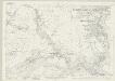
Derbyshire XXXIV.6 (includes: Bonsall; Cromford; Matlock Bath; Matlock; Wirksworth) - 25 Inch Map
1 : 2500 Topographic maps Ordnance Survey Ordnance Survey