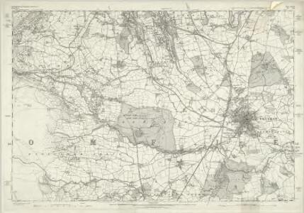
Maps of Wrexham
Denbighshire XXVIII - OS Six-Inch Map
1 : 10560 Topographic maps Ordnance Survey Ordnance Survey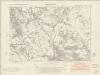
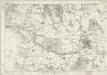
Denbighshire XXVIII.NE - OS Six-Inch Map
1 : 10560 Topographic maps Ordnance Survey Ordnance Survey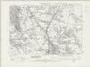
Denbighshire XXVIII.NE - OS Six-Inch Map
1 : 10560 Topographic maps Ordnance Survey Ordnance Survey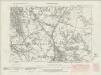
Denbighshire XXVIII.NE - OS Six-Inch Map
1 : 10560 Topographic maps Ordnance Survey Ordnance Survey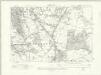
Denbighshire XXVIII.NE - OS Six-Inch Map
1 : 10560 Topographic maps Ordnance Survey Ordnance Survey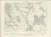
Denbighshire XXVIII.NE - OS Six-Inch Map
1 : 10560 Topographic maps Ordnance Survey Ordnance Survey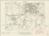
Denbighshire XXVIII.SE - OS Six-Inch Map
1 : 10560 Topographic maps Ordnance Survey Ordnance Survey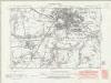
Denbighshire XXVIII.SE - OS Six-Inch Map
1 : 10560 Topographic maps Ordnance Survey Ordnance Survey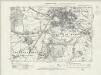
Denbighshire XXVIII.SE - OS Six-Inch Map
1 : 10560 Topographic maps Ordnance Survey Ordnance Survey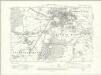
Denbighshire XXVIII.SE - OS Six-Inch Map
1 : 10560 Topographic maps Ordnance Survey Ordnance Survey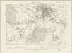
Denbighshire XXVIII.SE - OS Six-Inch Map
1 : 10560 Topographic maps Ordnance Survey Ordnance Survey
Erddig Wood, near Wrexham (detail from OSD Map 316 [Chester], surveyed in 1819)
1 : 31680 Detail from OSD 316, showing Wrexham and Erddig ('Erthig'),Wood to the south. The area to the west of Wrexham is not shown on this sheet. The whole,plan follows the meandering River Dee from Chester, at the top of the map, to Overton and Ruabon, at the bottom left. A section of the Shropshire Union Canal, running from Chester to Waverton, is shown in blue. At the bottom left of the map, an area calculation table survives in black ink. The pencil gridlines running through Chester were most likely guides for making enlarged or reduced copies of the map. Field, John
Denbighshire XXVIII.NW - OS Six-Inch Map
1 : 10560 Topographic maps Ordnance Survey Ordnance Survey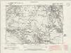
Denbighshire XXVIII.NW - OS Six-Inch Map
1 : 10560 Topographic maps Ordnance Survey Ordnance Survey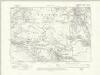
Denbighshire XXVIII.NW - OS Six-Inch Map
1 : 10560 Topographic maps Ordnance Survey Ordnance Survey
Flintshire XIX.NW - OS Six-Inch Map
1 : 10560 Topographic maps Ordnance Survey Ordnance Survey
Denbighshire XXVIII.SW - OS Six-Inch Map
1 : 10560 Topographic maps Ordnance Survey Ordnance Survey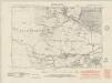
Denbighshire XXVIII.SW - OS Six-Inch Map
1 : 10560 Topographic maps Ordnance Survey Ordnance Survey
Denbighshire XXVIII.SW - OS Six-Inch Map
1 : 10560 Topographic maps Ordnance Survey Ordnance Survey
Denbighshire XXVIII.SW - OS Six-Inch Map
1 : 10560 Topographic maps Ordnance Survey Ordnance Survey
Denbighshire XXVIII.4 (includes: Bieston; Gresford; Gwersyllt; Llai; Wrexham Regis) - 25 Inch Map
1 : 2500 Topographic maps Ordnance Survey Ordnance Survey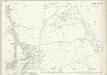
Denbighshire XXVIII.8 (includes: Bieston; Gwersyllt; Wrexham Regis) - 25 Inch Map
1 : 2500 Topographic maps Ordnance Survey Ordnance Survey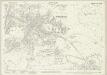
Denbighshire XXVIII.12 (includes: Marchwiail; Wrexham Regis) - 25 Inch Map
1 : 2500 Topographic maps Ordnance Survey Ordnance Survey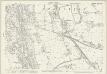
Denbighshire XXVIII.3 (includes: Broughton; Gwersyllt) - 25 Inch Map
1 : 2500 Topographic maps Ordnance Survey Ordnance Survey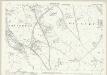
Denbighshire XXVIII.7 (includes: Bers; Broughton; Gwersyllt; Wrexham Regis) - 25 Inch Map
1 : 2500 Topographic maps Ordnance Survey Ordnance Survey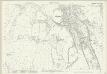
Denbighshire XXVIII.2 (includes: Broughton; Brymbo; Minera) - 25 Inch Map
1 : 2500 Topographic maps Ordnance Survey Ordnance Survey
Cyrn y Brain
1 : 31680 The county boundary of Denbighshire and Flintshire is indicated here by a red pecked line. The plan is formally titled, with a note in the top left corner explaining that it has been copied from the original protraction with north facing upwards instead of true. A triangulation diagram appears on the reverse of the drawing: this enabled the draughtsman to plot with prominent topographical features with precision. Many pencil lines radiate from a trigonometrical point at Cefny Fedw, indicated by a dot within a triangle. These represent the angular measurements taken from this point. Giles, John C.
Wrexham (Hills) - OS One-Inch Revised New Series
1 : 63360 Topographic maps Ordnance Survey Ordnance Survey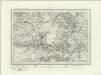
Wrexham (Outline) - OS One-Inch Revised New Series
1 : 63360 Topographic maps Ordnance Survey Ordnance Survey