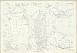
Maps of Denbighshire
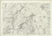
Denbighshire XIX - OS Six-Inch Map
1 : 10560 Topographic maps Ordnance Survey Ordnance Survey
Denbighshire XIX.NW - OS Six-Inch Map
1 : 10560 Topographic maps Ordnance Survey Ordnance Survey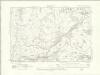
Denbighshire XIX.NW - OS Six-Inch Map
1 : 10560 Topographic maps Ordnance Survey Ordnance Survey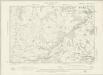
Denbighshire XIX.NW - OS Six-Inch Map
1 : 10560 Topographic maps Ordnance Survey Ordnance Survey
Denbighshire XIX.SW - OS Six-Inch Map
1 : 10560 Topographic maps Ordnance Survey Ordnance Survey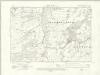
Denbighshire XIX.SW - OS Six-Inch Map
1 : 10560 Topographic maps Ordnance Survey Ordnance Survey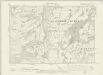
Denbighshire XIX.SW - OS Six-Inch Map
1 : 10560 Topographic maps Ordnance Survey Ordnance Survey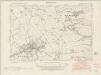
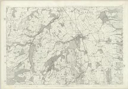
Denbighshire XIX.NE - OS Six-Inch Map
1 : 10560 Topographic maps Ordnance Survey Ordnance Survey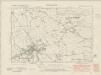
Denbighshire XIX.NE - OS Six-Inch Map
1 : 10560 Topographic maps Ordnance Survey Ordnance Survey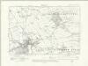
Denbighshire XIX.NE - OS Six-Inch Map
1 : 10560 Topographic maps Ordnance Survey Ordnance Survey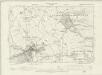
Denbighshire XIX.NE - OS Six-Inch Map
1 : 10560 Topographic maps Ordnance Survey Ordnance Survey
Denbighshire XIX.SE - OS Six-Inch Map
1 : 10560 Topographic maps Ordnance Survey Ordnance Survey
Denbighshire XIX.SE - OS Six-Inch Map
1 : 10560 Topographic maps Ordnance Survey Ordnance Survey
Denbighshire XIX.SE - OS Six-Inch Map
1 : 10560 Topographic maps Ordnance Survey Ordnance Survey
Denbighshire XIX.5 (includes: Llanfwrog Rural; Llanrhaiadr Yn Cinmerch; Llanynys Rural; Y Gyffylliog) - 25 Inch Map
1 : 2500 Topographic maps Ordnance Survey Ordnance Survey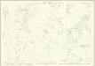
Denbighshire XIX.1 (includes: Llanrhaiadr Yn Cinmerch; Llanynys Rural) - 25 Inch Map
1 : 2500 Topographic maps Ordnance Survey Ordnance Survey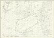
Denbighshire XIX.9 (includes: Clocaenog; Llanfwrog Rural; Llanrhaiadr Yn Cinmerch; Llanynys Rural; Y Gyffylliog) - 25 Inch Map
1 : 2500 Topographic maps Ordnance Survey Ordnance Survey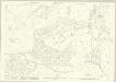
Denbighshire XIX.13 (includes: Clocaenog; Llanfwrog Rural; Y Gyffylliog) - 25 Inch Map
1 : 2500 Topographic maps Ordnance Survey Ordnance Survey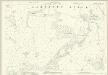
Denbighshire XIX.2 (includes: Llanfwrog Rural; Llanynys Rural) - 25 Inch Map
1 : 2500 Topographic maps Ordnance Survey Ordnance Survey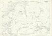
Denbighshire XIX.6 (includes: Llanfwrog Rural; Llanynys Rural; Rhuthun) - 25 Inch Map
1 : 2500 Topographic maps Ordnance Survey Ordnance Survey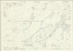
Denbighshire XIX.10 (includes: Efenechtid; Llanfwrog Rural; Rhuthun) - 25 Inch Map
1 : 2500 Topographic maps Ordnance Survey Ordnance Survey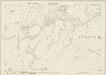
Denbighshire XIX.14 (includes: Clocaenog; Efenechtid; Llanfwrog Rural) - 25 Inch Map
1 : 2500 Topographic maps Ordnance Survey Ordnance Survey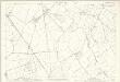
Denbighshire XIX.3 (includes: Llanbedr; Llangynhafal; Llanynys Rural; Rhuthun) - 25 Inch Map
1 : 2500 Topographic maps Ordnance Survey Ordnance Survey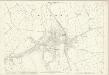
Denbighshire XIX.7 (includes: Llanbedr; Llanynys Rural; Rhuthun) - 25 Inch Map
1 : 2500 Topographic maps Ordnance Survey Ordnance Survey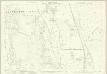
Denbighshire XIX.11 (includes: Efenechtid; Llanbedr; Llanfair Dyffryn Clwyd Rural; Llanfwrog Rural; Rhuthun) - 25 Inch Map
1 : 2500 Topographic maps Ordnance Survey Ordnance Survey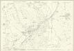
Denbighshire XIX.15 (includes: Efenechtid; Llanelidan; Llanfair Dyffryn Clwyd Rural; Llanfwrog Rural; Rhuthun) - 25 Inch Map
1 : 2500 Topographic maps Ordnance Survey Ordnance Survey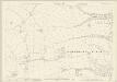
Denbighshire XIX.8 (includes: Llanbedr; Llanfair Dyffryn Clwyd Rural; Rhuthun) - 25 Inch Map
1 : 2500 Topographic maps Ordnance Survey Ordnance Survey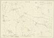
Denbighshire XIX.12 (includes: Llanbedr; Llanfair Dyffryn Clwyd Rural; Rhuthun) - 25 Inch Map
1 : 2500 Topographic maps Ordnance Survey Ordnance Survey
Denbighshire XIX.16 (includes: Llanfair Dyffryn Clwyd Rural) - 25 Inch Map
1 : 2500 Topographic maps Ordnance Survey Ordnance Survey