Maps of Cheshire
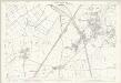
Cheshire XXXII - OS Six-Inch Map
1 : 10560 Topographic maps Ordnance Survey Ordnance Survey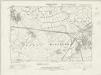
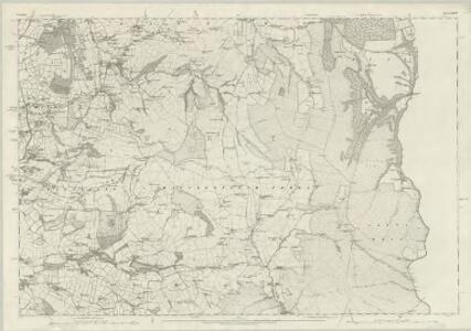
Cheshire XXXII.NW - OS Six-Inch Map
1 : 10560 Topographic maps Ordnance Survey Ordnance Survey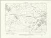
Cheshire XXXII.NW - OS Six-Inch Map
1 : 10560 Topographic maps Ordnance Survey Ordnance Survey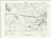
Cheshire XXXII.NW - OS Six-Inch Map
1 : 10560 Topographic maps Ordnance Survey Ordnance Survey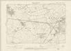
Cheshire XXXII.NW - OS Six-Inch Map
1 : 10560 Topographic maps Ordnance Survey Ordnance Survey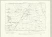
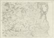
Cheshire XXXII.SW - OS Six-Inch Map
1 : 10560 Topographic maps Ordnance Survey Ordnance Survey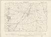
Cheshire XXXII.SW - OS Six-Inch Map
1 : 10560 Topographic maps Ordnance Survey Ordnance Survey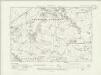
Cheshire XXXII.NE - OS Six-Inch Map
1 : 10560 Topographic maps Ordnance Survey Ordnance Survey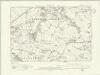
Cheshire XXXII.NE - OS Six-Inch Map
1 : 10560 Topographic maps Ordnance Survey Ordnance Survey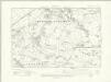
Cheshire XXXII.NE - OS Six-Inch Map
1 : 10560 Topographic maps Ordnance Survey Ordnance Survey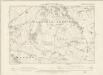
Cheshire XXXII.NE - OS Six-Inch Map
1 : 10560 Topographic maps Ordnance Survey Ordnance Survey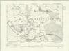
Cheshire XXXII.SE - OS Six-Inch Map
1 : 10560 Topographic maps Ordnance Survey Ordnance Survey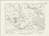
Cheshire XXXII.SE - OS Six-Inch Map
1 : 10560 Topographic maps Ordnance Survey Ordnance Survey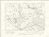
Cheshire XXXII.SE - OS Six-Inch Map
1 : 10560 Topographic maps Ordnance Survey Ordnance Survey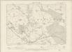
Cheshire XXXII.SE - OS Six-Inch Map
1 : 10560 Topographic maps Ordnance Survey Ordnance Survey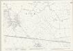
Cheshire XXXII.1 (includes: Ellesmere Port; Elton) - 25 Inch Map
1 : 2500 Topographic maps Ordnance Survey Ordnance Survey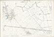
Cheshire XXXII.1 (includes: Ellesmere Port; Elton) - 25 Inch Map
1 : 2500 Topographic maps Ordnance Survey Ordnance Survey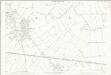
Cheshire XXXII.1 (includes: Ellesmere Port; Elton) - 25 Inch Map
1 : 2500 Topographic maps Ordnance Survey Ordnance Survey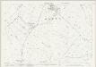
Cheshire XXXII.5 (includes: Dunham on the Hill; Ellesmere Port; Elton; Hapsford; Thornton Le Moors) - 25 Inch Map
1 : 2500 Topographic maps Ordnance Survey Ordnance Survey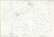
Cheshire XXXII.5 (includes: Dunham on the Hill; Ellesmere Port; Elton; Hapsford; Thornton Le Moors) - 25 Inch Map
1 : 2500 Topographic maps Ordnance Survey Ordnance Survey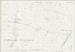
Cheshire XXXII.9 (includes: Dunham on the Hill; Elton; Hapsford; Thornton Le Moors; Wimbolds Trafford) - 25 Inch Map
1 : 2500 Topographic maps Ordnance Survey Ordnance Survey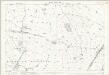
Cheshire XXXII.9 (includes: Dunham on the Hill; Elton; Hapsford; Thornton Le Moors; Wimbolds Trafford) - 25 Inch Map
1 : 2500 Topographic maps Ordnance Survey Ordnance Survey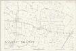
Cheshire XXXII.9 (includes: Dunham on the Hill; Elton; Hapsford; Thornton Le Moors; Wimbolds Trafford) - 25 Inch Map
1 : 2500 Topographic maps Ordnance Survey Ordnance Survey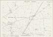
Cheshire XXXII.13 (includes: Barrow; Bridge Trafford; Dunham on the Hill; Mickle Trafford; Picton; Wimbolds Trafford) - 25 Inch Map
1 : 2500 Topographic maps Ordnance Survey Ordnance Survey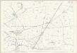
Cheshire XXXII.13 (includes: Barrow; Bridge Trafford; Dunham on the Hill; Mickle Trafford; Picton; Wimbolds Trafford) - 25 Inch Map
1 : 2500 Topographic maps Ordnance Survey Ordnance Survey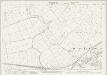
Cheshire XXXII.2 (includes: Ellesmere Port; Elton; Frodsham; Hapsford; Helsby) - 25 Inch Map
1 : 2500 Topographic maps Ordnance Survey Ordnance Survey
Cheshire XXXII.2 (includes: Ellesmere Port; Elton; Frodsham; Hapsford; Helsby) - 25 Inch Map
1 : 2500 Topographic maps Ordnance Survey Ordnance Survey
Cheshire XXXII.2 (includes: Ellesmere Port; Elton; Frodsham; Hapsford; Helsby) - 25 Inch Map
1 : 2500 Topographic maps Ordnance Survey Ordnance Survey
Cheshire XXXII.6 (includes: Alvanley; Dunham on the Hill; Elton; Hapsford; Helsby) - 25 Inch Map
1 : 2500 Topographic maps Ordnance Survey Ordnance Survey