Maps of Cumbria
Cumberland LXXXVI - OS Six-Inch Map
1 : 10560 Topographic maps Ordnance Survey Ordnance Survey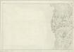
Lancashire VI - OS Six-Inch Map
1 : 10560 Topographic maps Ordnance Survey Ordnance Survey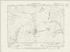
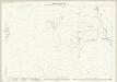
Cumberland LXXXVI.NW - OS Six-Inch Map
1 : 10560 Topographic maps Ordnance Survey Ordnance Survey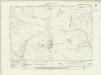
Cumberland LXXXVI.NW - OS Six-Inch Map
1 : 10560 Topographic maps Ordnance Survey Ordnance Survey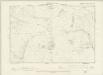
Cumberland LXXXVI.NW - OS Six-Inch Map
1 : 10560 Topographic maps Ordnance Survey Ordnance Survey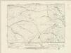
Cumberland LXXXVI.SW - OS Six-Inch Map
1 : 10560 Topographic maps Ordnance Survey Ordnance Survey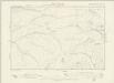
Cumberland LXXXVI.SW - OS Six-Inch Map
1 : 10560 Topographic maps Ordnance Survey Ordnance Survey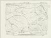
Cumberland LXXXVI.SW - OS Six-Inch Map
1 : 10560 Topographic maps Ordnance Survey Ordnance Survey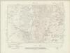
Lancashire VI.NE - OS Six-Inch Map
1 : 10560 Topographic maps Ordnance Survey Ordnance Survey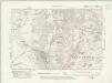
Lancashire VI.NE - OS Six-Inch Map
1 : 10560 Topographic maps Ordnance Survey Ordnance Survey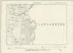
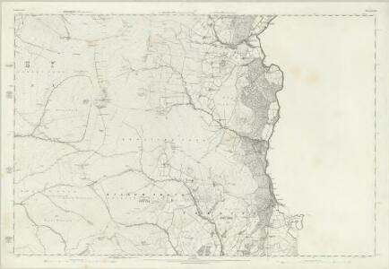
Cumberland LXXXVI.NE - OS Six-Inch Map
1 : 10560 Topographic maps Ordnance Survey Ordnance Survey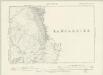
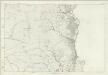
Cumberland LXXXVI.SE - OS Six-Inch Map
1 : 10560 Topographic maps Ordnance Survey Ordnance Survey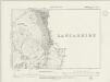
Cumberland LXXXVI.SE - OS Six-Inch Map
1 : 10560 Topographic maps Ordnance Survey Ordnance Survey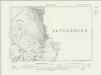
Cumberland LXXXVI.SE - OS Six-Inch Map
1 : 10560 Topographic maps Ordnance Survey Ordnance Survey
Lancashire VI.3 (includes: Dunnerdale With Seathwaite; Millom Without; Ulpha) - 25 Inch Map
1 : 2500 Topographic maps Ordnance Survey Ordnance Survey
Lancashire VI.3 (includes: Dunnerdale With Seathwaite; Millom Without; Ulpha) - 25 Inch Map
1 : 2500 Topographic maps Ordnance Survey Ordnance Survey
Lancashire VI.7 (includes: Broughton West; Dunnerdale With Seathwaite; Millom Without; Ulpha) - 25 Inch Map
1 : 2500 Topographic maps Ordnance Survey Ordnance Survey
Lancashire VI.7 (includes: Broughton West; Dunnerdale With Seathwaite; Millom Without; Ulpha) - 25 Inch Map
1 : 2500 Topographic maps Ordnance Survey Ordnance Survey
Lancashire VI.11 (includes: Broughton West; Millom Without) - 25 Inch Map
1 : 2500 Topographic maps Ordnance Survey Ordnance Survey
Lancashire VI.11 (includes: Broughton West; Millom Without) - 25 Inch Map
1 : 2500 Topographic maps Ordnance Survey Ordnance Survey
Cumberland LXXXVI.5 (inset LXXXVI.1) (includes: Bootle; Ulpha) - 25 Inch Map
1 : 2500 Topographic maps Ordnance Survey Ordnance Survey
Cumberland LXXXVI.5 (includes: Bootle) - 25 Inch Map
1 : 2500 Topographic maps Ordnance Survey Ordnance Survey
Cumberland LXXXVI.5 (inset LXXXVI.1) (includes: Bootle; Ulpha) - 25 Inch Map
1 : 2500 Topographic maps Ordnance Survey Ordnance Survey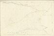
Cumberland LXXXVI.9 (includes: Bootle) - 25 Inch Map
1 : 2500 Topographic maps Ordnance Survey Ordnance Survey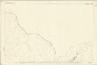
Cumberland LXXXVI.13 (includes: Bootle) - 25 Inch Map
1 : 2500 Topographic maps Ordnance Survey Ordnance Survey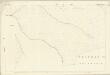
Cumberland LXXXVI.13 (inset LXXXVI.14) (includes: Bootle) - 25 Inch Map
1 : 2500 Topographic maps Ordnance Survey Ordnance Survey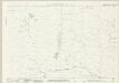
Cumberland LXXXVI.2 (includes: Ulpha) - 25 Inch Map
1 : 2500 Topographic maps Ordnance Survey Ordnance Survey
Cumberland LXXXVI.2 (includes: Ulpha) - 25 Inch Map
1 : 2500 Topographic maps Ordnance Survey Ordnance Survey
Cumberland LXXXVI.2 (inset LXXXIII.14) (includes: Muncaster; Ulpha) - 25 Inch Map
1 : 2500 Topographic maps Ordnance Survey Ordnance Survey