Maps of Monmouthshire
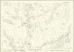
Brecknockshire XLII - OS Six-Inch Map
1 : 10560 Topographic maps Ordnance Survey Ordnance Survey
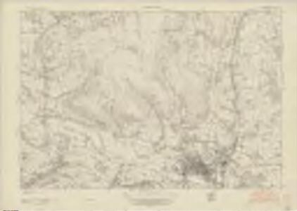
Brecknockshire XLII - OS Six-Inch Map
1 : 10560 Topographic maps Ordnance Survey Ordnance Survey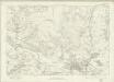
Brecknockshire XLII - OS Six-Inch Map
1 : 10560 Topographic maps Ordnance Survey Ordnance Survey
Monmouthshire VI.NE - OS Six-Inch Map
1 : 10560 Topographic maps Ordnance Survey Ordnance Survey
Monmouthshire VI.SE - OS Six-Inch Map
1 : 10560 Topographic maps Ordnance Survey Ordnance Survey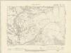
Brecknockshire XLII.NW - OS Six-Inch Map
1 : 10560 Topographic maps Ordnance Survey Ordnance Survey
Monmouthshire VI.NW - OS Six-Inch Map
1 : 10560 Topographic maps Ordnance Survey Ordnance Survey
Brecknockshire XLII.NW - OS Six-Inch Map
1 : 10560 Topographic maps Ordnance Survey Ordnance Survey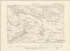
Brecknockshire XLII.SW - OS Six-Inch Map
1 : 10560 Topographic maps Ordnance Survey Ordnance Survey
Monmouthshire VI.SW - OS Six-Inch Map
1 : 10560 Topographic maps Ordnance Survey Ordnance Survey
Brecknockshire XLII.SW - OS Six-Inch Map
1 : 10560 Topographic maps Ordnance Survey Ordnance Survey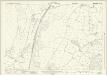
Monmouthshire VI.4 (includes: Crucornau Fawr; Llandeilo Bertholau) - 25 Inch Map
1 : 2500 Topographic maps Ordnance Survey Ordnance Survey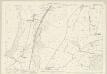
Monmouthshire VI.4 (includes: Crucornau Fawr; Llandeilo Bertholau) - 25 Inch Map
1 : 2500 Topographic maps Ordnance Survey Ordnance Survey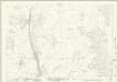
Monmouthshire VI.8 (includes: Llanddewi Ysgyryd; Llandeilo Bertholau) - 25 Inch Map
1 : 2500 Topographic maps Ordnance Survey Ordnance Survey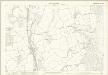
Monmouthshire VI.8 (includes: Llanddewi Ysgyryd; Llandeilo Bertholau) - 25 Inch Map
1 : 2500 Topographic maps Ordnance Survey Ordnance Survey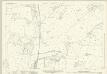
Monmouthshire VI.12 (includes: Abergavenny Urban; Llandeilo Bertholau) - 25 Inch Map
1 : 2500 Topographic maps Ordnance Survey Ordnance Survey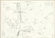
Monmouthshire VI.12 (includes: Abergavenny Urban; Llandeilo Bertholau) - 25 Inch Map
1 : 2500 Topographic maps Ordnance Survey Ordnance Survey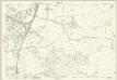
Monmouthshire VI.16 (includes: Abergavenny Rural; Abergavenny Urban; Llandeilo Bertholau) - 25 Inch Map
1 : 2500 Topographic maps Ordnance Survey Ordnance Survey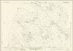
Monmouthshire VI.3 (includes: Abergavenny Urban; Llandeilo Bertholau) - 25 Inch Map
1 : 2500 Topographic maps Ordnance Survey Ordnance Survey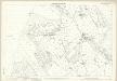
Monmouthshire VI.3 (includes: Abergavenny Urban; Llandeilo Bertholau) - 25 Inch Map
1 : 2500 Topographic maps Ordnance Survey Ordnance Survey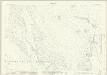
Monmouthshire VI.7 (includes: Abergavenny Urban; Llandeilo Bertholau) - 25 Inch Map
1 : 2500 Topographic maps Ordnance Survey Ordnance Survey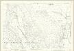
Monmouthshire VI.7 (includes: Abergavenny Urban; Llandeilo Bertholau) - 25 Inch Map
1 : 2500 Topographic maps Ordnance Survey Ordnance Survey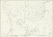
Monmouthshire VI.11 (includes: Abergavenny Urban; Llandeilo Bertholau; Llanfoist Fawr) - 25 Inch Map
1 : 2500 Topographic maps Ordnance Survey Ordnance Survey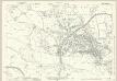
Monmouthshire VI.15 (includes: Abergavenny Rural; Abergavenny Urban; Llanfoist Fawr) - 25 Inch Map
1 : 2500 Topographic maps Ordnance Survey Ordnance Survey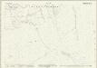
Brecknockshire XLII.2 (includes: Abergavenny Urban; Llanbedr Ystrad Yw; Llandeilo Bertholau; Llanfoist Fawr; Llangenni) - 25 Inch Map
1 : 2500 Topographic maps Ordnance Survey Ordnance Survey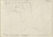
Monmouthshire VI.2 (includes: Abergavenny Urban; Llanbedr Ystrad Yw; Llandeilo Bertholau; Llanfoist Fawr; Llangenni) - 25 Inch Map
1 : 2500 Topographic maps Ordnance Survey Ordnance Survey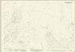
Monmouthshire VI.6 (includes: Abergavenny Urban; Llanfoist Fawr; Llangenni) - 25 Inch Map
1 : 2500 Topographic maps Ordnance Survey Ordnance Survey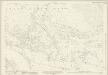
Monmouthshire VI.10 (includes: Abergavenny Urban; Llanelli; Llanfoist Fawr) - 25 Inch Map
1 : 2500 Topographic maps Ordnance Survey Ordnance Survey
Brecknockshire XLII.14 (includes: Llanelli; Llanfoist Fawr) - 25 Inch Map
1 : 2500 Topographic maps Ordnance Survey Ordnance Survey
Monmouthshire VI.5 (includes: Llanfoist Fawr; Llangenni) - 25 Inch Map
1 : 2500 Topographic maps Ordnance Survey Ordnance Survey