Maps of Chester
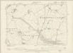
Flintshire XV.NW - OS Six-Inch Map
1 : 10560 Topographic maps Ordnance Survey Ordnance Survey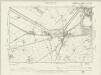
Flintshire XV.NW - OS Six-Inch Map
1 : 10560 Topographic maps Ordnance Survey Ordnance Survey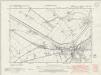
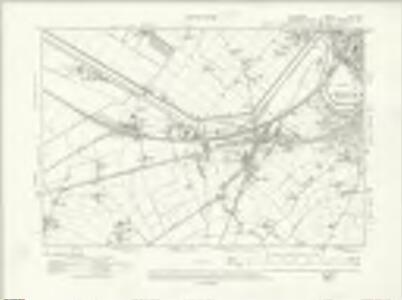
Cheshire XXXVIII.SW - OS Six-Inch Map
1 : 10560 Topographic maps Ordnance Survey Ordnance Survey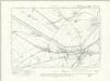
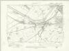
Cheshire XXXVIII.SW - OS Six-Inch Map
1 : 10560 Topographic maps Ordnance Survey Ordnance Survey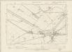
Cheshire XXXVIII.SW - OS Six-Inch Map
1 : 10560 Topographic maps Ordnance Survey Ordnance Survey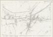
Cheshire XXXVIII.14 (includes: Chester; East Saltney; Marlston cum Lache; Sealand) - 25 Inch Map
1 : 2500 Topographic maps Ordnance Survey Ordnance Survey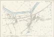
Cheshire XXXVIII.14 (includes: Chester; East Saltney; Marlston cum Lache; Sealand) - 25 Inch Map
1 : 2500 Topographic maps Ordnance Survey Ordnance Survey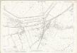
Cheshire XXXVIII.14 (includes: Chester; East Saltney; Marlston cum Lache; Sealand) - 25 Inch Map
1 : 2500 Topographic maps Ordnance Survey Ordnance Survey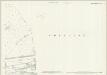
Flintshire XV.2 & XI.14 (includes: Bache; Chester; East Saltney; Sealand) - 25 Inch Map
1 : 2500 Topographic maps Ordnance Survey Ordnance Survey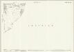
Flintshire XV.6 (includes: Chester; Claverton; East Saltney; Marlston Cum Lache) - 25 Inch Map
1 : 2500 Topographic maps Ordnance Survey Ordnance Survey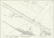
Flintshire XV.1 (includes: East Saltney; Hawarden; Sealand) - 25 Inch Map
1 : 2500 Topographic maps Ordnance Survey Ordnance Survey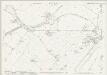
Cheshire XXXVIII.10 (includes: Chester; Sealand) - 25 Inch Map
1 : 2500 Topographic maps Ordnance Survey Ordnance Survey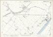
Cheshire XXXVIII.10 (includes: Chester; Sealand) - 25 Inch Map
1 : 2500 Topographic maps Ordnance Survey Ordnance Survey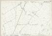
Cheshire XLVI.2 (includes: Chester; Dodleston; East Saltney; Eccleston; Hawarden; Marlston cum Lache) - 25 Inch Map
1 : 2500 Topographic maps Ordnance Survey Ordnance Survey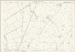
Cheshire XLVI.2 (includes: Chester; Dodleston; East Saltney; Eccleston; Hawarden; Marlston cum Lache) - 25 Inch Map
1 : 2500 Topographic maps Ordnance Survey Ordnance Survey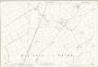
Cheshire XLVI.2 (includes: Chester; Dodleston; East Saltney; Eccleston; Hawarden; Marlston cum Lache) - 25 Inch Map
1 : 2500 Topographic maps Ordnance Survey Ordnance Survey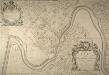
PLAN Of The City & Castle Of Chester
This plan was surveyed and drawn by Alexander de Lavaux, engineer and surveyor. As well as naming the owners of many houses, the plan includes informative details such as the "North Gate May Pole" and the "Water Engine", which was mentioned in Daniel Defoe’s diary record of his second visit to the city: "When I was formerly at this city, about the year 1690, they had no water to supply their ordinary occasions, but what was carried from the River Dee upon horses, in great leather vessels, like a pair of bakers panyers... But at my coming there this time, I found a very good water-house in the river, and the city plentifully supply'd by pipes, just as London is from the Thames; tho' some parts of Chester stands very high from the river". de Lavaux, Alexander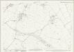
Cheshire XLVI.1 (includes: Dodleston; East Saltney; Hawarden; Lower Kinnerton) - 25 Inch Map
1 : 2500 Topographic maps Ordnance Survey Ordnance Survey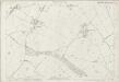
Cheshire XLVI.1 (includes: Dodleston; East Saltney; Hawarden; Lower Kinnerton) - 25 Inch Map
1 : 2500 Topographic maps Ordnance Survey Ordnance Survey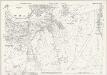
Cheshire XXXVIII.15 (includes: Chester Castle; Chester; Huntington) - 25 Inch Map
1 : 2500 Topographic maps Ordnance Survey Ordnance Survey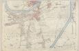
Cheshire XXXVIII.15 (includes: Chester Castle; Chester; Huntington) - 25 Inch Map
1 : 2500 Topographic maps Ordnance Survey Ordnance Survey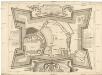
A plan of the castle of Chester
Chester (Anglie) Lavaux, Alexander de Parr, R.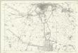
Flintshire XV - OS Six-Inch Map
1 : 10560 Topographic maps Ordnance Survey Ordnance Survey

SJ36 - OS 1:25,000 Provisional Series Map
1 : 25000 Topographic maps Ordnance Survey Ordnance Survey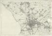
Cheshire XXXVIII - OS Six-Inch Map
1 : 10560 Topographic maps Ordnance Survey Ordnance Survey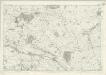
Cheshire XLVI - OS Six-Inch Map
1 : 10560 Topographic maps Ordnance Survey Ordnance Survey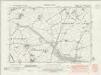
Cheshire XLVI.NW - OS Six-Inch Map
1 : 10560 Topographic maps Ordnance Survey Ordnance Survey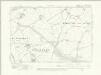
Cheshire XLVI.NW - OS Six-Inch Map
1 : 10560 Topographic maps Ordnance Survey Ordnance Survey