Maps of Chester
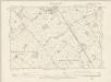
Flintshire X.NE - OS Six-Inch Map
1 : 10560 Topographic maps Ordnance Survey Ordnance Survey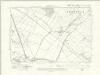
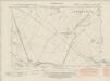
Flintshire X.NE - OS Six-Inch Map
1 : 10560 Topographic maps Ordnance Survey Ordnance Survey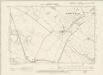
Flintshire X.NE - OS Six-Inch Map
1 : 10560 Topographic maps Ordnance Survey Ordnance Survey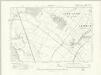
Cheshire XXX.SE - OS Six-Inch Map
1 : 10560 Topographic maps Ordnance Survey Ordnance Survey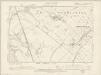
Cheshire XXX.SE - OS Six-Inch Map
1 : 10560 Topographic maps Ordnance Survey Ordnance Survey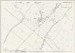
Cheshire XXX.16 (includes: Puddington; Sealand; Shotwick Park; Shotwick; Woodbank) - 25 Inch Map
1 : 2500 Topographic maps Ordnance Survey Ordnance Survey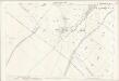
Cheshire XXX.16 (includes: Puddington; Sealand; Shotwick Park; Shotwick; Woodbank) - 25 Inch Map
1 : 2500 Topographic maps Ordnance Survey Ordnance Survey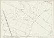
Flintshire X.3 & 4 (includes: Burton; Connahs Quay; Puddington; Saughall; Sealand; Shotwick Park; Shotwick; Woodbank) - 25 Inch Map
1 : 2500 Topographic maps Ordnance Survey Ordnance Survey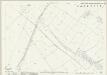
Flintshire X.8 (includes: Saughall; Sealand; Shotwick Park; Shotwick; Woodbank) - 25 Inch Map
1 : 2500 Topographic maps Ordnance Survey Ordnance Survey
Flintshire X.7 (includes: Connahs Quay; Sealand) - 25 Inch Map
1 : 2500 Topographic maps Ordnance Survey Ordnance Survey
Flintshire X.3 & 4 (includes: Burton; Connahs Quay; Puddington; Saughall; Sealand; Shotwick Park; Shotwick; Woodbank) - 25 Inch Map
1 : 2500 Topographic maps Ordnance Survey Ordnance Survey
Cheshire XXX.15 (includes: Connahs Quay; Puddington; Sealand) - 25 Inch Map
1 : 2500 Topographic maps Ordnance Survey Ordnance Survey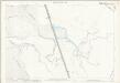
Cheshire XXX.15 (includes: Connahs Quay; Puddington; Sealand) - 25 Inch Map
1 : 2500 Topographic maps Ordnance Survey Ordnance Survey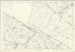
Flintshire X - OS Six-Inch Map
1 : 10560 Topographic maps Ordnance Survey Ordnance Survey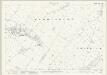
Cheshire XXX.12 (includes: Burton; Puddington; Shotwick; Woodbank) - 25 Inch Map
1 : 2500 Topographic maps Ordnance Survey Ordnance Survey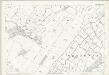
Cheshire XXX.12 (includes: Burton; Puddington; Shotwick; Woodbank) - 25 Inch Map
1 : 2500 Topographic maps Ordnance Survey Ordnance Survey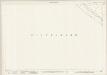
Cheshire XXXVIIIA.4 (includes: Sealand; Shotwick Park) - 25 Inch Map
1 : 2500 Topographic maps Ordnance Survey Ordnance Survey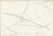
Cheshire XXXVIIIA.4 (includes: Sealand; Shotwick Park) - 25 Inch Map
1 : 2500 Topographic maps Ordnance Survey Ordnance Survey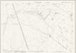
Cheshire XXX.11 (includes: Burton; Connahs Quay; Puddington; Sealand) - 25 Inch Map
1 : 2500 Topographic maps Ordnance Survey Ordnance Survey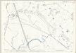
Cheshire XXX.11 (includes: Burton; Connahs Quay; Puddington; Sealand) - 25 Inch Map
1 : 2500 Topographic maps Ordnance Survey Ordnance Survey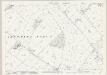
Cheshire XXXI.13 (includes: Capenhurst; Mollington; Saughall; Shotwick Park; Woodbank) - 25 Inch Map
1 : 2500 Topographic maps Ordnance Survey Ordnance Survey
SJ37 - OS 1:25,000 Provisional Series Map
1 : 25000 Topographic maps Ordnance Survey Ordnance Survey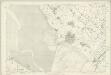
Cheshire XXX - OS Six-Inch Map
1 : 10560 Topographic maps Ordnance Survey Ordnance Survey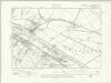
Cheshire XXXVIIIA.NE - OS Six-Inch Map
1 : 10560 Topographic maps Ordnance Survey Ordnance Survey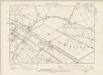
Cheshire XXXVIIIA.NE - OS Six-Inch Map
1 : 10560 Topographic maps Ordnance Survey Ordnance Survey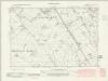
Cheshire XXXI.SW - OS Six-Inch Map
1 : 10560 Topographic maps Ordnance Survey Ordnance Survey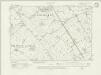
Cheshire XXXI.SW - OS Six-Inch Map
1 : 10560 Topographic maps Ordnance Survey Ordnance Survey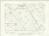
Cheshire XXXI.SW - OS Six-Inch Map
1 : 10560 Topographic maps Ordnance Survey Ordnance Survey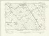
Cheshire XXXI.SW - OS Six-Inch Map
1 : 10560 Topographic maps Ordnance Survey Ordnance Survey