Maps of Wrexham

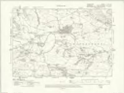
Denbighshire XLIV.SE - OS Six-Inch Map
1 : 10560 Topographic maps Ordnance Survey Ordnance Survey
Denbighshire XLIV.SE - OS Six-Inch Map
1 : 10560 Topographic maps Ordnance Survey Ordnance Survey
Denbighshire XLIV.SE - OS Six-Inch Map
1 : 10560 Topographic maps Ordnance Survey Ordnance Survey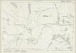
Shropshire XVIII.15 (includes: Llangedwyn; Llansilin; Llanyblodwel; Pool) - 25 Inch Map
1 : 2500 Topographic maps Ordnance Survey Ordnance Survey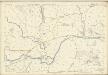
Shropshire XVIII.15 (includes: Llangedwyn; Llansilin; Llanyblodwel; Pool) - 25 Inch Map
1 : 2500 Topographic maps Ordnance Survey Ordnance Survey
Denbighshire XLIV.15 (includes: Llanfechain; Llanyblodwel; Pool) - 25 Inch Map
1 : 2500 Topographic maps Ordnance Survey Ordnance Survey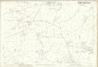
Denbighshire XLIV.15 (includes: Llanfechain; Llanyblodwel; Pool) - 25 Inch Map
1 : 2500 Topographic maps Ordnance Survey Ordnance Survey
Denbighshire XLIV.11 (includes: Llangedwyn; Llansilin; Llanyblodwel; Pool) - 25 Inch Map
1 : 2500 Topographic maps Ordnance Survey Ordnance Survey
Denbighshire XLIV.11 (includes: Llangedwyn; Llansilin; Llanyblodwel; Pool) - 25 Inch Map
1 : 2500 Topographic maps Ordnance Survey Ordnance Survey
Shropshire XVIII.16 (includes: Llanyblodwel; Oswestry Rural) - 25 Inch Map
1 : 2500 Topographic maps Ordnance Survey Ordnance Survey
Shropshire XVIII.16 (includes: Llanyblodwel; Oswestry Rural) - 25 Inch Map
1 : 2500 Topographic maps Ordnance Survey Ordnance Survey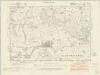
Shropshire XVIII.SE - OS Six-Inch Map
1 : 10560 Topographic maps Ordnance Survey Ordnance Survey
Shropshire XVIII.SE - OS Six-Inch Map
1 : 10560 Topographic maps Ordnance Survey Ordnance Survey
Shropshire XVIII.SE - OS Six-Inch Map
1 : 10560 Topographic maps Ordnance Survey Ordnance Survey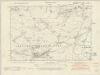
Montgomeryshire X.NE - OS Six-Inch Map
1 : 10560 Topographic maps Ordnance Survey Ordnance Survey
Shropshire XXV.NE - OS Six-Inch Map
1 : 10560 Topographic maps Ordnance Survey Ordnance Survey
Montgomeryshire X.NE - OS Six-Inch Map
1 : 10560 Topographic maps Ordnance Survey Ordnance Survey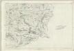
Denbighshire XLIV (insert XLVI) - OS Six-Inch Map
1 : 10560 Topographic maps Ordnance Survey Ordnance Survey
SJ22 - OS 1:25,000 Provisional Series Map
1 : 25000 Topographic maps Ordnance Survey Ordnance Survey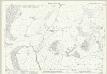
Shropshire XVIII.11 (includes: Llansilin; Llanyblodwel; Sychtyn) - 25 Inch Map
1 : 2500 Topographic maps Ordnance Survey Ordnance Survey
Shropshire XVIII.11 (includes: Llansilin; Llanyblodwel; Sychtyn) - 25 Inch Map
1 : 2500 Topographic maps Ordnance Survey Ordnance Survey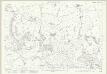
Shropshire XVIII.12 (includes: Llanyblodwel; Oswestry Rural; Sychtyn) - 25 Inch Map
1 : 2500 Topographic maps Ordnance Survey Ordnance Survey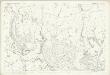
Shropshire XVIII.12 (includes: Llanyblodwel; Oswestry Rural; Sychtyn) - 25 Inch Map
1 : 2500 Topographic maps Ordnance Survey Ordnance Survey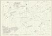
Montgomeryshire X.2 (includes: Llanfechain; Llangedwyn; Llanrhaeadr Ym Mochnant; Pool) - 25 Inch Map
1 : 2500 Topographic maps Ordnance Survey Ordnance Survey
Oswestry (Hills) - OS One-Inch Revised New Series
1 : 63360 Topographic maps Ordnance Survey Ordnance Survey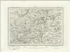
Oswestry (Outline) - OS One-Inch Revised New Series
1 : 63360 Topographic maps Ordnance Survey Ordnance Survey
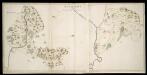
Oswestry
1 : 31680 This drawing is formally titled. The scale of the drawing isgiven and the area of the land noted as 145.9838 square miles., A triangulation diagram appears on the reverse of the manuscript., This enabled draughtsmen to plot the exact location of topographical features., Archaeological sites are named in gothic script., Colour washes are combined with numerical annotations to indicate the relative relief and overall height of hills. Dawson, Robert
Actual Survey of the County of Salop
Rocque, John
Bala and Welshpool - OS One-Inch Map
1 : 63360 Topographic maps Ordnance Survey Ordnance Survey