Maps of Conwy
Denbighshire VI.NW - OS Six-Inch Map
1 : 10560 Topographic maps Ordnance Survey Ordnance Survey
Denbighshire VI.NW - OS Six-Inch Map
1 : 10560 Topographic maps Ordnance Survey Ordnance Survey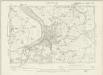
Denbighshire VI.NW - OS Six-Inch Map
1 : 10560 Topographic maps Ordnance Survey Ordnance Survey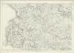
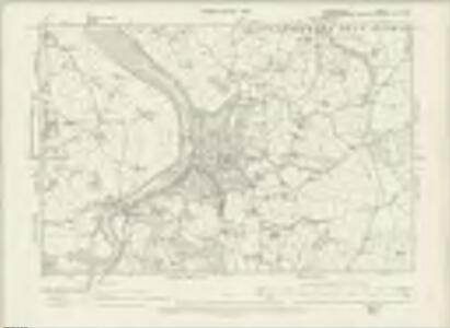
Denbighshire VI - OS Six-Inch Map
1 : 10560 Topographic maps Ordnance Survey Ordnance Survey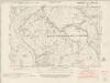
Caernarvonshire IX.NW - OS Six-Inch Map
1 : 10560 Topographic maps Ordnance Survey Ordnance Survey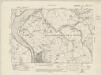
Caernarvonshire IX.NW - OS Six-Inch Map
1 : 10560 Topographic maps Ordnance Survey Ordnance Survey
Caernarvonshire IX.NW - OS Six-Inch Map
1 : 10560 Topographic maps Ordnance Survey Ordnance Survey
Caernarvonshire IX.NW - OS Six-Inch Map
1 : 10560 Topographic maps Ordnance Survey Ordnance Survey
Caernarvonshire IX.NW - OS Six-Inch Map
1 : 10560 Topographic maps Ordnance Survey Ordnance Survey
Caernarvonshire IX.SW - OS Six-Inch Map
1 : 10560 Topographic maps Ordnance Survey Ordnance Survey
Caernarvonshire IX.SW - OS Six-Inch Map
1 : 10560 Topographic maps Ordnance Survey Ordnance Survey
Caernarvonshire IX.SW - OS Six-Inch Map
1 : 10560 Topographic maps Ordnance Survey Ordnance Survey
Caernarvonshire IX.SW - OS Six-Inch Map
1 : 10560 Topographic maps Ordnance Survey Ordnance Survey
SH87 - OS 1:25,000 Provisional Series Map
1 : 25000 Topographic maps Ordnance Survey Ordnance Survey
SH77 - OS 1:25,000 Provisional Series Map
1 : 25000 Topographic maps Ordnance Survey Ordnance Survey
Caernarvonshire VIII.NE - OS Six-Inch Map
1 : 10560 Topographic maps Ordnance Survey Ordnance Survey
Caernarvonshire VIII.NE - OS Six-Inch Map
1 : 10560 Topographic maps Ordnance Survey Ordnance Survey
Caernarvonshire VIII.NE - OS Six-Inch Map
1 : 10560 Topographic maps Ordnance Survey Ordnance Survey
Caernarvonshire VIII.NE - OS Six-Inch Map
1 : 10560 Topographic maps Ordnance Survey Ordnance Survey
Caernarvonshire VIII.NE - OS Six-Inch Map
1 : 10560 Topographic maps Ordnance Survey Ordnance Survey
Caernarvonshire VIII.NE - OS Six-Inch Map
1 : 10560 Topographic maps Ordnance Survey Ordnance Survey
Caernarvonshire VIII.SE - OS Six-Inch Map
1 : 10560 Topographic maps Ordnance Survey Ordnance Survey
Caernarvonshire VIII.SE - OS Six-Inch Map
1 : 10560 Topographic maps Ordnance Survey Ordnance Survey
Caernarvonshire VIII.SE - OS Six-Inch Map
1 : 10560 Topographic maps Ordnance Survey Ordnance Survey
Caernarvonshire VIII.SE - OS Six-Inch Map
1 : 10560 Topographic maps Ordnance Survey Ordnance Survey
St. Asaph
1 : 31680 This plan of a section of the Vale of Clwyd is formally titled with the scale of the drawing noted and the area of the land recorded as 188.84 square miles. Archaeological sites are named in gothic script. Colour washes depicting relief are combined with numerical annotations ('spot heights') in red and black ink, indicating the height of the hills. The altitudes shown in red ink have been trigonometrically ascertained; those in black are estimated. Dawson, Robert
Snowdon - OS One-Inch Map
1 : 63360 Topographic maps Ordnance Survey Ordnance Survey
Denbigiensis comitatus et comitatus Flintensis
1 Karte : Kupferdruck ; 36 x 48 cm Blaeu Joan Blaeu
DENBIGIENSIS | Comitatus et Comitatus | FLINTENSIS; | DENBIGH er FLINTSHIRE.
[Amsterdam : Joan Blaeu]