Maps of Cherwell
Warwickshire LII.NW - OS Six-Inch Map
1 : 10560 Topographic maps Ordnance Survey Ordnance Survey
Warwickshire LII.NW - OS Six-Inch Map
1 : 10560 Topographic maps Ordnance Survey Ordnance Survey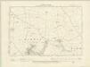
Warwickshire LII.NW - OS Six-Inch Map
1 : 10560 Topographic maps Ordnance Survey Ordnance Survey
Warwickshire LII.NW - OS Six-Inch Map
1 : 10560 Topographic maps Ordnance Survey Ordnance Survey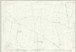
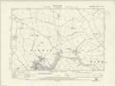
Warwickshire LII.1 (includes: Burton Dassett; Kineton; Radway; Warmington) - 25 Inch Map
1 : 2500 Topographic maps Ordnance Survey Ordnance Survey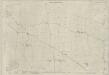
Warwickshire LII.1 (includes: Burton Dassett; Kineton; Radway; Warmington) - 25 Inch Map
1 : 2500 Topographic maps Ordnance Survey Ordnance Survey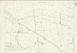
Warwickshire LII.1 (includes: Burton Dassett; Kineton; Radway; Warmington) - 25 Inch Map
1 : 2500 Topographic maps Ordnance Survey Ordnance Survey
Warwickshire LII.5 (includes: Kineton; Radway; Ratley and Upton; Tysoe) - 25 Inch Map
1 : 2500 Topographic maps Ordnance Survey Ordnance Survey
Warwickshire LII.5 (includes: Kineton; Radway; Ratley and Upton; Tysoe) - 25 Inch Map
1 : 2500 Topographic maps Ordnance Survey Ordnance Survey
Warwickshire LII.5 (includes: Kineton; Radway; Ratley and Upton; Tysoe) - 25 Inch Map
1 : 2500 Topographic maps Ordnance Survey Ordnance Survey
Warwickshire LII.6 (includes: Avon Dassett; Radway; Ratley and Upton; Warmington) - 25 Inch Map
1 : 2500 Topographic maps Ordnance Survey Ordnance Survey
Warwickshire LII.6 (includes: Avon Dassett; Radway; Ratley and Upton; Warmington) - 25 Inch Map
1 : 2500 Topographic maps Ordnance Survey Ordnance Survey
Warwickshire LII.6 (includes: Avon Dassett; Radway; Ratley and Upton; Warmington) - 25 Inch Map
1 : 2500 Topographic maps Ordnance Survey Ordnance Survey
Warwickshire LII.2 (includes: Avon Dassett; Burton Dassett; Radway; Warmington) - 25 Inch Map
1 : 2500 Topographic maps Ordnance Survey Ordnance Survey
Warwickshire LII.2 (includes: Avon Dassett; Burton Dassett; Radway; Warmington) - 25 Inch Map
1 : 2500 Topographic maps Ordnance Survey Ordnance Survey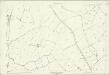
Warwickshire LII.2 (includes: Avon Dassett; Burton Dassett; Radway; Warmington) - 25 Inch Map
1 : 2500 Topographic maps Ordnance Survey Ordnance Survey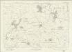
Oxfordshire II - OS Six-Inch Map
1 : 10560 Topographic maps Ordnance Survey Ordnance Survey
SP34 - OS 1:25,000 Provisional Series Map
1 : 25000 Topographic maps Ordnance Survey Ordnance Survey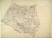
Ladbroke
1 : 31680 This part of Warwickshire is dominated by enclosed land, characterised by regular hedgerows and fish ponds for watering stock. A section of the Oxford Canal, between Napton and Croperdy, is depicted in blue along the right side of the sheet. Completed in 1790, the canal was used to ferry coal from the north to Oxford. At top left, forming the boundary of the surveyed area, is the Fosse Way. This Roman road ran from Exeter to Lincoln via Bath, Cirencester and Leicester (where it intersected the Watling Street from London). At lower right, the county border between Warwickshire and Northamptonshire is indicated by a red dotted line. Stevens, Henry
Shipston-on-Stour
1 : 31680 This area at the edge of the Cotswolds is dominated by enclosed farmland. Depicted at top left is the Fosse Way, the old Roman road running from Exeter to Lincoln, via Bath, Cirencester and Leicester (where it intersected the Watling Street from London).
Banbury (Hills) - OS One-Inch Revised New Series
1 : 63360 Topographic maps Ordnance Survey Ordnance Survey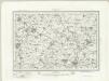
Banbury (Outline) - OS One-Inch Revised New Series
1 : 63360 Topographic maps Ordnance Survey Ordnance Survey
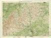
Warwick
1 : 31680 This,plan of,part of South Warwickshire shows the broad valley of the River Avon,to the,left of the sheet with the county town,shown at middle left along the riverbank. Major roads are highlighted in buff and feature tollgates and turnpikes along their routes. Turnpike Trusts were,established between the 17th and 19th centuries to raise money from travellers for the upkeep and maintenance of roads. Stevens, Henry
Coventry and Rugby - OS One-Inch Map
1 : 63360 Topographic maps Ordnance Survey Ordnance Survey
Banbury - OS One-Inch Map
1 : 63360 Topographic maps Ordnance Survey Ordnance Survey
The counti of Warwick the shire towne and citie of Coventre described
1 : 1
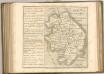
A new improved map of Oxfordshire
1 Karte : Kupferdruck ; 69 x 51 cm Kitchin; Hinton sold by J. Hinton at the Kings Arms in St. Pauls Church Yard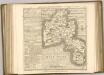
Oxford, Sheet 24 - Bartholomew's "Half Inch to the Mile Maps" of England & Wales
1 : 126720 Topographic maps Bartholomew, John George John Bartholomew & Co