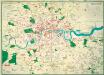
Maps of Bromley
London (Edition of 1894-96) CXLVII (includes: Beckenham; Bromley; Lewisham) - 25 Inch Map
1 : 2500 Topographic maps Ordnance Survey Ordnance Survey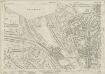
Kent VII.16 (includes: Beckenham; Bromley; Lewisham) - 25 Inch Map
1 : 2500 Topographic maps Ordnance Survey Ordnance Survey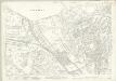
Kent VII.16 (includes: Beckenham; Bromley; Lewisham) - 25 Inch Map
1 : 2500 Topographic maps Ordnance Survey Ordnance Survey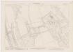
London XVI.32 - OS London Town Plan
1 : 1056 Topographic maps Ordnance Survey Ordnance Survey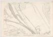
London XVI.42 - OS London Town Plan
1 : 1056 Topographic maps Ordnance Survey Ordnance Survey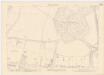
London XVI.31 - OS London Town Plan
1 : 1056 Topographic maps Ordnance Survey Ordnance Survey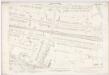
London XVI.41 - OS London Town Plan
1 : 1056 Topographic maps Ordnance Survey Ordnance Survey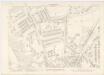
London XVI.43 - OS London Town Plan
1 : 1056 Topographic maps Ordnance Survey Ordnance Survey
London XVI.33 - OS London Town Plan
1 : 1056 Topographic maps Ordnance Survey Ordnance Survey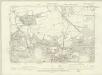
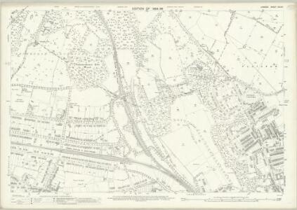
London XVI.NW - OS Six-Inch Map
1 : 10560 Topographic maps Ordnance Survey Ordnance Survey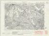
Kent VII.SE - OS Six-Inch Map
1 : 10560 Topographic maps Ordnance Survey Ordnance Survey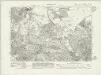
Kent VII.SE - OS Six-Inch Map
1 : 10560 Topographic maps Ordnance Survey Ordnance Survey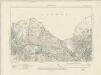
Kent VII.SE - OS Six-Inch Map
1 : 10560 Topographic maps Ordnance Survey Ordnance Survey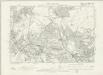
Kent VII.SE - OS Six-Inch Map
1 : 10560 Topographic maps Ordnance Survey Ordnance Survey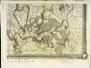
An exact survey of the city's of London Westminster , I
1 Blatt : 53 x 71 cm John Rocque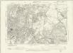
Surrey VIII.SE - OS Six-Inch Map
1 : 10560 Topographic maps Ordnance Survey Ordnance Survey
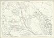
Kent VII.12 (includes: Bromley; Lewisham) - 25 Inch Map
1 : 2500 Topographic maps Ordnance Survey Ordnance Survey
Kent VII.12 (includes: Bromley; Lewisham) - 25 Inch Map
1 : 2500 Topographic maps Ordnance Survey Ordnance Survey
Kent VII.12 (includes: Bromley; Lewisham) - 25 Inch Map
1 : 2500 Topographic maps Ordnance Survey Ordnance Survey
Kent VII.12 (includes: Bromley; Lewisham) - 25 Inch Map
1 : 2500 Topographic maps Ordnance Survey Ordnance Survey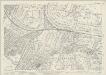
Kent VII.15 (includes: Beckenham) - 25 Inch Map
1 : 2500 Topographic maps Ordnance Survey Ordnance Survey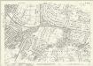
Kent VII.15 (includes: Beckenham) - 25 Inch Map
1 : 2500 Topographic maps Ordnance Survey Ordnance Survey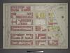
Plate 24: Part of Section 6.
from Atlas of the city of New York, borough of Manhattan / from actual surveys and official plans by George W. and Walter S. Bromley.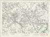
London Sheet T - OS Six-Inch Map
1 : 10560 Topographic maps Ordnance Survey Ordnance Survey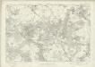
London Sheet T - OS Six-Inch Map
1 : 10560 Topographic maps Ordnance Survey Ordnance Survey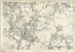
Kent VII - OS Six-Inch Map
1 : 10560 Topographic maps Ordnance Survey Ordnance Survey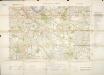
Militärgeographische Angaben über England.
Generalstab des Heeres, Abteilung für Kriegskarten u. Vermessungswesen IV. Mil.-Geo
Bromley (Kent)
1 : 21120 Drawing showing the area around Bromley in Kent. Field boundaries enclosing cultivated land dominate this map of what is now south-east London. Such land is depicted by a striped pattern. Ruled dashed red lines also feature strongly. They radiate from trigonometrical stations used for measuring and plotting topographical features. The signalling telegraph station in Plow Garlic Hill at the top left of the plan marks the site of a trigonometrical station.
A topographical-map, of the county of Kent, No. 1
1 Blatt : 54 x 69 cm A. Dury, W. Herbert