Maps of Greenwich
London (1915- Numbered sheets) X.3 (includes: Borough Of Woolwich) - 25 Inch Map
1 : 2500 Topographic maps Ordnance Survey Ordnance Survey
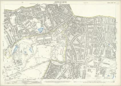
London (Edition of 1894-96) XCIV (includes: Borough Of Woolwich) - 25 Inch Map
1 : 2500 Topographic maps Ordnance Survey Ordnance Survey
London (First Editions c1850s) LX (includes: Borough Of Woolwich) - 25 Inch Map
1 : 2500 Topographic maps Ordnance Survey Ordnance Survey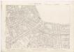
London XII.7 - OS London Town Plan
1 : 1056 Topographic maps Ordnance Survey Ordnance Survey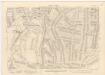
London XII.17 - OS London Town Plan
1 : 1056 Topographic maps Ordnance Survey Ordnance Survey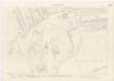
London XII.16 - OS London Town Plan
1 : 1056 Topographic maps Ordnance Survey Ordnance Survey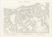
London XII.6 - OS London Town Plan
1 : 1056 Topographic maps Ordnance Survey Ordnance Survey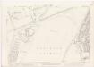
London XII.26 - OS London Town Plan
1 : 1056 Topographic maps Ordnance Survey Ordnance Survey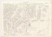
London XII.27 - OS London Town Plan
1 : 1056 Topographic maps Ordnance Survey Ordnance Survey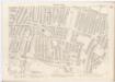
London XII.18 - OS London Town Plan
1 : 1056 Topographic maps Ordnance Survey Ordnance Survey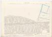
London XII.8 - OS London Town Plan
1 : 1056 Topographic maps Ordnance Survey Ordnance Survey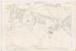
London XII.28 - OS London Town Plan
1 : 1056 Topographic maps Ordnance Survey Ordnance Survey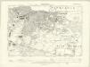
London XII.NE - OS Six-Inch Map
1 : 10560 Topographic maps Ordnance Survey Ordnance Survey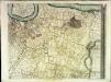
An exact survey of the city's of London Westminster , II
1 Blatt : 53 x 71 cm John Rocque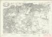
London Sheet P - OS Six-Inch Map
1 : 10560 Topographic maps Ordnance Survey Ordnance Survey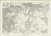
London Sheet P - OS Six-Inch Map
1 : 10560 Topographic maps Ordnance Survey Ordnance Survey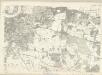
Middlesex XXIII - OS Six-Inch Map
1 : 10560 Topographic maps Ordnance Survey Ordnance Survey
Insurance Plan of London Vol. xi: Key Plan 2
1 : 3600 This "key plan" indicates coverage of the Goad 1891 series of fire insurance maps of London that were originally produced to aid insurance companies in assessing fire risks. The building footprints, their use (commercial, residential, educational, etc.), the number of floors and the height of the building, as well as construction materials (and thus risk of burning) and special fire hazards (chemicals, kilns, ovens) were documented in order to estimate premiums. Names of individual businesses, property lines, and addresses were also often recorded. Together these maps provide a rich historical shapshot of the commercial activity and urban landscape of towns and cities at the time. The British Library holds a comprehensive collection of fire insurance plans produced by the London-based firm Charles E. Goad Ltd. dating back to 1885. These plans were made for most important towns and cities of the British Isles at the scales of 1:480 (1 inch to 40 feet), as well as many foreign towns at 1:600 (1 inch to 50 feet). Chas E Goad Limited Chas E Goad Limited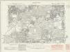
Kent II.SW & SE - OS Six-Inch Map
1 : 10560 Topographic maps Ordnance Survey Ordnance Survey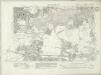
Kent II.SW & SE - OS Six-Inch Map
1 : 10560 Topographic maps Ordnance Survey Ordnance Survey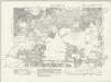
Kent II.SW & SE - OS Six-Inch Map
1 : 10560 Topographic maps Ordnance Survey Ordnance Survey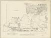
Kent II.SW & SE - OS Six-Inch Map
1 : 10560 Topographic maps Ordnance Survey Ordnance Survey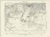
Kent II.SW - OS Six-Inch Map
1 : 10560 Topographic maps Ordnance Survey Ordnance Survey
Insurance Plan of London East District Vol. G: sheet E
1 : 7200 This detailed 1900 plan of London is one of a series of thirty-five sheets in an atlas originally produced to aid insurance companies in assessing fire risks. The building footprints, their use (commercial, residential, educational, etc.), the number of floors and the height of the building, as well as construction materials (and thus risk of burning) and special fire hazards (chemicals, kilns, ovens) were documented in order to estimate premiums. Names of individual businesses, property lines, and addresses were also often recorded. Together these maps provide a rich historical shapshot of the commercial activity and urban landscape of towns and cities at the time. The British Library holds a comprehensive collection of fire insurance plans produced by the London-based firm Charles E. Goad Ltd. dating back to 1885. These plans were made for most important towns and cities of the British Isles at the scales of 1:480 (1 inch to 40 feet), as well as many foreign towns at 1:600 (1 inch to 50 feet). Chas E Goad Limited Chas E Goad Limited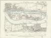
Essex LXXXI.NE - OS Six-Inch Map
1 : 10560 Topographic maps Ordnance Survey Ordnance Survey
Kent II.NW - OS Six-Inch Map
1 : 10560 Topographic maps Ordnance Survey Ordnance Survey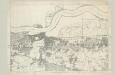
Kent II - OS Six-Inch Map
1 : 10560 Topographic maps Ordnance Survey Ordnance Survey
TQ47 - OS 1:25,000 Provisional Series Map
1 : 25000 Topographic maps Ordnance Survey Ordnance Survey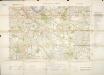
Militärgeographische Angaben über England.
Generalstab des Heeres, Abteilung für Kriegskarten u. Vermessungswesen IV. Mil.-Geo