Maps of Savernake
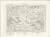
Wiltshire XXIX.SW - OS Six-Inch Map
1 : 10560 Topographic maps Ordnance Survey Ordnance Survey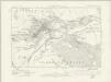
Wiltshire XXIX.SW - OS Six-Inch Map
1 : 10560 Topographic maps Ordnance Survey Ordnance Survey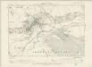
Wiltshire XXIX.SW - OS Six-Inch Map
1 : 10560 Topographic maps Ordnance Survey Ordnance Survey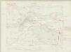
Wiltshire XXIX.SW - OS Six-Inch Map
1 : 10560 Topographic maps Ordnance Survey Ordnance Survey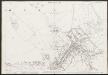
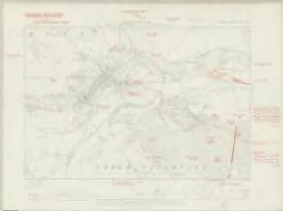
Wiltshire XXIX.9 (includes: Marlborough; Mildenhall; Preshute) - 25 Inch Map
1 : 2500 Topographic maps Ordnance Survey Ordnance Survey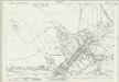
Wiltshire XXIX.9 (includes: Marlborough; Mildenhall; Preshute) - 25 Inch Map
1 : 2500 Topographic maps Ordnance Survey Ordnance Survey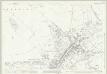
Wiltshire XXIX.9 (includes: Marlborough; Mildenhall; Preshute) - 25 Inch Map
1 : 2500 Topographic maps Ordnance Survey Ordnance Survey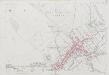
Wiltshire XXIX.9 (includes: Marlborough; Mildenhall; Preshute) - 25 Inch Map
1 : 2500 Topographic maps Ordnance Survey Ordnance Survey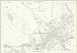
Wiltshire XXIX.9 (includes: Marlborough; Mildenhall; Preshute) - 25 Inch Map
1 : 2500 Topographic maps Ordnance Survey Ordnance Survey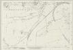
Wiltshire XXIX.13 (includes: Marlborough; Preshute; Savernake) - 25 Inch Map
1 : 2500 Topographic maps Ordnance Survey Ordnance Survey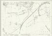
Wiltshire XXIX.13 (includes: Marlborough; Preshute; Savernake) - 25 Inch Map
1 : 2500 Topographic maps Ordnance Survey Ordnance Survey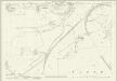
Wiltshire XXIX.13 (includes: Marlborough; Preshute; Savernake) - 25 Inch Map
1 : 2500 Topographic maps Ordnance Survey Ordnance Survey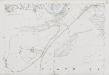
Wiltshire XXIX.13 (includes: Marlborough; Preshute; Savernake) - 25 Inch Map
1 : 2500 Topographic maps Ordnance Survey Ordnance Survey
Wiltshire XXIX.13 (includes: Marlborough; Preshute; Savernake) - 25 Inch Map
1 : 2500 Topographic maps Ordnance Survey Ordnance Survey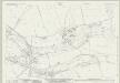
Wiltshire XXIX.10 (includes: Marlborough; Mildenhall; Savernake) - 25 Inch Map
1 : 2500 Topographic maps Ordnance Survey Ordnance Survey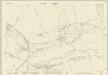
Wiltshire XXIX.10 (includes: Marlborough; Mildenhall; Savernake) - 25 Inch Map
1 : 2500 Topographic maps Ordnance Survey Ordnance Survey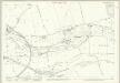
Wiltshire XXIX.10 (includes: Marlborough; Mildenhall; Savernake) - 25 Inch Map
1 : 2500 Topographic maps Ordnance Survey Ordnance Survey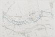
Wiltshire XXIX.10 (includes: Marlborough; Mildenhall; Savernake) - 25 Inch Map
1 : 2500 Topographic maps Ordnance Survey Ordnance Survey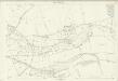
Wiltshire XXIX.10 (includes: Marlborough; Mildenhall; Savernake) - 25 Inch Map
1 : 2500 Topographic maps Ordnance Survey Ordnance Survey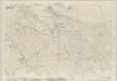
Wiltshire XXIX.14 (includes: Marlborough; Mildenhall; Savernake) - 25 Inch Map
1 : 2500 Topographic maps Ordnance Survey Ordnance Survey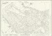
Wiltshire XXIX.14 (includes: Marlborough; Mildenhall; Savernake) - 25 Inch Map
1 : 2500 Topographic maps Ordnance Survey Ordnance Survey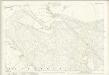
Wiltshire XXIX.14 (includes: Marlborough; Mildenhall; Savernake) - 25 Inch Map
1 : 2500 Topographic maps Ordnance Survey Ordnance Survey
Wiltshire XXIX.14 (includes: Marlborough; Mildenhall; Savernake) - 25 Inch Map
1 : 2500 Topographic maps Ordnance Survey Ordnance Survey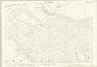
Wiltshire XXIX.14 (includes: Marlborough; Mildenhall; Savernake) - 25 Inch Map
1 : 2500 Topographic maps Ordnance Survey Ordnance Survey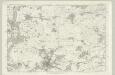
Wiltshire XXIX - OS Six-Inch Map
1 : 10560 Topographic maps Ordnance Survey Ordnance Survey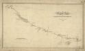
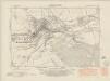
The Turnpike Road From Marlborough To Hungerford
1 : 31680 .Records from the Ordnance Survey Letter Book suggest that Edmund Crocker surveyed the turnpike road from Hungerford to Marlborough and William Stanley, draughtsman, made the drawing. The road is coloured yellow ochre and one side is thickened to indicate its importance. Notes of mileage in ink figures appear alongside the road. The close attention given to communication routes highlights the military emphasis of these studies. Stanley, William
SU16 - OS 1:25,000 Provisional Series Map
1 : 25000 Topographic maps Ordnance Survey Ordnance Survey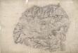
Wilcot
Several orientation points used to plot the survey appear at the edges of this drawing. The draughtsman has recorded the precise layout of the fir plantations at Everly, a chalk pit on Bushton Down, and the Roman road from Bath to Malborough, which is at the top of the drawing. The Kennet and Avon Canal also features. Opened in 1810 to better exploit the resources of the Somerset Coalfields, the canal is contemporary with the survey of this drawing. Extending from Shepherds Shore, a thick grey line is marked 'The Wansdyke'. This is a linear defensive earthwork dating from the 5th century. The area is rich is archaeological sites: Casterely Camp on Black Heath is a large hillfort. The paper is watermarked JAMES WHATMAN TURKEY MILL KENT 1807.
Marlborough (Hills) - OS One-Inch Revised New Series
1 : 63360 Topographic maps Ordnance Survey Ordnance Survey