Maps of Somerset
Devonshire XXV.SW - OS Six-Inch Map
1 : 10560 Topographic maps Ordnance Survey Ordnance Survey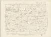
Devonshire XXV.SW - OS Six-Inch Map
1 : 10560 Topographic maps Ordnance Survey Ordnance Survey
Devonshire XXV.SW - OS Six-Inch Map
1 : 10560 Topographic maps Ordnance Survey Ordnance Survey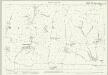
Devon XXV.10 (includes: Ashbrittle; Clayhanger) - 25 Inch Map
1 : 2500 Topographic maps Ordnance Survey Ordnance Survey
Devon XXV.10 (includes: Ashbrittle; Clayhanger) - 25 Inch Map
1 : 2500 Topographic maps Ordnance Survey Ordnance Survey
Devon XXV.14 (includes: Ashbrittle; Clayhanger; Hockworthy) - 25 Inch Map
1 : 2500 Topographic maps Ordnance Survey Ordnance Survey
Devon XXV.14 (includes: Ashbrittle; Clayhanger; Hockworthy) - 25 Inch Map
1 : 2500 Topographic maps Ordnance Survey Ordnance Survey
Devon XXV.9 (includes: Bampton; Clayhanger) - 25 Inch Map
1 : 2500 Topographic maps Ordnance Survey Ordnance Survey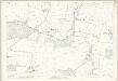
Devon XXV.9 (includes: Bampton; Clayhanger) - 25 Inch Map
1 : 2500 Topographic maps Ordnance Survey Ordnance Survey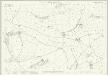
Devon XXV.13 (includes: Bampton; Clayhanger; Hockworthy; Huntsham) - 25 Inch Map
1 : 2500 Topographic maps Ordnance Survey Ordnance Survey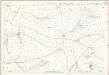
Devon XXV.13 (includes: Bampton; Clayhanger; Hockworthy; Huntsham) - 25 Inch Map
1 : 2500 Topographic maps Ordnance Survey Ordnance Survey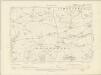
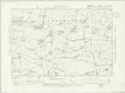
Somerset LXXVII.NE - OS Six-Inch Map
1 : 10560 Topographic maps Ordnance Survey Ordnance Survey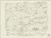
Somerset LXXVII.NE - OS Six-Inch Map
1 : 10560 Topographic maps Ordnance Survey Ordnance Survey
Somerset LXXVII.NE - OS Six-Inch Map
1 : 10560 Topographic maps Ordnance Survey Ordnance Survey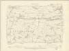
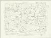
Somerset LXVIII.SE - OS Six-Inch Map
1 : 10560 Topographic maps Ordnance Survey Ordnance Survey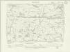
Somerset LXVIII.SE - OS Six-Inch Map
1 : 10560 Topographic maps Ordnance Survey Ordnance Survey
Somerset LXVIII.SE - OS Six-Inch Map
1 : 10560 Topographic maps Ordnance Survey Ordnance Survey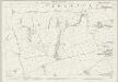
Somerset LXXVII.4 (includes: Ashbrittle; Clayhanger; Hockworthy; Holcombe Rogus) - 25 Inch Map
1 : 2500 Topographic maps Ordnance Survey Ordnance Survey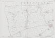
Somerset LXXVII.4 (includes: Ashbrittle; Clayhanger; Hockworthy; Holcombe Rogus) - 25 Inch Map
1 : 2500 Topographic maps Ordnance Survey Ordnance Survey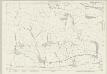
Somerset LXVIII.16 (includes: Ashbrittle; Chipstable; Clayhanger) - 25 Inch Map
1 : 2500 Topographic maps Ordnance Survey Ordnance Survey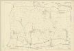
Somerset LXVIII.16 (includes: Ashbrittle; Chipstable; Clayhanger) - 25 Inch Map
1 : 2500 Topographic maps Ordnance Survey Ordnance Survey
ST02 - OS 1:25,000 Provisional Series Map
1 : 25000 Topographic maps Ordnance Survey Ordnance Survey
Cullompton
The heavy colour washes used to depict relief make this plan difficult to interpret. These Ordnance Survey drawings show a greater preoccupation with the lie of the land than any previous maps - testimony to the military impetus of the project. Inclines are indicated by interlining ('hachuring'), with the summits left bare. The boundary of Devon and Somerset is shown by a red pecked line. A note in the margin of the paper provides a key to the plan's interpretation.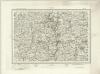
Tiverton (Outline) - OS One-Inch Revised New Series
1 : 63360 Topographic maps Ordnance Survey Ordnance Survey
Tiverton (Hills) - OS One-Inch Revised New Series
1 : 63360 Topographic maps Ordnance Survey Ordnance Survey
Minehead - OS One-Inch Map
1 : 63360 Topographic maps Ordnance Survey Ordnance Survey
Cary's Improved Map of England and Wales
Cary, George, & Cary, John London : G. & J. Cary
North Devon, Sheet 35 - Bartholomew's "Half Inch to the Mile Maps" of England & Wales
1 : 126720 Topographic maps Bartholomew, John George John Bartholomew & Co
An improved map of the county of Somerset
1 Karte : Kupferdruck ; 51 x 68 cm Bowen; Hinton sold by I. Hinton at the Kings Arms in St. Pauls Church Yard
Somersettensis comitatvs
1 Karte : Kupferdruck ; 36 x 48 cm Valck; Schenk apud G. Valk et P. Schenk