Maps of Claypole CP
Lincolnshire XCV.SW - OS Six-Inch Map
1 : 10560 Topographic maps Ordnance Survey Ordnance Survey
Lincolnshire XCV.SW - OS Six-Inch Map
1 : 10560 Topographic maps Ordnance Survey Ordnance Survey
Lincolnshire XCV.SW - OS Six-Inch Map
1 : 10560 Topographic maps Ordnance Survey Ordnance Survey
Nottinghamshire XXXVI.SW - OS Six-Inch Map
1 : 10560 Topographic maps Ordnance Survey Ordnance Survey
Lincolnshire XCV.SW - OS Six-Inch Map
1 : 10560 Topographic maps Ordnance Survey Ordnance Survey
Nottinghamshire XXXVI.SW - OS Six-Inch Map
1 : 10560 Topographic maps Ordnance Survey Ordnance Survey
Lincolnshire XCV.SW - OS Six-Inch Map
1 : 10560 Topographic maps Ordnance Survey Ordnance Survey
Lincolnshire XCV.14 (includes: Claypole; Stubton; Westborough and Dry Doddington) - 25 Inch Map
1 : 2500 Topographic maps Ordnance Survey Ordnance Survey
Lincolnshire XCV.14 (includes: Claypole; Stubton; Westborough and Dry Doddington) - 25 Inch Map
1 : 2500 Topographic maps Ordnance Survey Ordnance Survey
Lincolnshire XCV.14 (includes: Claypole; Stubton; Westborough and Dry Doddington) - 25 Inch Map
1 : 2500 Topographic maps Ordnance Survey Ordnance Survey
Lincolnshire XCV.10 (includes: Claypole; Fenton; Stubton) - 25 Inch Map
1 : 2500 Topographic maps Ordnance Survey Ordnance Survey
Lincolnshire XCV.10 (includes: Claypole; Fenton; Stubton) - 25 Inch Map
1 : 2500 Topographic maps Ordnance Survey Ordnance Survey
Lincolnshire XCV.10 (includes: Claypole; Fenton; Stubton) - 25 Inch Map
1 : 2500 Topographic maps Ordnance Survey Ordnance Survey
Lincolnshire XCV.13 (includes: Balderton; Claypole; Long Bennington; Westborough and Dry Doddington) - 25 Inch Map
1 : 2500 Topographic maps Ordnance Survey Ordnance Survey
Nottinghamshire XXXVI.13 (includes: Balderton; Claypole; Long Bennington; Westborough And Dry Doddington) - 25 Inch Map
1 : 2500 Topographic maps Ordnance Survey Ordnance Survey
Lincolnshire XCV.13 (includes: Balderton; Claypole; Long Bennington; Westborough and Dry Doddington) - 25 Inch Map
1 : 2500 Topographic maps Ordnance Survey Ordnance Survey
Lincolnshire XCV.9 (includes: Balderton; Claypole) - 25 Inch Map
1 : 2500 Topographic maps Ordnance Survey Ordnance Survey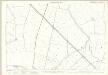
Nottinghamshire XXXVI.9 (includes: Balderton; Claypole) - 25 Inch Map
1 : 2500 Topographic maps Ordnance Survey Ordnance Survey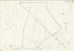
Nottinghamshire XXXVI.9 (includes: Balderton; Claypole) - 25 Inch Map
1 : 2500 Topographic maps Ordnance Survey Ordnance Survey
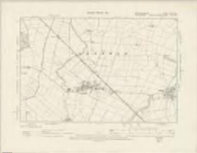
SK84 - OS 1:25,000 Provisional Series Map
1 : 25000 Topographic maps Ordnance Survey Ordnance Survey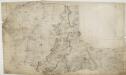
Grantham 24
1 : 31680 This drawing depicts the county boundary of Lincolnshire and Leicestershire as a red dotted line at lower left. The Ermine Street (or High Dyke) is shown running down the right of the sheet. This Roman road extended from Cichester in Sussex to York, passing through Lincolnshire. At lower left, in the Vale of Belvoir, the villages of Plungar, Redmile, Bottesford and Muston are recorded along the Grantham Canal, along with the prominent Belvoir Castle. Budgen, Charles
Lincon and Grantham - OS One-Inch Map
1 : 63360 Topographic maps Ordnance Survey Ordnance Survey
An accurate map of Nottingham Shire
1 Karte : Kupferdruck ; 68 x 52 cm Bowen; Tinney; Bowles; Sayer; Bowles; Bowles printed for T. Bowles in St. Pauls Church Yard John Bowles and son in Cornhil John Tinney and Robert Sayer in Fleet street
Comitatvs Nottinghamiensis
1 Karte : Kupferdruck ; 37 x 48 cm Blaeu Joan Blaeu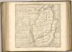

Lincoln Fens, Sheet 14 - Bartholomew's "Half Inch to the Mile Maps" of England & Wales
1 : 126720 Topographic maps Bartholomew, John George John Bartholomew & Co
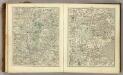
Leicestrensis Comitatus cum Rutlandiae. Vulgo Leicester & Rutland Shire. [Karte], in: Novus atlas absolutissimus, Bd. 7, S. 316.
1 Karte aus Atlas Janssonius Offizin
COMITATVS | NOTTINGHA- | MIENSIS; | NOTTINGHAM SHIRE.
[Amsterdam : Joan Blaeu]
Comitatus Nottinghamiensis, sive Nottingham Shire
1 : 240000 [Amstelodami] : [apud Joannem Janssonium]