Maps of Broxtowe
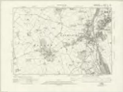
Derbyshire LI.SW - OS Six-Inch Map
1 : 10560 Topographic maps Ordnance Survey Ordnance Survey
Derbyshire LI.SW - OS Six-Inch Map
1 : 10560 Topographic maps Ordnance Survey Ordnance Survey
Derbyshire LI.SW - OS Six-Inch Map
1 : 10560 Topographic maps Ordnance Survey Ordnance Survey
Derbyshire LI.SW - OS Six-Inch Map
1 : 10560 Topographic maps Ordnance Survey Ordnance Survey
Derbyshire LI.9 (includes: Dale Abbey; Hopwell; Risley; Sandiacre; Stanton By Dale) - 25 Inch Map
1 : 2500 Topographic maps Ordnance Survey Ordnance Survey
Derbyshire LI.9 (includes: Dale Abbey; Hopwell; Risley; Sandiacre; Stanton By Dale) - 25 Inch Map
1 : 2500 Topographic maps Ordnance Survey Ordnance Survey
Derbyshire LI.9 (includes: Dale Abbey; Hopwell; Risley; Sandiacre; Stanton By Dale) - 25 Inch Map
1 : 2500 Topographic maps Ordnance Survey Ordnance Survey
Derbyshire LI.9 (includes: Dale Abbey; Hopwell; Risley; Sandiacre; Stanton By Dale) - 25 Inch Map
1 : 2500 Topographic maps Ordnance Survey Ordnance Survey
Derbyshire LI.13 (includes: Breaston; Draycott and Church Wilne; Hopwell; Long Eaton; Risley; Sandiacre) - 25 Inch Map
1 : 2500 Topographic maps Ordnance Survey Ordnance Survey
Derbyshire LI.13 (includes: Breaston; Draycott and Church Wilne; Hopwell; Long Eaton; Risley; Sandiacre) - 25 Inch Map
1 : 2500 Topographic maps Ordnance Survey Ordnance Survey
Derbyshire LI.13 (includes: Breaston; Draycott and Church Wilne; Hopwell; Long Eaton; Risley; Sandiacre) - 25 Inch Map
1 : 2500 Topographic maps Ordnance Survey Ordnance Survey
Derbyshire LI.13 (includes: Breaston; Draycott and Church Wilne; Hopwell; Long Eaton; Risley; Sandiacre) - 25 Inch Map
1 : 2500 Topographic maps Ordnance Survey Ordnance Survey
Derbyshire LI.14 (includes: Beeston and Stapleford; Breaston; Long Eaton; Risley; Sandiacre) - 25 Inch Map
1 : 2500 Topographic maps Ordnance Survey Ordnance Survey
Derbyshire LI.14 (includes: Beeston and Stapleford; Breaston; Long Eaton; Risley; Sandiacre) - 25 Inch Map
1 : 2500 Topographic maps Ordnance Survey Ordnance Survey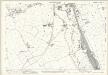
Derbyshire LI.14 (includes: Beeston and Stapleford; Breaston; Long Eaton; Risley; Sandiacre) - 25 Inch Map
1 : 2500 Topographic maps Ordnance Survey Ordnance Survey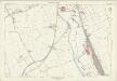
Derbyshire LI.14 (includes: Beeston and Stapleford; Breaston; Long Eaton; Risley; Sandiacre) - 25 Inch Map
1 : 2500 Topographic maps Ordnance Survey Ordnance Survey
Derbyshire LI.10 (includes: Beeston and Stapleford; Sandiacre; Stanton By Dale) - 25 Inch Map
1 : 2500 Topographic maps Ordnance Survey Ordnance Survey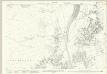
Derbyshire LI.10 (includes: Beeston and Stapleford; Sandiacre; Stanton By Dale) - 25 Inch Map
1 : 2500 Topographic maps Ordnance Survey Ordnance Survey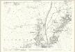
Derbyshire LI.10 (includes: Beeston and Stapleford; Sandiacre; Stanton By Dale) - 25 Inch Map
1 : 2500 Topographic maps Ordnance Survey Ordnance Survey
Derbyshire LI.10 (includes: Beeston and Stapleford; Sandiacre; Stanton By Dale) - 25 Inch Map
1 : 2500 Topographic maps Ordnance Survey Ordnance Survey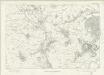
Derbyshire LI - OS Six-Inch Map
1 : 10560 Topographic maps Ordnance Survey Ordnance Survey
SK43 - OS 1:25,000 Provisional Series Map
1 : 25000 Topographic maps Ordnance Survey Ordnance Survey
Nottingham 12
1 : 31680 This drawing covers,the border territory,of Nottinghamshire and Leicestershire, the county boundary being indicated by a red dotted line at lower right. The city of Nottingham and the broad floodplain,that characterises this part of the Trent Valley,are depicted at the top of the sheet., The undulating countryside of the Nottinghamshire Wolds is represented by soft brushwork interlining ('hachuring') in the lower part of the sheet. Stevens, Henry
Derby and Leicester - OS One-Inch Map
1 : 63360 Topographic maps Ordnance Survey Ordnance Survey
Nottingham - OS One-Inch Map
1 : 63360 Topographic maps Ordnance Survey Ordnance Survey

Leicestrensis comitatvs
1 Karte : Kupferdruck ; 37 x 48 cm Blaeu Joan Blaeu
Leicestrensis Comitatus cum Rutlandiae vulgo Leicester & Rutland Shire
1 : 160000 Amstelodami : ex. Joannes Janssonius
An accurate map of the county of Derby
1 Karte : Kupferdruck ; 68 x 52 cm Bowen; Tinney; Bowles; Sayer; Bowles; Bowles sold by R. Sayer at the Golden Buck and I. Tinney at the Golden Lion in Fleet street T. Bowles in St. Pauls Church yard and I. Bowles and son in Cornhill