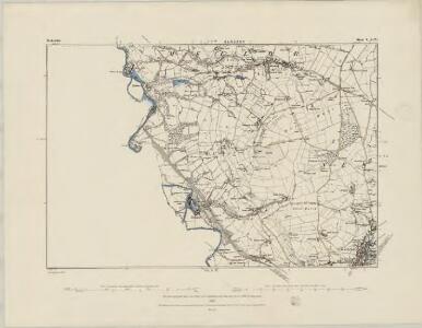
Maps of South Yorkshire
Derbyshire IV.SW - OS Six-Inch Map
1 : 10560 Topographic maps Ordnance Survey Ordnance Survey
Derbyshire IV.SW - OS Six-Inch Map
1 : 10560 Topographic maps Ordnance Survey Ordnance Survey
Yorkshire CCLXXXVIA.8 (includes: Bradfield; Hope Woodlands) - 25 Inch Map
1 : 2500 Topographic maps Ordnance Survey Ordnance Survey
Derbyshire IV.9 (inset IV.10) (includes: Bradfield; Hope Woodlands) - 25 Inch Map
1 : 2500 Topographic maps Ordnance Survey Ordnance Survey
Derbyshire IV.9 (inset IV.10) (includes: Bradfield; Hope Woodlands) - 25 Inch Map
1 : 2500 Topographic maps Ordnance Survey Ordnance Survey
Derbyshire IV.13 (includes: Bradfield; Hope Woodlands) - 25 Inch Map
1 : 2500 Topographic maps Ordnance Survey Ordnance Survey
Derbyshire IV.13 (includes: Bradfield; Hope Woodlands) - 25 Inch Map
1 : 2500 Topographic maps Ordnance Survey Ordnance Survey
Derbyshire IV.9 (inset IV.10) (includes: Bradfield; Hope Woodlands) - 25 Inch Map
1 : 2500 Topographic maps Ordnance Survey Ordnance Survey
Derbyshire IV.9 (inset IV.10) (includes: Bradfield; Hope Woodlands) - 25 Inch Map
1 : 2500 Topographic maps Ordnance Survey Ordnance Survey
Derbyshire IV - OS Six-Inch Map
1 : 10560 Topographic maps Ordnance Survey Ordnance Survey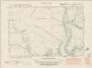
Yorkshire CCLXXXVIA.NE - OS Six-Inch Map
1 : 10560 Topographic maps Ordnance Survey Ordnance Survey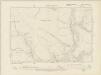
Yorkshire CCLXXXVIA.NE - OS Six-Inch Map
1 : 10560 Topographic maps Ordnance Survey Ordnance Survey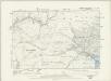
Yorkshire CCLXXXVIA.NE - OS Six-Inch Map
1 : 10560 Topographic maps Ordnance Survey Ordnance Survey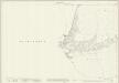
Yorkshire CCLXXXVIA.12 (includes: Bradfield; Derwent; Hope Woodlands) - 25 Inch Map
1 : 2500 Topographic maps Ordnance Survey Ordnance Survey
SK19 - OS 1:25,000 Provisional Series Map
1 : 25000 Topographic maps Ordnance Survey Ordnance Survey
Yorkshire 286a - OS Six-Inch Map
1 : 10560 Topographic maps Ordnance Survey Ordnance Survey
Yorkshire 287 - OS Six-Inch Map
1 : 10560 Topographic maps Ordnance Survey Ordnance Survey
Yorkshire CCLXXXVII.NW - OS Six-Inch Map
1 : 10560 Topographic maps Ordnance Survey Ordnance Survey
Yorkshire CCLXXXVII.NW - OS Six-Inch Map
1 : 10560 Topographic maps Ordnance Survey Ordnance Survey
Yorkshire CCLXXXVIA.SE - OS Six-Inch Map
1 : 10560 Topographic maps Ordnance Survey Ordnance Survey
Yorkshire CCLXXXVIA.SE - OS Six-Inch Map
1 : 10560 Topographic maps Ordnance Survey Ordnance Survey
Yorkshire CCLXXXVIA.SE - OS Six-Inch Map
1 : 10560 Topographic maps Ordnance Survey Ordnance Survey
Yorkshire CCLXXXVII.SW - OS Six-Inch Map
1 : 10560 Topographic maps Ordnance Survey Ordnance Survey
Yorkshire CCLXXXVII.SW - OS Six-Inch Map
1 : 10560 Topographic maps Ordnance Survey Ordnance Survey
Huddersfield - OS One-Inch Map
1 : 63360 Topographic maps Ordnance Survey Ordnance Survey
An accurate map of the county of Derby
1 Karte : Kupferdruck ; 68 x 52 cm Bowen; Tinney; Bowles; Sayer; Bowles; Bowles sold by R. Sayer at the Golden Buck and I. Tinney at the Golden Lion in Fleet street T. Bowles in St. Pauls Church yard and I. Bowles and son in Cornhill
Darbiensis comitatvs vernacule Darbie Shire
1 Karte : Kupferdruck ; 37 x 48 cm Blaeu Joan Blaeu
Sheffield, Sheet 9 - Bartholomew's "Half Inch to the Mile Maps" of England & Wales
1 : 126720 Topographic maps Bartholomew, John George John Bartholomew & Co
Derbyshire. Designed and drawn by Ernest Clegg
1 : 285000 Clegg, Ernest