Maps of South Kesteven
Lincolnshire CXVI.SW - OS Six-Inch Map
1 : 10560 Topographic maps Ordnance Survey Ordnance Survey
Lincolnshire CXVI.SW - OS Six-Inch Map
1 : 10560 Topographic maps Ordnance Survey Ordnance Survey
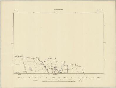
Lincolnshire CXVI.SW - OS Six-Inch Map
1 : 10560 Topographic maps Ordnance Survey Ordnance Survey
Rutland VII.SW - OS Six-Inch Map
1 : 10560 Topographic maps Ordnance Survey Ordnance Survey
Lincolnshire CXLVI.14 (includes: Barholm and Stowe; Braceborough and Wilsthorpe; Essendine; Greatford; Ryhall; Uffington) - 25 Inch Map
1 : 2500 Topographic maps Ordnance Survey Ordnance Survey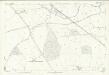
Lincolnshire CXLVI.14 (includes: Barholm and Stowe; Braceborough and Wilsthorpe; Essendine; Greatford; Ryhall; Uffington) - 25 Inch Map
1 : 2500 Topographic maps Ordnance Survey Ordnance Survey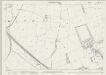
Rutland VII.10 (includes: Braceborough and Wilsthorpe; Essendine; Greatford; Ryhall) - 25 Inch Map
1 : 2500 Topographic maps Ordnance Survey Ordnance Survey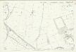
Rutland VII.10 (includes: Braceborough and Wilsthorpe; Essendine; Greatford; Ryhall) - 25 Inch Map
1 : 2500 Topographic maps Ordnance Survey Ordnance Survey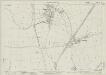
Rutland VII.13 (includes: Little Casterton; Ryhall; Uffington) - 25 Inch Map
1 : 2500 Topographic maps Ordnance Survey Ordnance Survey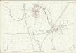
Rutland VII.13 (includes: Little Casterton; Ryhall; Uffington) - 25 Inch Map
1 : 2500 Topographic maps Ordnance Survey Ordnance Survey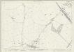
Rutland VII.9 (includes: Essendine; Ryhall) - 25 Inch Map
1 : 2500 Topographic maps Ordnance Survey Ordnance Survey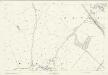
Rutland VII.9 (includes: Essendine; Ryhall) - 25 Inch Map
1 : 2500 Topographic maps Ordnance Survey Ordnance Survey
TF01 - OS 1:25,000 Provisional Series Map
1 : 25000 Topographic maps Ordnance Survey Ordnance Survey
Stamford
This plan details a section of the Welland and Nene Valleys running through Cambridgeshire and Lincolnshire. It depicts the system of man-made drains, ditches and sluices for draining the lowland area between Peterborough and Ely, offering a navigable route to the fenland rivers. Milton Park at the bottom right is a good example of 18th-century formal parkland, with grass, trees and lakes well detailed. Boyce
Stamford (Hills) - OS One-Inch Revised New Series
1 : 63360 Topographic maps Ordnance Survey Ordnance Survey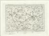
Stamford (Outline) - OS One-Inch Revised New Series
1 : 63360 Topographic maps Ordnance Survey Ordnance Survey
Stamford
1 : 31680 .This plan details a section of the Welland and Nene Valleys running through Cambridgeshire and Lincolnshire., It depicts the system of man-made drains, ditches and sluices,for draining the lowland area between Peterborough and Ely, offering a navigable route to the fenland rivers., Milton Park at the bottom right is a good example of 18th-century formal parkland, with grass, trees and lakes well detailed. Boyce
RVTLANDIA | COMITATVS. | RVTLAND SHIRE.
[Amsterdam : Joan Blaeu]
Rutlandia Comitatus. Rutland Shire. [Karte], in: Theatrum orbis terrarum, sive, Atlas novus, Bd. 4, S. 332.
1 Karte aus Atlas Blaeu, Joan Blaeu, Willem Janszoon
Rutlandia Comitatus. Rutland Shire. [Karte], in: Theatrum orbis terrarum, sive, Atlas novus, Bd. 4, S. 332.
1 Karte aus Atlas Blaeu, Joan Blaeu, Willem Janszoon
Rutlandia Comitatus. Rutland Shire. [Karte], in: Le théâtre du monde, ou, Nouvel atlas contenant les chartes et descriptions de tous les païs de la terre, Bd. 4, S. 290.
1 Karte aus Atlas Blaeu, Willem Janszoon und Blaeu, Joan Blaeu, Willem Janszoon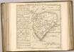

Spalding - OS One-Inch Map
1 : 63360 Topographic maps Ordnance Survey Ordnance Survey
Comitatis Cantabrigiensis; vernacule Cambridge Shire
1 Karte : Kupferdruck ; 40 x 50 cm Valck; Schenk venditant Gerardus Valk et Petrus Schenk
Lincoln Fens, Sheet 14 - Bartholomew's "Half Inch to the Mile Maps" of England & Wales
1 : 126720 Topographic maps Bartholomew, John George John Bartholomew & Co
Leicestrensis Comitatus cum Rutlandiae. Vulgo Leicester & Rutland Shire. [Karte], in: Novus atlas absolutissimus, Bd. 7, S. 316.
1 Karte aus Atlas Janssonius Offizin
A general plott and description of the Fennes and surounded grounds in the sixe counties of Norfolke, Suffolke, Cambridge
1 Karte : Kupferdruck ; 44 x 55 cm Valck; Schenk sumptibus G. Valk et P. Schenk
Regiones invndatæ in finibus comitatus Norfolciæ, Svffolciæ, Cantabrigiæ, Hvntingtoniæ Northamtoniæ, et Lincolniæ
1 Karte : Kupferdruck ; 43 x 54 cm Blaeu Joan Blaeu
A general plott and description of the Fennes and surounded grounds in the sixe counties of Norfolke, Suffolke, Cambridge
1 Karte : Kupferdruck ; 44 x 55 cm Mercator; Hondius sumptibus Henrici Hondii