Maps of Chester
Cheshire XXXVIII.SE - OS Six-Inch Map
1 : 10560 Topographic maps Ordnance Survey Ordnance Survey
Cheshire XXXVIII.SE - OS Six-Inch Map
1 : 10560 Topographic maps Ordnance Survey Ordnance Survey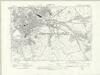
Cheshire XXXVIII.SE - OS Six-Inch Map
1 : 10560 Topographic maps Ordnance Survey Ordnance Survey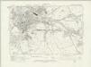
Cheshire XXXVIII.SE - OS Six-Inch Map
1 : 10560 Topographic maps Ordnance Survey Ordnance Survey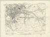
Cheshire XXXVIII.SE - OS Six-Inch Map
1 : 10560 Topographic maps Ordnance Survey Ordnance Survey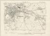
Cheshire XXXVIII.SE - OS Six-Inch Map
1 : 10560 Topographic maps Ordnance Survey Ordnance Survey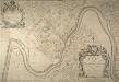
PLAN Of The City & Castle Of Chester
This plan was surveyed and drawn by Alexander de Lavaux, engineer and surveyor. As well as naming the owners of many houses, the plan includes informative details such as the "North Gate May Pole" and the "Water Engine", which was mentioned in Daniel Defoe’s diary record of his second visit to the city: "When I was formerly at this city, about the year 1690, they had no water to supply their ordinary occasions, but what was carried from the River Dee upon horses, in great leather vessels, like a pair of bakers panyers... But at my coming there this time, I found a very good water-house in the river, and the city plentifully supply'd by pipes, just as London is from the Thames; tho' some parts of Chester stands very high from the river". de Lavaux, Alexander
Chester f. 173
This Plan of Chester is by the cartographer and antiquarian William Smith. Smith was Rouge Dragon at the College of Heralds/College of Arms, an institution that specialised in genealogical work, increasingly more so during the Elizabethan age as the gentry class rose in importance. The Rouge Dragon is the name of one of the Pursuivants, a heraldic officer attendant on the heralds, often attached to a particular nobleman, named so because of their badges. The prominent coat of arms on this plan reveals Smiths heraldic interests. Chester is shown as a walled city, fortified by towers. Outside the city walls the horse market is shown, indicated by an outline drawing of a horse. The cardinal points are noted in the margins of the map and an alphabetical key provide information about the city. In 1588 Smith completed "The Particuler Description of England. With the portratures of certaine of the cheiffest citties & townes". This work consisted of drawings of English cities and towns in a traditional bird's eye view style, and combination drawings amalgamating the bird's eye view and plan. This plan of Chester, dating from 1585, is possibly a preparatory drawing for this work. In the years 1602-03, William Smith anonymously published maps of Chester, Essex, Hertfordshire Lancashire, Leicester, Norfolk, Northamptonshire, Staffordshire, Suffolk, Surrey, Warwickshire and Worcester. These were probably engraved in Amsterdam and were intended to form sheets of a new atlas. After the publication of Saxton’s county maps in the 1570s, cartographers attempted to improve on Saxton’s atlas and replicate its success. Unfortunately for Smith, another cartographer, John Speed, was also preparing county maps at this time and competition proved too great, Speed being the victor. Smith, William
Plan de Chester
1 Plan : Kupferdruck ; 13 x 19 cm Le Rouge Georges Louis Le Rouge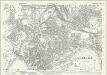
Cheshire XXXVIII.11 (includes: Chester; Hoole) - 25 Inch Map
1 : 2500 Topographic maps Ordnance Survey Ordnance Survey
Cheshire XXXVIII.11 (includes: Chester; Hoole) - 25 Inch Map
1 : 2500 Topographic maps Ordnance Survey Ordnance Survey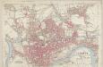
Cheshire XXXVIII.11 (includes: Chester; Hoole) - 25 Inch Map
1 : 2500 Topographic maps Ordnance Survey Ordnance Survey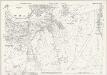
Cheshire XXXVIII.15 (includes: Chester Castle; Chester; Huntington) - 25 Inch Map
1 : 2500 Topographic maps Ordnance Survey Ordnance Survey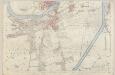
Cheshire XXXVIII.15 (includes: Chester Castle; Chester; Huntington) - 25 Inch Map
1 : 2500 Topographic maps Ordnance Survey Ordnance Survey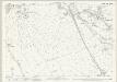
Cheshire XXXVIII.16 (includes: Chester; Christleton; Great Boughton; Huntington; Rowton) - 25 Inch Map
1 : 2500 Topographic maps Ordnance Survey Ordnance Survey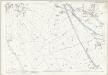
Cheshire XXXVIII.16 (includes: Chester; Christleton; Great Boughton; Huntington; Rowton) - 25 Inch Map
1 : 2500 Topographic maps Ordnance Survey Ordnance Survey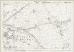
Cheshire XXXVIII.12 (includes: Chester; Christleton; Great Boughton; Guilden Sutton; Hoole; Littleton) - 25 Inch Map
1 : 2500 Topographic maps Ordnance Survey Ordnance Survey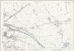
Cheshire XXXVIII.12 (includes: Chester; Christleton; Great Boughton; Guilden Sutton; Hoole; Littleton) - 25 Inch Map
1 : 2500 Topographic maps Ordnance Survey Ordnance Survey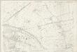
Cheshire XXXVIII.12 (includes: Chester; Christleton; Great Boughton; Guilden Sutton; Hoole; Littleton) - 25 Inch Map
1 : 2500 Topographic maps Ordnance Survey Ordnance Survey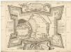
A plan of the castle of Chester
Chester (Anglie) Lavaux, Alexander de Parr, R.
Flintshire XV.2 & XI.14 (includes: Bache; Chester; East Saltney; Sealand) - 25 Inch Map
1 : 2500 Topographic maps Ordnance Survey Ordnance Survey
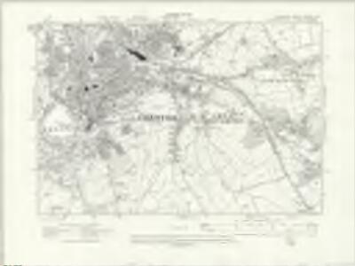
Cheshire XXXVIII - OS Six-Inch Map
1 : 10560 Topographic maps Ordnance Survey Ordnance Survey

SJ46 - OS 1:25,000 Provisional Series Map
1 : 25000 Topographic maps Ordnance Survey Ordnance Survey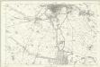
Flintshire XV - OS Six-Inch Map
1 : 10560 Topographic maps Ordnance Survey Ordnance Survey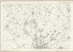
Flintshire XI - OS Six-Inch Map
1 : 10560 Topographic maps Ordnance Survey Ordnance Survey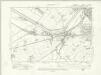
Flintshire XV.NW - OS Six-Inch Map
1 : 10560 Topographic maps Ordnance Survey Ordnance Survey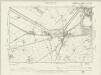
Flintshire XV.NW - OS Six-Inch Map
1 : 10560 Topographic maps Ordnance Survey Ordnance Survey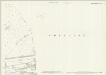
Flintshire XV.2 & XI.14 (includes: Bache; Chester; East Saltney; Sealand) - 25 Inch Map
1 : 2500 Topographic maps Ordnance Survey Ordnance Survey