Maps of Shropshire
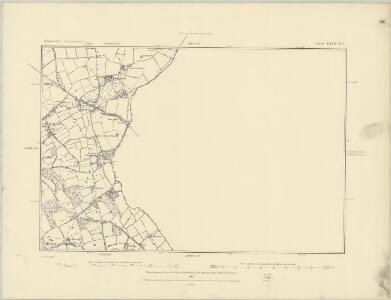
Shropshire LXVII.NW - OS Six-Inch Map
1 : 10560 Topographic maps Ordnance Survey Ordnance Survey
Shropshire LXVII.NW - OS Six-Inch Map
1 : 10560 Topographic maps Ordnance Survey Ordnance Survey
Shropshire LXVII.NW - OS Six-Inch Map
1 : 10560 Topographic maps Ordnance Survey Ordnance Survey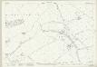
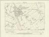
Shropshire LXVII.2 (includes: Alveley; Claverley; Quatt Malvern) - 25 Inch Map
1 : 2500 Topographic maps Ordnance Survey Ordnance Survey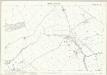
Shropshire LXVII.2 (includes: Alveley; Claverley; Quatt Malvern) - 25 Inch Map
1 : 2500 Topographic maps Ordnance Survey Ordnance Survey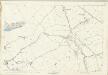
Shropshire LXVII.2 (includes: Alveley; Claverley; Quatt Malvern) - 25 Inch Map
1 : 2500 Topographic maps Ordnance Survey Ordnance Survey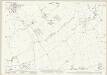
Shropshire LXVII.6 (includes: Alveley; Quatt Malvern) - 25 Inch Map
1 : 2500 Topographic maps Ordnance Survey Ordnance Survey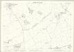
Shropshire LXVII.6 (includes: Alveley; Quatt Malvern) - 25 Inch Map
1 : 2500 Topographic maps Ordnance Survey Ordnance Survey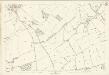
Shropshire LXVII.6 (includes: Alveley; Quatt Malvern) - 25 Inch Map
1 : 2500 Topographic maps Ordnance Survey Ordnance Survey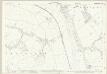
Shropshire LXVII.5 (includes: Chelmarsh; Quatt Malvern) - 25 Inch Map
1 : 2500 Topographic maps Ordnance Survey Ordnance Survey
Shropshire LXVII.5 (includes: Chelmarsh; Quatt Malvern) - 25 Inch Map
1 : 2500 Topographic maps Ordnance Survey Ordnance Survey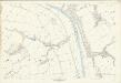
Shropshire LXVII.5 (includes: Chelmarsh; Quatt Malvern) - 25 Inch Map
1 : 2500 Topographic maps Ordnance Survey Ordnance Survey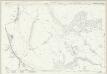
Shropshire LXVII.1 (includes: Chelmarsh; Eardington; Quatford; Quatt Malvern) - 25 Inch Map
1 : 2500 Topographic maps Ordnance Survey Ordnance Survey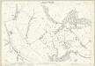
Shropshire LXVII.1 (includes: Chelmarsh; Eardington; Quatford; Quatt Malvern) - 25 Inch Map
1 : 2500 Topographic maps Ordnance Survey Ordnance Survey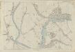
Shropshire LXVII.1 (includes: Chelmarsh; Eardington; Quatford; Quatt Malvern) - 25 Inch Map
1 : 2500 Topographic maps Ordnance Survey Ordnance Survey
SO78 - OS 1:25,000 Provisional Series Map
1 : 25000 Topographic maps Ordnance Survey Ordnance Survey
Foresta de Morfe, [Shropshire?]
This is a map of the "Forresta de Morfe", Shropshire(?). It is a simple pen and ink drawing whose intention seems to be to record the extent to which the neighbouring villages lie on forest land, presumably so that any further encroachment and claim to forest land can be refuted. It is annotated with "All the villages herein named be commoners in the said forest". A path through the forest is marked, houses are indicated with a generic symbol and churches are distinguished. Cardinal points are indicated. Maps such as this one of a small locality, drawn to illustrate a particular situation with regards to land boundaries and ownership is an invention of the later 16th century and illustrates how map use was developing to fulfil a practical function, contrasting with the symbolic and religious function of maps in the previous centuries. William Cecil, Lord Burghley
Staffordshire LXX.NW - OS Six-Inch Map
1 : 10560 Topographic maps Ordnance Survey Ordnance Survey
Staffordshire LXX.NW - OS Six-Inch Map
1 : 10560 Topographic maps Ordnance Survey Ordnance Survey
Staffordshire LXX.NW - OS Six-Inch Map
1 : 10560 Topographic maps Ordnance Survey Ordnance Survey
Staffordshire LXX.1 (includes: Alveley; Bobbington; Claverley; Enville; Quatt Malvern) - 25 Inch Map
1 : 2500 Topographic maps Ordnance Survey Ordnance Survey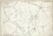
Staffordshire LXX.1 (includes: Alveley; Bobbington; Claverley; Enville; Quatt Malvern) - 25 Inch Map
1 : 2500 Topographic maps Ordnance Survey Ordnance Survey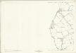
Staffordshire LXX.1 (includes: Alveley; Bobbington; Claverley; Enville; Quatt Malvern) - 25 Inch Map
1 : 2500 Topographic maps Ordnance Survey Ordnance Survey
Staffordshire LXVI.13 (includes: Alveley; Bobbington; Claverley; Quatt Malvern) - 25 Inch Map
1 : 2500 Topographic maps Ordnance Survey Ordnance Survey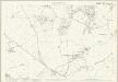
Staffordshire LXVI.13 (includes: Alveley; Bobbington; Claverley; Quatt Malvern) - 25 Inch Map
1 : 2500 Topographic maps Ordnance Survey Ordnance Survey
Staffordshire LXX.5 (includes: Alveley; Enville) - 25 Inch Map
1 : 2500 Topographic maps Ordnance Survey Ordnance Survey
Staffordshire LXX.5 (includes: Alveley; Enville) - 25 Inch Map
1 : 2500 Topographic maps Ordnance Survey Ordnance Survey
Staffordshire LXX.5 (includes: Alveley; Enville) - 25 Inch Map
1 : 2500 Topographic maps Ordnance Survey Ordnance Survey
Kidderminster
1 : 31680 This plan covers North Worcestershire and parts of Shropshire and Staffordshire. The draughtsman used different shades of green wash to distinguish woods, meadows, commons and parks. The Severn Valley extends down the left-hand side of the map, with the royal hunting forest of Wyre depicted at middle-left. To the right of the sheet is the Stour Valley, with the Staffordshire and Worcestershire Canal following the river valley. Rising above the two valleys is the ancient settlement of Kinver Edge, with its outcrops of red weathering sandstone formed in the Triassic age. Stevens, Henry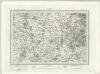
Dudley (Outline) - OS One-Inch Revised New Series
1 : 63360 Topographic maps Ordnance Survey Ordnance Survey