Maps of Bromsgrove
Worcestershire XXIII.NE - OS Six-Inch Map
1 : 10560 Topographic maps Ordnance Survey Ordnance Survey
Warwickshire XXX.NE - OS Six-Inch Map
1 : 10560 Topographic maps Ordnance Survey Ordnance Survey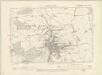
Warwickshire XXX.NE - OS Six-Inch Map
1 : 10560 Topographic maps Ordnance Survey Ordnance Survey
Worcestershire XXIII.NE - OS Six-Inch Map
1 : 10560 Topographic maps Ordnance Survey Ordnance Survey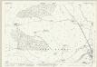
Worcestershire XXIII.3 (includes: Alvechurch; Redditch; Tutnall and Cobley) - 25 Inch Map
1 : 2500 Topographic maps Ordnance Survey Ordnance Survey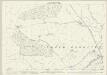
Worcestershire XXIII.3 (includes: Alvechurch; Redditch; Tutnall and Cobley) - 25 Inch Map
1 : 2500 Topographic maps Ordnance Survey Ordnance Survey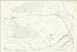
Worcestershire XXIII.3 (includes: Alvechurch; Redditch; Tutnall and Cobley) - 25 Inch Map
1 : 2500 Topographic maps Ordnance Survey Ordnance Survey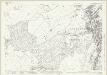
Worcestershire XXIII.7 (includes: Feckenham; Ipsley; Redditch; Tutnall and Cobley; Upper Ipsley) - 25 Inch Map
1 : 2500 Topographic maps Ordnance Survey Ordnance Survey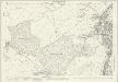
Worcestershire XXIII.7 (includes: Feckenham; Ipsley; Redditch; Tutnall and Cobley; Upper Ipsley) - 25 Inch Map
1 : 2500 Topographic maps Ordnance Survey Ordnance Survey
Worcestershire XXIII.8 (includes: Beoley; Ipsley; Redditch; Upper Ipsley) - 25 Inch Map
1 : 2500 Topographic maps Ordnance Survey Ordnance Survey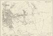
Warwickshire XXX.8 (includes: Beoley; Ipsley; Redditch; Upper Ipsley) - 25 Inch Map
1 : 2500 Topographic maps Ordnance Survey Ordnance Survey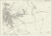
Worcestershire XXIII.8 (includes: Beoley; Ipsley; Redditch; Upper Ipsley) - 25 Inch Map
1 : 2500 Topographic maps Ordnance Survey Ordnance Survey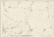
Worcestershire XXIII.4 (includes: Beoley; Redditch; Tutnall and Cobley) - 25 Inch Map
1 : 2500 Topographic maps Ordnance Survey Ordnance Survey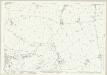
Worcestershire XXIII.4 (includes: Beoley; Redditch; Tutnall and Cobley) - 25 Inch Map
1 : 2500 Topographic maps Ordnance Survey Ordnance Survey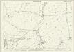
Worcestershire XXIII.4 (includes: Beoley; Redditch; Tutnall and Cobley) - 25 Inch Map
1 : 2500 Topographic maps Ordnance Survey Ordnance Survey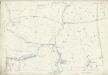
Worcestershire XXIII.4 (includes: Beoley; Redditch; Tutnall and Cobley) - 25 Inch Map
1 : 2500 Topographic maps Ordnance Survey Ordnance Survey
SP06 - OS 1:25,000 Provisional Series Map
1 : 25000 Topographic maps Ordnance Survey Ordnance Survey
Tardebigge
1 : 31680 .This map covers part of Worcestershire., The right-hand boundary of the plan is formed by a Roman road, Ikenild Street., Another such road, the Salt Way, is drawn across the middle of the sheet., In Roman times, this road connected the salt mines at Droitwich,,near the top right, with Alcester, at the bottom. .Outside Alcester is Ragley Hall, designed in 1680 by Robert Hooke (1635-1703), the eminent natural philosopher and Surveyor of the City of London after the Great Fire of 1666., The landscaped gardens were added in the 18th century by Lancelot 'Capability' Brown (1716-1783) - so called because he often told prospective clients that their gardens had "great capabilities"., Brown and his followers revolutionised parkland design, virtually inventing the English parkland as we know it today, with carefully planned vistas of grassland, trees and lakes. Dawson, Robert
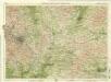
Stourbridge
1 : 31680 This plan covers parts of Worcestershire and Warwickshire. Hills and reliefs are illustrated by a combination of brushwork interlining ('hachures'), layering of colour washes and the use of aerial perspective. Tollroads are highlighted in buff and milestones noted along their routes. Stevens, Henry
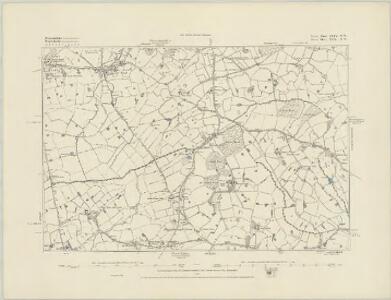
Redditch (Hills) - OS One-Inch Revised New Series
1 : 63360 Topographic maps Ordnance Survey Ordnance Survey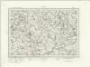
Redditch (Outline) - OS One-Inch Revised New Series
1 : 63360 Topographic maps Ordnance Survey Ordnance Survey
Birmingham - OS One-Inch Map
1 : 63360 Topographic maps Ordnance Survey Ordnance Survey
The counti of Warwick the shire towne and citie of Coventre described
1 : 1
An accurate map of the county of Worcester
1 Karte : Kupferdruck ; 51 x 68 cm Bowen; Tinney; Bowles; Sayer; Bowles; Bowles sold by I. Tinney at the Golden Lion and R. Sayer at the Golden Buck in Fleet street T. Bowles in St. Pauls Church Yard and I. Bowles and son at the Black Horse in Cornhill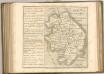
Birmingham, Leicester, Sheet 18 - Bartholomew's "Half Inch to the Mile Maps" of England & Wales
1 : 126720 Topographic maps Bartholomew, John George John Bartholomew & Co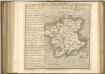

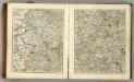
Wigorniensis Comitatus cum Warwicensi, nec non Conventriae Libertas
1 : 180000 Amstelodami : apud Joannem Janssonium
Herefordia Comitatus vernacule Hereford Shire
1 : 280000 Amstelodami : apud Joannem Janssonium