Maps of King's Lynn and West Norfolk
Norfolk LVII.NW - OS Six-Inch Map
1 : 10560 Topographic maps Ordnance Survey Ordnance Survey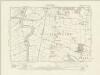
Norfolk LVII.NW - OS Six-Inch Map
1 : 10560 Topographic maps Ordnance Survey Ordnance Survey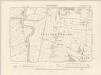
Norfolk LVII.NW - OS Six-Inch Map
1 : 10560 Topographic maps Ordnance Survey Ordnance Survey
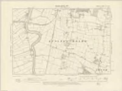
Norfolk LVII.NW - OS Six-Inch Map
1 : 10560 Topographic maps Ordnance Survey Ordnance Survey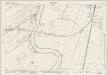
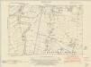
Norfolk LVII.1 (includes: Runcton Holme; Watlington; Wiggenhall St Mary Magdalen) - 25 Inch Map
1 : 2500 Topographic maps Ordnance Survey Ordnance Survey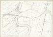
Norfolk LVII.1 (includes: Runcton Holme; Watlington; Wiggenhall St Mary Magdalen) - 25 Inch Map
1 : 2500 Topographic maps Ordnance Survey Ordnance Survey
Norfolk LVII.1 (includes: Runcton Holme; Watlington; Wiggenhall St Mary Magdalen) - 25 Inch Map
1 : 2500 Topographic maps Ordnance Survey Ordnance Survey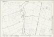
Norfolk LVII.5 (includes: Runcton Holme; Stow Bardolph; Wiggenhall St Mary Magdalen) - 25 Inch Map
1 : 2500 Topographic maps Ordnance Survey Ordnance Survey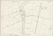
Norfolk LVII.5 (includes: Runcton Holme; Stow Bardolph; Wiggenhall St Mary Magdalen) - 25 Inch Map
1 : 2500 Topographic maps Ordnance Survey Ordnance Survey
Norfolk LVII.5 (includes: Runcton Holme; Stow Bardolph; Wiggenhall St Mary Magdalen) - 25 Inch Map
1 : 2500 Topographic maps Ordnance Survey Ordnance Survey
Norfolk LVII.6 (includes: Runcton Holme) - 25 Inch Map
1 : 2500 Topographic maps Ordnance Survey Ordnance Survey
Norfolk LVII.6 (includes: Runcton Holme) - 25 Inch Map
1 : 2500 Topographic maps Ordnance Survey Ordnance Survey
Norfolk LVII.2 (includes: Runcton Holme; Tottenhill; Watlington) - 25 Inch Map
1 : 2500 Topographic maps Ordnance Survey Ordnance Survey
Norfolk LVII.2 (includes: Runcton Holme; Tottenhill; Watlington) - 25 Inch Map
1 : 2500 Topographic maps Ordnance Survey Ordnance Survey
Norfolk LVII.2 (includes: Runcton Holme; Tottenhill; Watlington) - 25 Inch Map
1 : 2500 Topographic maps Ordnance Survey Ordnance Survey
TF60 - OS 1:25,000 Provisional Series Map
1 : 25000 Topographic maps Ordnance Survey Ordnance Survey
Wisbech
1 : 31680 This plan covers part of East Anglia, with the town of Wisbech depicted at lower left. The Great Ouse estuary, depicted near top right, served as a way into the Port of Wisbech until it became so silted up that the river was diverted into the sea at Kings Lynn. Drains across fens and marshland are highlighted in blue. These date from the 17th century, when James I appointed Dutch engineer Cornelius Vermuyden to direct the drainage of the fens wetlands. Many local people opposed the scheme as the plan involved commonland on which they grazed cattle. As a result of Vermuyden's work, the Fens changed radically in appearance, from an area of flooded marshes to one of extensively farmed agricultural land. Yeakell, Thomas Jr.
Wisbech (Hills) - OS One-Inch Revised New Series
1 : 63360 Topographic maps Ordnance Survey Ordnance Survey
Wisbech (Outline) - OS One-Inch Revised New Series
1 : 63360 Topographic maps Ordnance Survey Ordnance Survey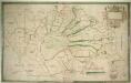
A Chart of the Fens between Lynn Regis, Denver Sluice and Wisbich
This is a plan of the Fenlands around Kings Lynn dating from around 1610. It is thought to be a close copy of a map of the same area by William Hayward dating from 1591, now lost. Fenlands are wet lands usually dominated by grasses and sedges, and often used for agricultural purposes. Here the fenland is divided into plots with the names of the land holder marked. Red roofed buildings provide a generalised view of Kings Lynn on the River Ouse. A scale bar records the scale in perches and furlongs and a decorative but unfinished cartouche dominates the top right corner. Hayward, William
Kings Lynn - OS One-Inch Map
1 : 63360 Topographic maps Ordnance Survey Ordnance Survey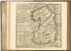

Cantabrigiensis comitatvs
1 Karte : Kupferdruck ; 41 x 51 cm Blaeu Joan Blaeu
Cambridge, Huntingdon, Sheet 19 - Bartholomew's "Half Inch to the Mile Maps" of England & Wales
1 : 126720 Topographic maps Bartholomew, John George John Bartholomew & Co
Comitatis Cantabrigiensis; vernacule Cambridge Shire
1 Karte : Kupferdruck ; 40 x 50 cm Valck; Schenk venditant Gerardus Valk et Petrus Schenk
Norfolk, Sheet 15 - Bartholomew's "Half Inch to the Mile Maps" of England & Wales
1 : 126720 Topographic maps Bartholomew, John George John Bartholomew & Co
Lincoln Fens, Sheet 14 - Bartholomew's "Half Inch to the Mile Maps" of England & Wales
1 : 126720 Topographic maps Bartholomew, John George John Bartholomew & Co
REGIONES | INVNDATÆ | In finibus Comitatus | NORFOLCIÆ, SUFFOLCIÆ, | CANTABRIGIÆ, HVNTINGTONIÆ | NORTHAMTONIÆ, et | LINCOLNIÆ
[Amsterdam : Joan Blaeu]
A general plott and description of the Fennes and surounded grounds in the sixe counties of Norfolke, Suffolke, Cambridge, with in the Isle of Ely, Huntington, Northampton and Lincolne etc.
1 : 180000 Amstelodami : sumptibus Joannis Janssonii