Maps of Luton
Hertfordshire XXXIII.NE - OS Six-Inch Map
1 : 10560 Topographic maps Ordnance Survey Ordnance Survey
Hertfordshire XXXIII.NE - OS Six-Inch Map
1 : 10560 Topographic maps Ordnance Survey Ordnance Survey
Hertfordshire XXXIII.NE - OS Six-Inch Map
1 : 10560 Topographic maps Ordnance Survey Ordnance Survey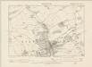
Hertfordshire XXXIII.NE - OS Six-Inch Map
1 : 10560 Topographic maps Ordnance Survey Ordnance Survey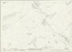
Hertfordshire XXXIII.3 (includes: Great Gaddesden; Hemel Hempstead) - 25 Inch Map
1 : 2500 Topographic maps Ordnance Survey Ordnance Survey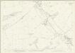
Hertfordshire XXXIII.3 (includes: Great Gaddesden; Hemel Hempstead) - 25 Inch Map
1 : 2500 Topographic maps Ordnance Survey Ordnance Survey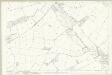
Hertfordshire XXXIII.3 (includes: Great Gaddesden; Hemel Hempstead) - 25 Inch Map
1 : 2500 Topographic maps Ordnance Survey Ordnance Survey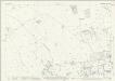
Hertfordshire XXXIII.7 (includes: Hemel Hempstead) - 25 Inch Map
1 : 2500 Topographic maps Ordnance Survey Ordnance Survey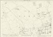
Hertfordshire XXXIII.7 (includes: Hemel Hempstead) - 25 Inch Map
1 : 2500 Topographic maps Ordnance Survey Ordnance Survey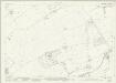
Hertfordshire XXXIII.4 (includes: Great Gaddesden; Hemel Hempstead) - 25 Inch Map
1 : 2500 Topographic maps Ordnance Survey Ordnance Survey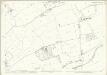
Hertfordshire XXXIII.4 (includes: Great Gaddesden; Hemel Hempstead) - 25 Inch Map
1 : 2500 Topographic maps Ordnance Survey Ordnance Survey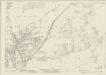
Hertfordshire XXXIII.8 (includes: Hemel Hempstead) - 25 Inch Map
1 : 2500 Topographic maps Ordnance Survey Ordnance Survey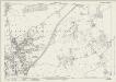
Hertfordshire XXXIII.8 (includes: Hemel Hempstead) - 25 Inch Map
1 : 2500 Topographic maps Ordnance Survey Ordnance Survey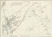
Hertfordshire XXXIII.8 (includes: Hemel Hempstead) - 25 Inch Map
1 : 2500 Topographic maps Ordnance Survey Ordnance Survey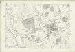
Hertfordshire XXXIII - OS Six-Inch Map
1 : 10560 Topographic maps Ordnance Survey Ordnance Survey
TL00 - OS 1:25,000 Provisional Series Map
1 : 25000 Topographic maps Ordnance Survey Ordnance Survey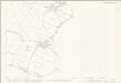
Buckinghamshire XXXV.8 (includes: Great Gaddesden; Nettleden with Potten End) - 25 Inch Map
1 : 2500 Topographic maps Ordnance Survey Ordnance Survey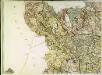
A topographical map of Hartford-Shire, 4
1 Blatt : 54 x 72 cm A. Dury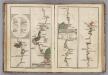
Watford to Rickmans Worth to Amersham, Watford to St. Albans.
1 : 63360 Cary, John
Aylesbury (Hills) - OS One-Inch Revised New Series
1 : 63360 Topographic maps Ordnance Survey Ordnance Survey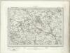
Aylesbury (Outline) - OS One-Inch Revised New Series
1 : 63360 Topographic maps Ordnance Survey Ordnance Survey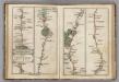
London to Tring.
1 : 63360 Cary, John
Chipping Barnet
1 : 31680 The most obvious features of this plan are major roads coloured yellow, with their cumulative lengths noted at intervals of one mile. North is not orientated towards the top. As a result,Watford appears to the left of St Albans, and the boundary between Middlesex and Hertfordshire (a dashed black-ink line)runs from the top left of the map down through Elstree to Hadley. The paper carries a watermark from the James Whatman Turkey Mill. Hyett, William
Hemel Hempstead
1 : 31680 This drawing describes a section of the Grand Junction Canal. The prehistoric Icknield Way appears at the top left of the plan. Hill-shading techniques and the attention given to communications routes conform to the military and cartographic standards employed by the Survey. Some name corrections are visible in faded ink in the centre of the map around Bovingdon. Harefield Common is also revised. Hyett, William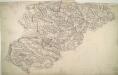
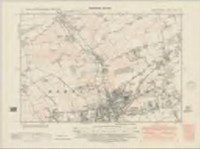
Luton
The boundaries of the counties of Bedfordshire, Buckinghamshire, and Hertfordshire are marked on this plan by pecked red lines. Red dots within circles indicate trigonometrical points from which the surveyor took angular measurements to plot topographical features of the landscape. Hyett, William
England and Wales [OS of]
Ordnance Survey
The Chilterns
1 : 63360 Ordnance Survey Office
Middle-Sexia. [Karte], in: Theatrum orbis terrarum, sive, Atlas novus, Bd. 4, S. 263.
1 Karte aus Atlas Blaeu, Joan Blaeu, Willem Janszoon
London N.W. - OS One-Inch Map
1 : 63360 Topographic maps Ordnance Survey Ordnance Survey